Home Ground
Home Ground
A field at the top of Hendford Hill
Home Ground was a triangular field bounded by Hendford Hill to the north, Dorchester Road to the west and the old Yeovil to Dorchester road to the east.
Iron age pottery together with animal bones and ashes were found in Home Ground and sherds of coarse black ware from the site are held at the Community Heritage Access Centre. The area concerned is now occupied by a house and garden.
The
1846 Tithe
Apportionment
described
Home Ground
(Parcel 776) as
arable and
measuring 5a 1r
0p and noted
that draper and
grocer
John Glyde
was the owner
and it was
occupied by
Lionel Harrison,
a sailcloth
weaver of East
Coker.
As seen in the
aerial
photograph of
1946 below,
Home Ground
appears to be
chiefly grassed
with just a
couple of large
houses on the
Dorchester Road
side.
Today the site
of the former
Home Ground is
still mainly
grassed and is occupied by a
couple more large houses.
MAPs & Aerial photographs
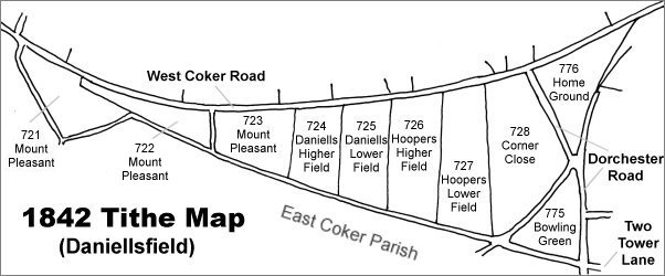
Map based on the 1842 Tithe Map with field names added from the 1846 Tithe Award. Home Ground is at top right.
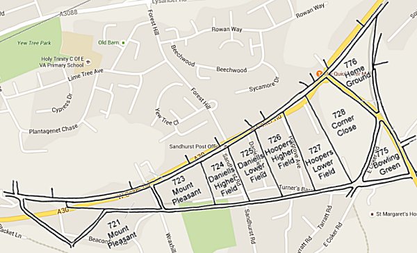
The 1842 Tithe Map superimposed over a modern map of the area. Although the field boundaries do not align precisely, remember that the 1849 survey was undertaken by hand using primitive surveying equipment.
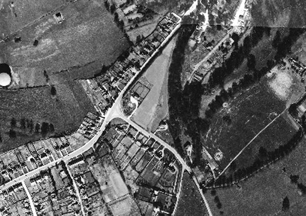
The 1946 aerial photograph with West Coker Road running from bottom left to centre top and Dorchester Road running from left of centre down to bottom right of centre. Home Ground is the light triangular field at centre.
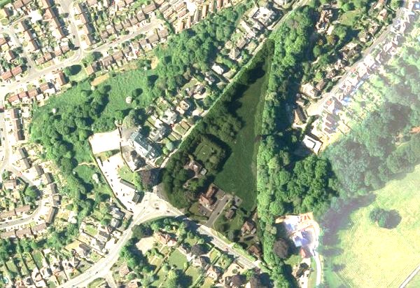
The modern satellite image of the former Home Ground at centre bounded with trees on two sides and with just a few houses alongside the Dorchester Road. West Coker Road is at bottom left and Hendford Hill runs from lower left of centre to top right of centre. The rest of the image has been lightened to make Home Ground stand out.
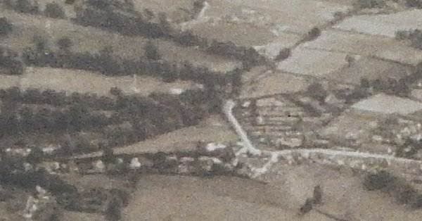
This is an aerial photograph taken in 1941 and looking south. West Coker Road runs across the width of the lower part of the photograph and Dorchester Road is seen at right of centre running up and across towards top right. Home Ground is seen at centre as a light-coloured triangular field bounded by trees to the left and Dorchester Road to the right.