little home close
little home Close
Now the eastern end of Birchfield playing field
Little Home Close (Parcel 901) was part of the 'home' close (close of land near the farm house) of Great Lyde Farm (now the Great Lyde Inn) although in 1653, as seen on the first map below, it was the western end of a field called the Hither Cowleaze. The western end of Hither Cowleaze was later partitioned off as Little Home Close (901) and the remainder formed Great Home Close (903). Hither Cowleaze formed the western end of the northern side of a steep-sided valley through which ran Lyde Brook, the southern boundary of Great Lyde Farm.
A remnant of the steep valley profile may still be seen in the northern part of Lower Cowleaze (907) however in the late 1960s and 1970s the valley was used as a landfill waste site. When the valley was all but filled, earth was brought in to level this and the adjoining fields - forming the flat field surface we see today. Since it is made up ground it cannot have housing built on it and will remain a green (technically brown) site since there is a danger of gas build-up from the rotting waste below. A walk along the path to the River Yeo will show several vent pipes.
The 1842 Tithe Map showed that Little Home Close was bounded on its south by the Lyde Brook, to the west by Long Orchard (899), to the north by Great Lyde farm (900) and to the east by Great Home Close (903). The 1846 Tithe Award noted that it was 1a 2r 0p in area and used as pasture for grazing livestock.
Today Little Home Close is the field to the immediate west of the Lyde Road / Great Mead roundabout and forms the eastern end of the Birchfield playing field.
maps
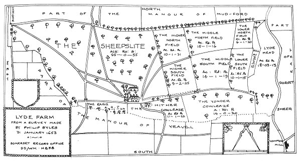
Philip Byles map of Lyde Farm dated 31 January 1653. Great Home Close is shown as 'Hither Cowleaze' at bottom centre.
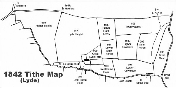
The Lyde area reproduced from the 1842 Tithe Map.
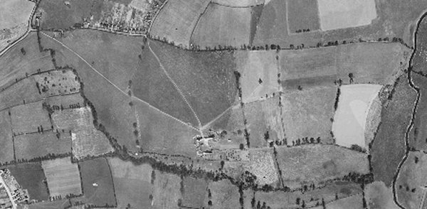
The 1946 aerial photograph of Great Lyde Farm
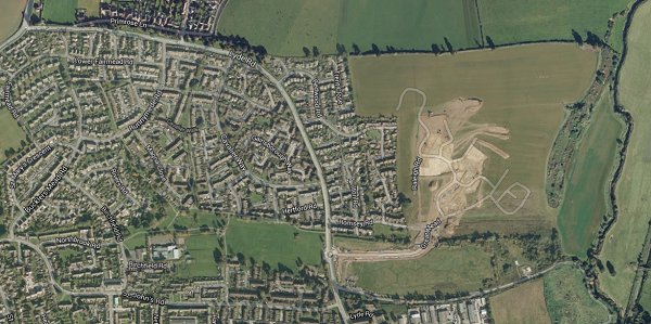
The same area today 'borrowed' from Google maps and taken around 2010 when the groundworks for Wyndham Park were being started. This is some twenty years after Great Home Close and Lower Cowleaze had been used as a waste disposal site and the valley leveled off.
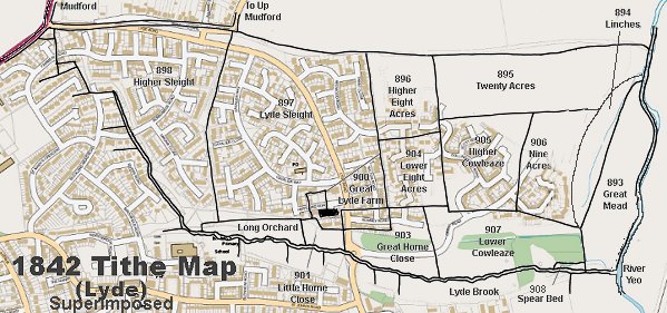
The 1842 Tithe Map superimposed over a modern map.
gallery
Courtesy of Tony
Davies
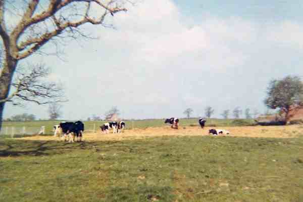
A photograph taken from Little Home Close around 1966. The field the other side of the fence is Lyde Sleight.
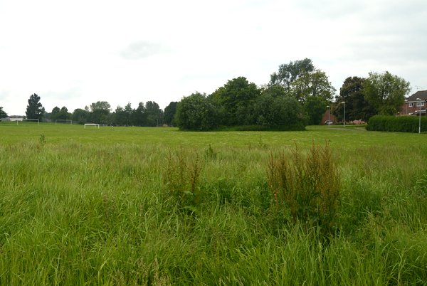
Little Home Close seen from the Lyde Road / Great Mead roundabout which originally would have been its boundary with Great Home Close. Beyond the football goal posts in the distance was Long Orchard.