Long Croft
Long Croft
A detached part of Preston Plucknett
Long Croft was a field, earlier part of Longcroft Farm, that lay just to the north of the Stone Lane junction with Mudford Road. The 1589 Terrier recorded "Marshe - Langcroft of 9a 1yd of pasture by est(imation) lying in the Great Close next to Down ditch".
This area is actually a detached part of the parish of Preston Plucknett, known as Preston in Stone, and the Preston Plucknett Tithe Map of 1849 shows Long Croft as Parcel 149. It was bounded on the south by Higher Ryalls (Parcel 1105), on the west by Longcroft Farm (Parcel 1106 and 1107) - all three parcels being in the Parish of Yeovil - and on the north by Little Stone (Parcel 151 of Preston). On the east it was bounded by Stone Lane, although Garden Plot (Parcel 150), a narrow strip of land running alongside Stone Lane formed much of the eastern boundary (see map).
The Preston Plucknett Tithe Apportionment of 1848 recorded Long Croft as 7a 1r 24p and noted that the owner was William Jones Prowse Esq. and the tenant was James Martin (see also 151 Little Stone and 152 Great Stone). Captain William Jones Prowse RN, was the last of the family to live in Kingston Manor House.
Today Long Croft remains as pasture.
maps
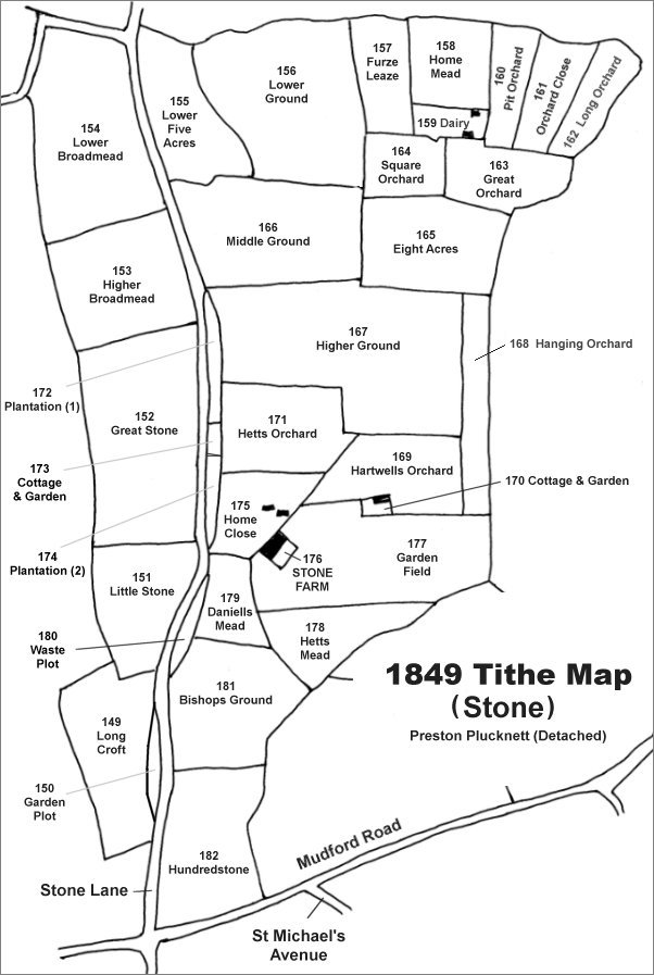
The Stone area reproduced from the 1849 Tithe Map. Long Croft is at bottom left.
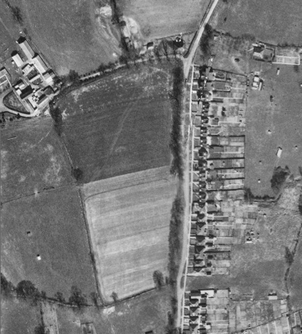
The 1946 aerial photograph showing Long Croft at centre. Ploughing has given it the appearance of two fields.
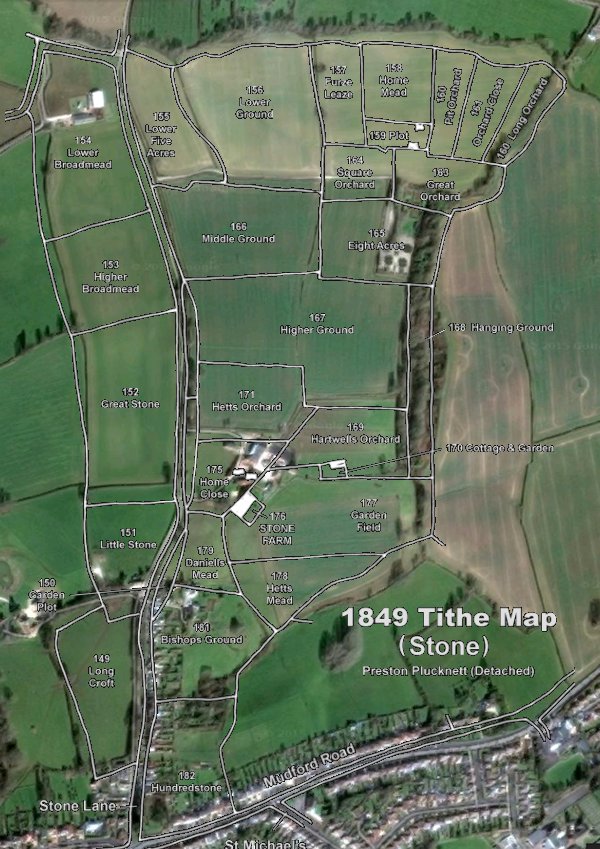
The 1849 Tithe Map superimposed over the current Google Earth image. Although the field boundaries do not align precisely, remember that the 1849 survey was undertaken by hand using primitive surveying equipment. Long Croft is at bottom left
Gallery
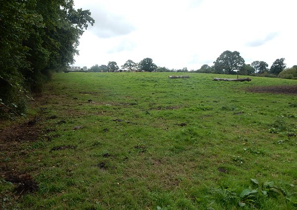
Long Croft, looking south. Photographed in 2015.