Long Close
Long Close
Today in East Coker
Long Close (Parcel 730) was a long rectangular field running alongside the southeastern side of East Coker Road. Today this parcel lies in East Coker parish.
The 1846 Tithe Apportionment described Long Close as measuring 4a 2r 4p and as arable farmland. It noted that George Bullock of North Coker was the owner and the occupier was Lionel Harrison of East Coker - half a mile to the west.
Long Close was
bounded on the
north by
Young
Orchard (Parcel
729), on the
west by East
Coker Road, on
the south by
Tarratt (Parcel
734) and on the
east by Tarratt
(Parcels 731 and
732).
As seen in the aerial photograph of 1946 below, the area that included Long Close was undergoing radical boundary changes which continued such that today Long Close has been absorbed into a much larger field made up of at least four of the 'old' fields.
For details on historic land measurement (ie acres, roods and perches) click here.
MAPs & Aerial Photographs
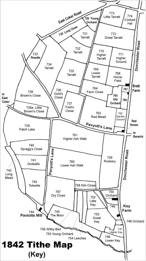
Map based on the 1842 Tithe Map with field names added from the 1846 Tithe Award. Long Close is at top centre.
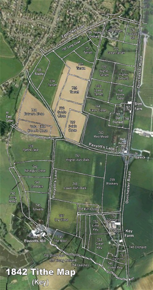
The 1842 Tithe Map superimposed over a modern aerial photograph of the area. Although the field boundaries do not align precisely, remember that the 1846 survey was undertaken by hand using primitive surveying equipment.
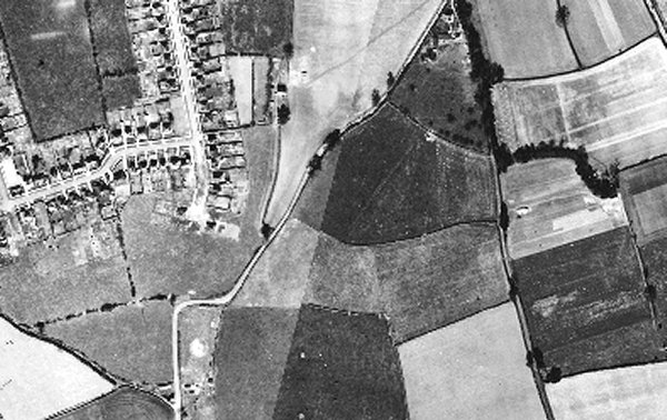
The 1946 aerial photograph with East Coker Road running from top, right of centre, to bottom left. Long Close is at centre albeit now merged with several of the parcels of Tarratt - a ghost of much of Long Close's eastern boundary is discernible
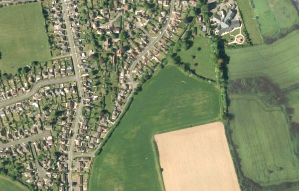
The modern satellite image showing the re-hashed fields. The area of what had been Long Close is at centre, again with a ghost of the eastern boundary just discernible.