Lower Broadmead
Lower Broadmead
Of Stone Farm, a detached part of Preston Plucknett, then Marsh Farm
Lower Broadmead was a large field in the northwest corner of Stone Farm on north-facing sloping ground to the west side of Stone Lane.
This area is actually a detached part of the parish of Preston Plucknett, known as Preston in Stone, and the Preston Plucknett Tithe Map of 1849 shows Lower Broadmead as Parcel 154. It was bounded on the south by Higher Broadmead (Parcel 153), on the west by Mead (Parcel 1133 - in the Parish of Yeovil), to the north by the lane to Yeovil Marsh and on the east by Stone Lane.
The Preston Plucknett Tithe Apportionment of 1848 infers that Higher Broadmead (Parcel 153) and Lower Broadmead (Parcel 154) were originally one large field but at the time of the Apportionment was divided into two fields, as they remain today. Both were in the ownership of Henry Goodford Esq of Chilton Cantello. and occupied by Mrs Phillis Coles, as indeed was the whole of Stone Farm at this time. The Tithe Apportionment reckoned Lower Broadmead as 10a 1r 15p.
Other known owners / occupiers had been James Harris (1800), Mr Pester (1810), Mr Spear (1818), Stephen Coles (c1821-1827). Phillis Coles, in her later years assisted by her sons, ran Stone Farm after the death of her husband Stephen until her own death in 1877. Her son Edmund ran the farm after her death until his death in 1885. By 1889 a Mr Russell was farming Stone Farm but his widow sold up and retired in February 1900. In 1901 the tenant farmer was John Sawtell. By the 1920s Lower Broadmead was being farmed by WF Snell & Sons of Marsh Farm to the immediate west.
During 1925 both Higher Broadmead and Lower Broadmead were subject to Foot-and-Mouth disease control orders, but both were declared free of the disease in November 1925.
Today Great Stone (Parcel 152), Higher Broadmead and Lower Broadmead are combined to form one very large field, with a portion of the latter fenced to form a paddock. The whole field remains as pasture - see photo below.
maps
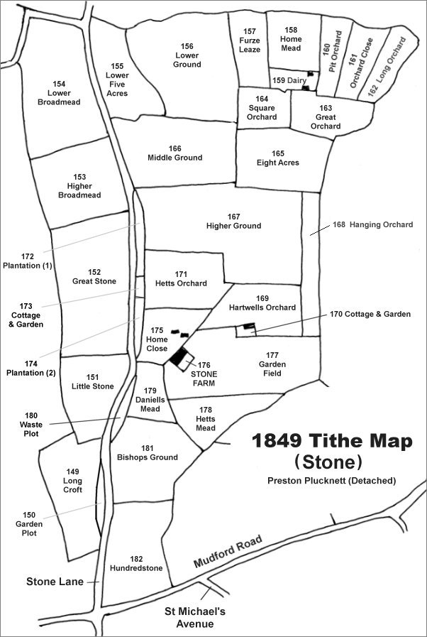
TThe Stone area reproduced from the 1849 Tithe Map. Lower Broadmead is at top left.
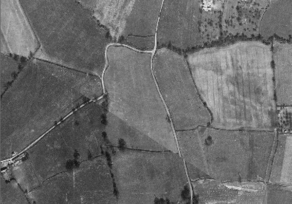
The 1946 aerial photograph showing Lower Broadmead at centre. Stone Lane runs vertically just right of centre with the lane to Yeovil Marsh running off to the left.
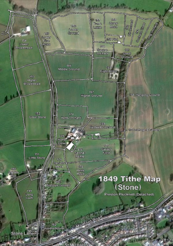
The 1849 Tithe Map superimposed over the current Google Earth image. Although the field boundaries do not align precisely, remember that the 1849 survey was undertaken by hand using primitive surveying equipment. Lower Broadmead is at top left.
Gallery
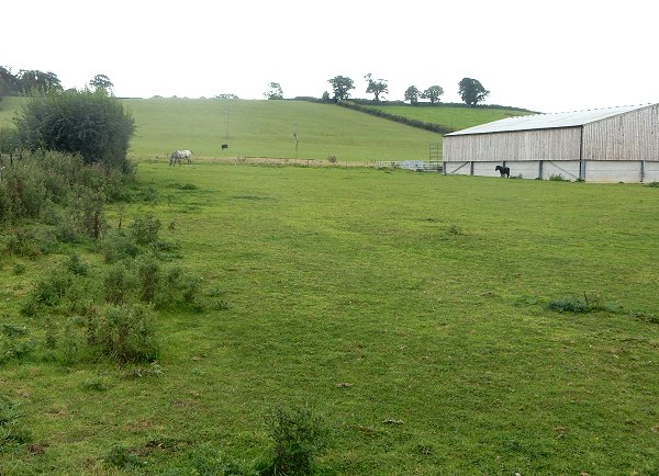
Lower Broadmead, looking north from the northeast corner of Lower Broadmead, with the bottom portion fenced off to form a paddock. Photographed in 2015.