Lower Crossways
Lower Crossways
One of the most northerly fields in Preston Plucknett
Field's End was originally a large field along the north parish boundary of Preston Plucknett, lying to the immediate south of Thorne Lane and bounded by the parish boundary with Brympton in the west and Larkhill Lane in the east.
By the time of the 1763 survey of the Manor of Preston, the large field was subdivided and six fields were created running along the southern side of Thorne Lane. Lower Crossways was the easternmost of these six fields, at the junction of Thorne Lane and Larkhill Lane. At this time it was, however, called Cross Way Meadow and was measured at 2 acres, 0 roods, 24 perches ('old' units) and was used as pasture for grazing livestock.
The 1846 Preston Tithe Map shows Lower Crossways (Parcel 72) bounded to the north by Thorne Lane, to the west by Gayley Mead (Parcel 71), to the south by Higher Great Down (Parcel 76) and to the east by Larkhill Lane.
The Preston Plucknett Tithe Apportionment of 1848 noted that Lower Crossways was owned and occupied by William Rodber. The field measured 2 acres, 3 roods and 2 perches ('new' units). It was used as both meadow (for making hay) and pasture (for grazing livestock).
The 1946 aerial photograph (see below) shows the field as undeveloped, but it disappeared when the Abbey Manor estate was built in the 1980s and the site is now occupied by the houses and gardens of Thorne Lane and Larkhill Road.
For details on historic land measurement (ie acres, roods and perches) click here.
maps & Aerial photograph
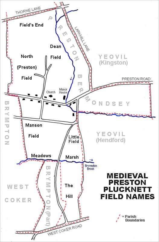
The main post-medieval fields of Preston Plucknett. The original large medieval field called Field's End is at top left.
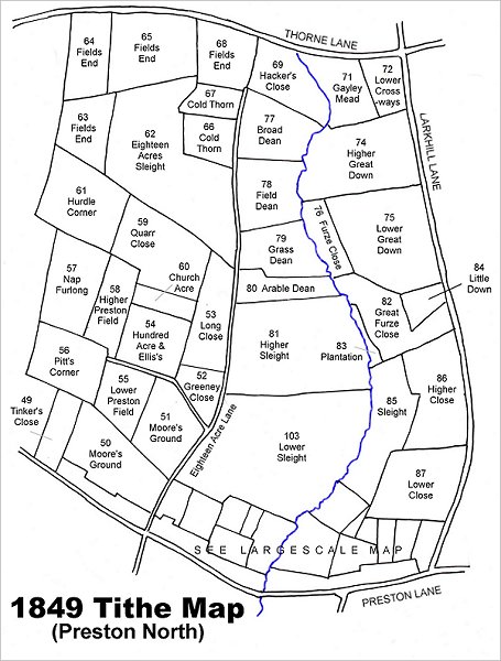
MMap based on the 1849 Tithe Map showing Lower Crossways (Parcel 72) at top right.
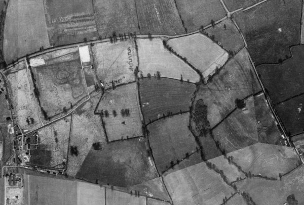
This is a 1946 aerial photograph showing Thorne Lane running across the top and Larkhill Lane (today's Larkhill Road) running diagonally across the top right quadrant. Lower Crossways is nestled in the southwest corner of the crossroads, seen at top right.
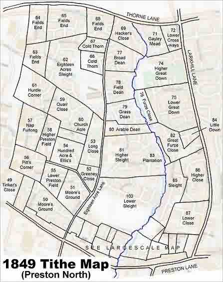
The 1849 Tithe Map superimposed over the modern Ordnance Survey map.
gallery
Courtesy of Jack
Sweet. This
photograph
features in my
book 'Now
That's What I
Call Yeovil'.
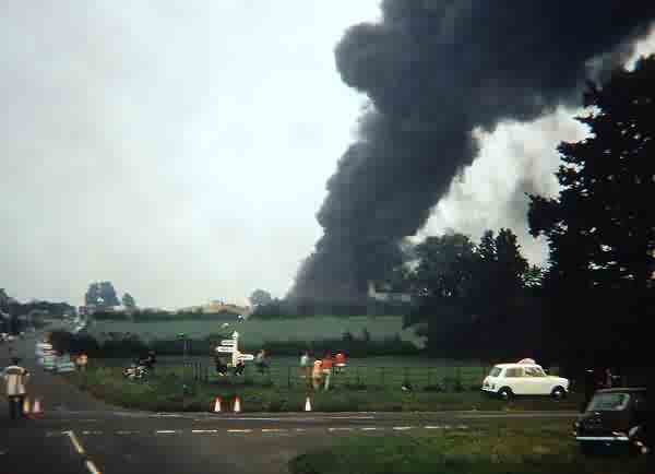
Larkhill Road is closed off by police at Thorne Lane as people stop to watch the spectacle of the fire at the Larkhill Soling Factory in 1970. Lower Crossways is the field at the crossways with people sitting on the fence. It is now occupied by the houses and gardens of Thorne Lane and Larkhill Road.