Mill Close
Mill Close
A field within the Manor of Hendford
Mill Close (Parcel 808) was originally a steep-sided field, falling west to east, within the Manor of Hendford and has been, for generations, part of Aldon Farm. The name Aldon was known before Aldon house was built since Watt's map of 1806 shows a footpath "To Aldon Farm, etc."
At the time of the 1846 Tithe Apportionment, Mill Close was owned by John Batten Snr and let to John Brook the Elder (from c1810 to 1846) followed by John Brook the Younger (from 1847 to 1854). It was, perhaps surprisingly, recorded as pasture for grazing livestock and measured 3a 1r 0p. For other tenant farmers, see Aldon Farm..
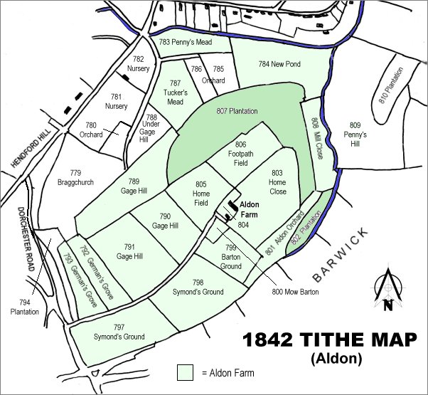
Mill Close (Parcel 808) was bordered on the north by New Pond (Parcel 784), to the east by Ninesprings Brook, and to the south by Aldon Orchard (Parcel 801) and Plantation 2 (Parcel 802). To the west it was bordered by Plantation 3 (Parcel 807).
Mill Close was developed as part of the ornamental park for the Aldon estate during the early nineteenth century (although its ownership was brought into question - see Yeovil Charities Scandal) and included walks, bridges, grottoes, springs and lakes. Until the middle of the twentieth century the public only had access by ticket obtainable from the owner, Colonel HB Batten, the Town Clerk.
Today, Mill Close is the western side of the main valley known locally as Ninesprings. Now a managed mixed woodland, it forms a part of the Yeovil Country Park.
For details on historic land measurement (ie acres, roods and perches) click here.
maps

This map, based on the descriptions in the 1589 Terrier and the 1846 Tithe Map of Yeovil shows the approximate boundaries of the Manors of Kingston and Hendford as well as the manorial three-field system used in Kingston.

The 1842 Tithe Map showing the Aldon area and the parcels of Aldon Farm shaded light green. Mill Close (Parcel 808) is right of centre.
Gallery

From my
collection.
This
image
features in my
book 'Yeovil
- The Postcard
Collection'.
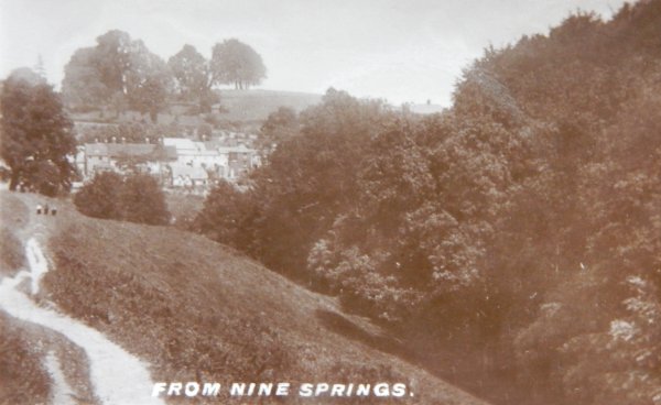
Looking across to Yeovil from Ninesprings in the 1920s. The field in the lower left quadrant was the former Mill Close.