Plantation (1)
Plantation (1)
Of Stone Farm, a detached part of Preston Plucknett
Plantation (1 - of two) was long narrow tree-planted strip running alongside Stone Lane northeast of Stone Farm.
This area is actually a detached part of the parish of Preston Plucknett, known as Preston in Stone, and the Preston Plucknett Tithe Map of 1849 shows Plantation (1) as Parcel 172. It was bounded on the east by Higher Ground (Parcel 168) and Hetts Orchard (Parcel 171), to the south by Stone Farm Cottage (Parcel 173) and to the west by Stone Lane. It simply narrowed to nothing at its northern end.
The Preston Plucknett Tithe Apportionment of 1848 notes that Plantation (1) was in the ownership of Henry Goodford Esq. of Chilton Cantello and occupied by Mrs Phillis Coles, as indeed was the whole of Stone Farm at this time. The Tithe Apportionment reckoned the area of Plantation (1) to be just 0a 0r 32p.
Other known owners / occupiers had been James Harris (1800), Mr Pester (1810), Mr Spear (1818), Stephen Coles (c1821-1827). Phillis Coles, in her later years assisted by her sons, ran Stone Farm after the death of her husband Stephen until her own death in 1877. Her son Edmund ran the farm after her death until his death in 1885. By 1886 a Mr Russell was farming Stone Farm but his widow sold up and retired in February 1900. In 1901 the tenant farmer was John Sawtell.
As seen in the aerial photograph of 1946, shown below, Plantation (1) appears to be extant. Today however, there is nothing more than a hedgerow with a couple trees.
map and aerial photographs
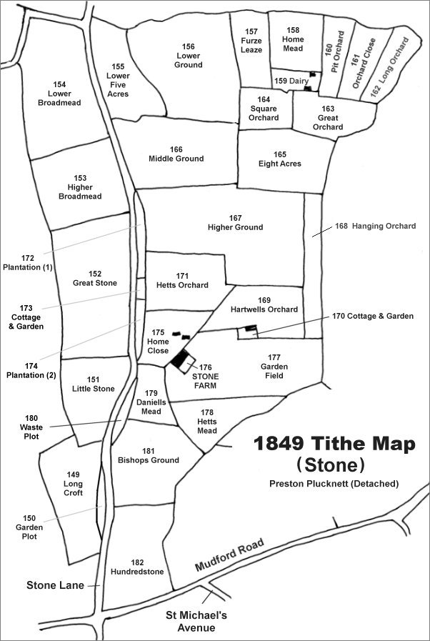
The Stone area reproduced from the 1849 Tithe Map. Plantation (1) is centre left.
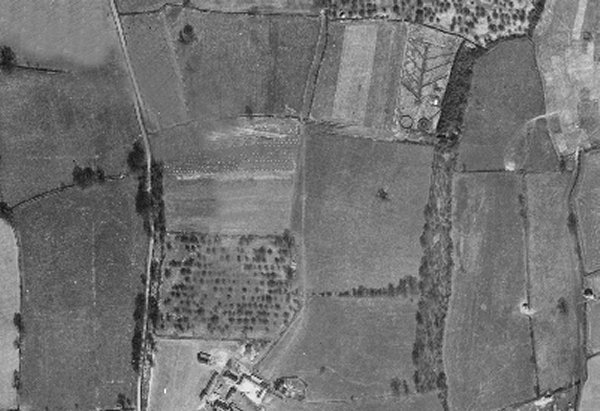
The 1946 aerial photograph showing Plantation (1) as a strip of trees between Stone Lane on the west and Higher Ground and Hetts Orchard to the east.
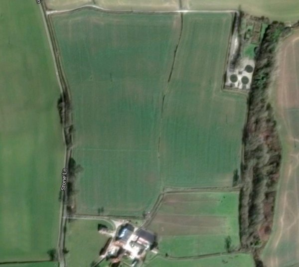
The modern aerial view showing Stone Farm at centre bottom and possible remnants of Plantation (1) running alongside Stone Lane.