rosebery avenue
rosebery avenue
Formerly known as Selling's Lane and Sydling's Lane
 First
recorded in
1589, Sydling's
Lane, later to
become called Rosebery Avenue,
was originally
simply a field
access track
leading through
fields from St
Michael's
Avenue, then
called Brickyard
Lane.
First
recorded in
1589, Sydling's
Lane, later to
become called Rosebery Avenue,
was originally
simply a field
access track
leading through
fields from St
Michael's
Avenue, then
called Brickyard
Lane.
The 1589 Terrier referred to "In Edmund Wills Close next to Selling's Lane" in the East Field. In 1790 a lease concerning fields by the same lane referred to Sotlinch or Sidland "by Sidland Lane" and a will of 1799 refers to an orchard "called Sidlands in Sidland Lane". A conveyance of 1800 referred to it as Sydlands Lane as did a deed of exchange dated 1823. It was called Sydling's Lane in 1805 and Sydling's Mead was recorded in the 1846 Tithe Apportionment.
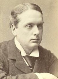
Sydling's Lane began to be laid out as a made-up road around 1895 and was re-named Rosebery Avenue for Archibald Philip Primrose, 5th Earl of Rosebery, photographed above left, who was the British Prime Minister from March 1894 to June 1895.
However Sydling's Lane continued in common use for at least another ten years and the name is perpetuated today in Sydling Road, a cul-de-sac off Rosebery Avenue.
The first houses to be built in Rosebery Avenue was the long terrace on the northern side of the road at the western end, close to St Michael's Avenue, and seen in the first photograph below. At this time the road only extended just beyond Alexandra Road and was not extended until the late 1920's or early 1930's when it was extended east and then southeast, following the borough boundary, until it joined with Lyde Road. The houses at the eastern end of Rosebery Avenue were built in the 1930's.
During the
Second World War
an 11,500 gallon
circular
emergency water
tank, 7m in
diameter was
located at the
bend in the
eastern half of
Rosebery Avenue.
Presumably
considered to be
in no danger of
being bombed
because of the
distance from
Westland's
airfield, no
air raid
shelters
were erected in
the vicinity.
map

This map, based on the descriptions in the 1589 Terrier and the 1846 Tithe Map of Yeovil shows the approximate boundaries of the Manors of Kingston and Hendford as well as the manorial three-field system used in Kingston. Sidlings Lane, albeit un-named on the map, is shown to the left of 'East Field'.
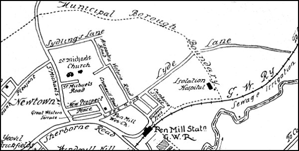
The 1904 Borough Boundary Extension map showing Sydling's Lane at top left. At this time Sydling's Lane had no buildings and simply went through fields. St Michael's Avenue had about eight houses near the Sherborne Road, Cromwell Road only had eight houses near Lyde Road but Alexandra Road had only just been laid out and had no buildings at all.
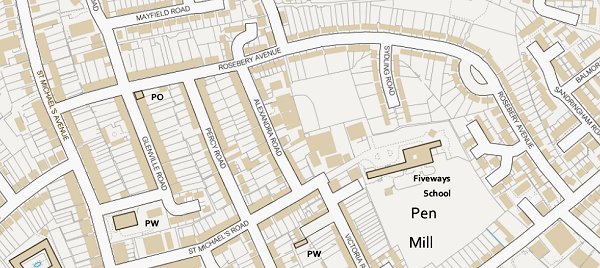
The modern Ordnance Survey map showing Rosebery Avenue running along the top of the map before dropping to the southeast to meet Lyde Road, almost following the 1904 Municipal boundary. Note Sydling Road at top, right of centre.
gallery
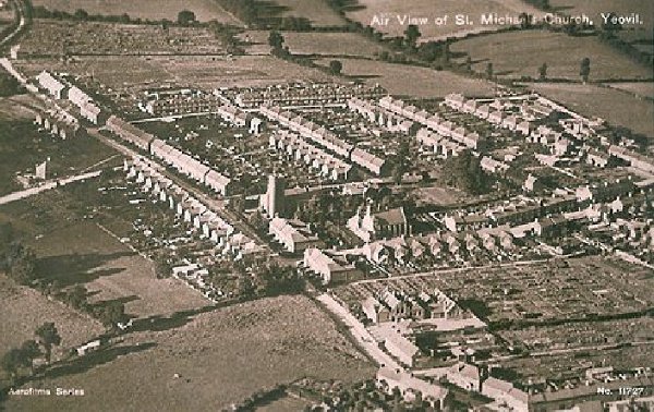
An aerial postcard of the very early 1920s with St Michael's church at centre. This photograph demonstrates remarkably well how isolated this part of Yeovil was at the time; St Michael's Avenue runs diagonally across the image from bottom right to top left, the first road off to its right is St Michael's Road, the last road off to the right towards the top of the photo is the partly-built Rosebery Avenue and the three roads between are, from left to right, Glenville Road, Percy Road and Alexandra Road.
Courtesy of the
Western Gazette
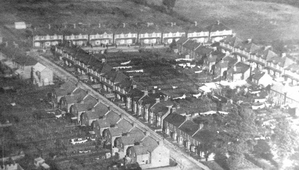
This aerial photograph dates to 1928 and shows Rosebery Avenue running across the top of the photograph with Glenville Road running from top left to bottom centre and Percy Road at right.
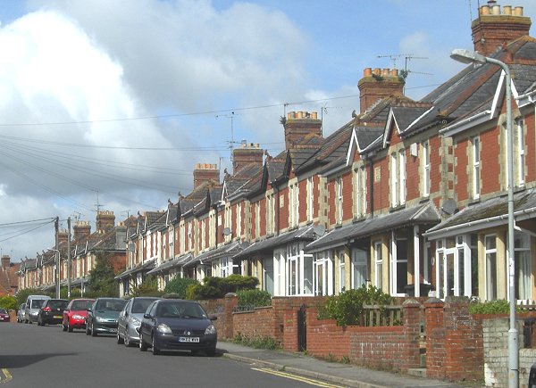
The first houses erected in Rosebery Avenue, on the northern side at the western end adjoining St Michael's Avenue. Photographed in 2013.
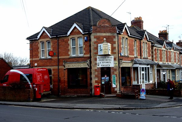
The Glenville Road Post Office photographed in 2015 from Rosebery Avenue.
Courtesy of South Somerset Heritage Collection
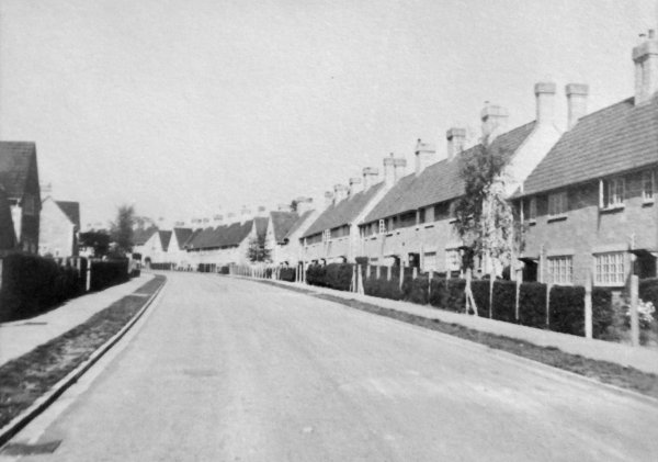
Towards the eastern end of Rosebery Avenue, looking north. Photographed in the 1950s.
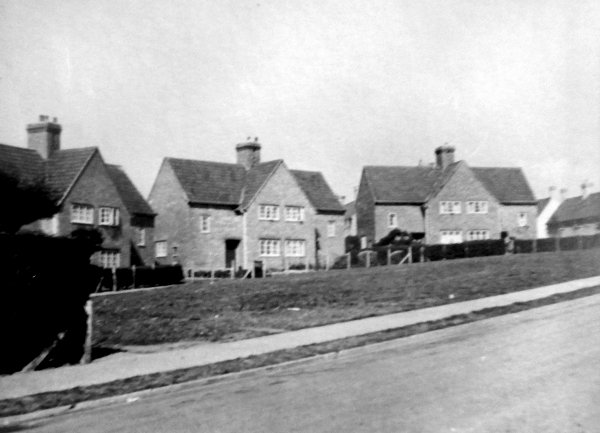
Courtesy of South Somerset Heritage Collection
The Crescent, Rosebery Avenue. Photographed in the 1950s.
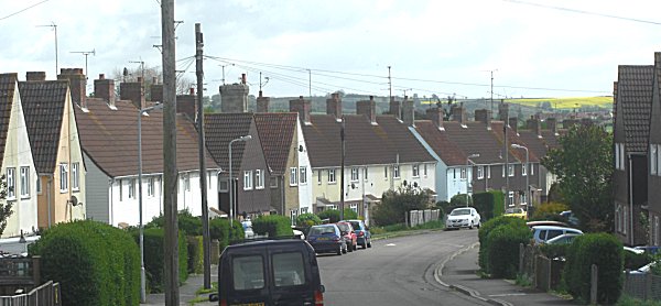
Looking towards the eastern end of Rosebery Avenue, with housing erected by the Borough Council in the 1930's. Photographed in 2013.
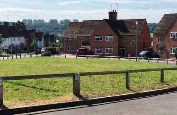
The Rosebery Avenue green open space, the Crescent. During the Second World War this was the site of an emergency water tank. Photographed in 2021.