sparrow road
sparrow road
Formerly Sparrow Lane and Coalpaxy Lane
There was a John Sperwe, or Sparrow, whose will leaving lands in Yeovil is dated 1417. What we know today as Sparrow Road was shown on Bidder's map of 1843, albeit un-named but in the 1841 census it was called Sparrow Lane. In 1858 G Harris tendered an "Estimate for repairs to Caldpecksey Lane" being works to raise the road between Roping Path and Mudford Road Turnpike Road. In the 1871 census it was called Coalpaxy Lane but it was also known as Colpexin Lane.
At this time it was little better than an un-surfaced farm track between Mudford Road and Roping Path, later to become Roping Road, although several houses in two short terraces had been built on the northern side. No trace of these houses survive.
By 1881 it was
known as Sparrow
Lane again, a
name which
continued in use
until well into
the twentieth
century. Between
Roping Path and
Milford Cross,
where it met
Goldcroft, it
was only a
footpath and is
noted as such on
the 1901
Ordnance Survey
below, by which
time there were
still only some
dozen or so
houses on the
north side
between Mudford
Road and Sparrow
Lane, the south
side being a
large orchard.
The eastern end
was flanked by
fields. This
eastern end was not
constructed as a
road and built
up until the
late 1920s,
which was
probably the
time it became
known as Sparrow
Road rather than
Sparrow Lane.
MAP
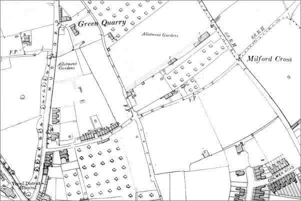
The 1901 Ordnance Survey showing Sparrow Lane running across the map from Mudford Road at left to Milford Cross on Goldcroft at right. The eastern half was still just a footpath.
gallery
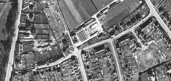
An aerial photograph of 1946 showing Sparrow Road running across the photograph from Mudford Road at left to Goldcroft at right. The two roads at the bottom of the photograph are Roping Road at left of centre and Mitchelmore Road at right of centre.
This
photograph
features in my
book "Lost Yeovil"
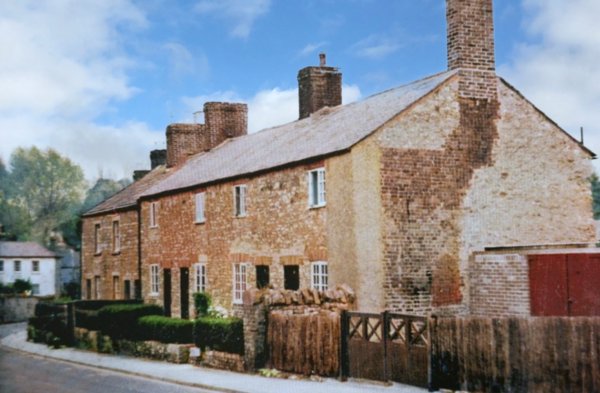
Cottages in Sparrow Road photographed in 1956, looking west towards Mudford Road. The cottages, typical of Yeovil, were built in local Yeovil stone that was affected by heat from fires hence the flues often had to be rebuilt in brickwork as seen on the end house here.
Courtesy of
Vivien and John
Cornelius
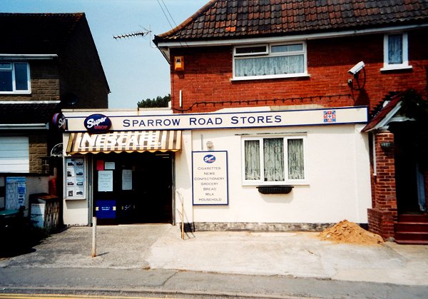
The Sparrow Road Stores, almost opposite Mitchelmore Road - another 'corner shop' now closed and converted back to a private house. Photographed in 2003.