summerhouse terrace
summerhouse terrace
Originally a short cul-de-sac off Stars Lane
Summerhouse Terrace was originally a short road, built shortly after 1880, between Stars Lane and Mill Lane. Today, of course, it has been extended east beyond Stars Lane to become Old Station Road and west beyond Mill Lane to become Park Street.
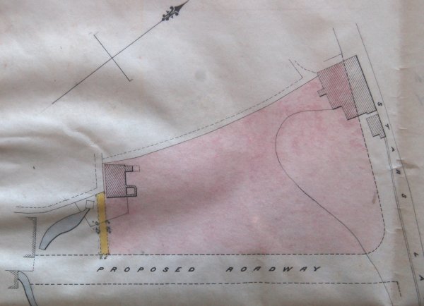
A document in my collection, dated 1875, in which Samuel Cridland leased from Yeovil Borough the property known as Stars Lane House and a large area of land off Stars Lane - essentially what is now the whole of Stars Lane car park. On this lease the future Summerhouse Terrace was drawn on the plan and shown as an un-named ‘proposed road’ - see below. The terrace of houses on its north side was, coincidentally, built in 1875, although whether built by Samuel Cridland or not is unknown. As a side-note, Samuel Cridland was born in 1835 in Bradford Abbas, Dorset. He was a Master Mason and in 1881 was living at 16 South Street with his Oxford-born wife, Susan née Rowland. Also living with them were sons Ned and Herbert, both masons, dressmaker daughter Kate, Lucy and youngest son, William, both scholars. William Cridland was later to become the landlord of the George Inn in the 1890's.
On the 1901 and 1912 Ordnance Surveys the land to the south of Summerhouse Terrace, later a conglomeration of small factories and workshops was shown as ‘Allotment Gardens’. Even until the 1960’s Summerhouse Terrace ended at Mill Lane.
The terrace of housing, known as Summerhouse Terrace (as opposed to the road), was demolished in the very early 1960s in order to create the present car park.
maps & Aerial photograph
From my
collection
1875 map in my collection showing Stars Lane House and its gardens coloured pink. The dotted 'Proposed Roadway' running along the bottom was to become Summerhouse Terrace.
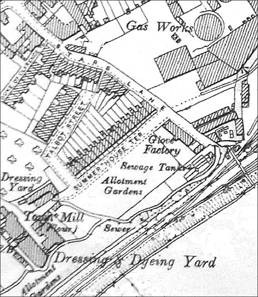
Based on the 1901 Ordnance Survey, Summerhouse Terrace is shown but only went as far as the Town Mill. (Surprising to see Dodham Brook labelled as a 'sewer').
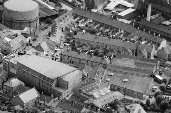
Photographed in 1953. At top left is the gas holder adjacent to Stars Lane and at bottom left is the Gaumont Cinema. Duke of Clarence Yard is at the centre of the picture above and right of the Gaumont. Further up are the backs of the houses in Talbot Street and further still the backs of the houses in Summerhouse Terrace.
gallery
From my
collection. This
image
features in my
book 'Yeovil
- The Postcard
Collection'.
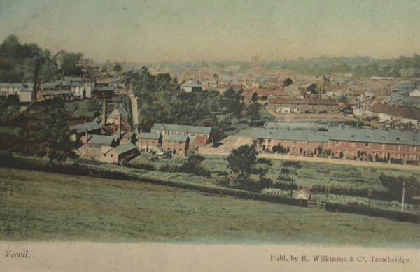
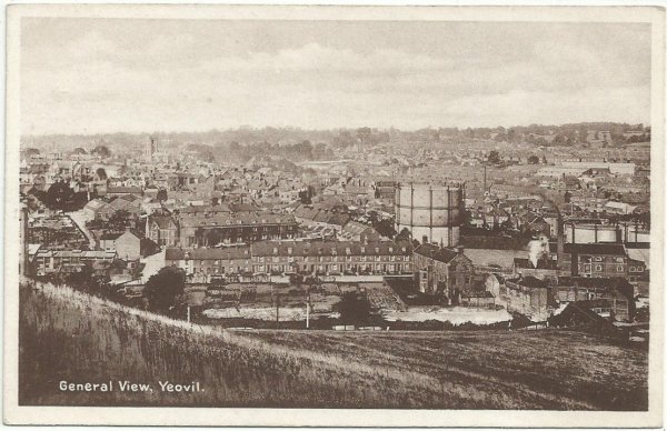
A view from Summerhouse Hill dating to about 1898. At this time Summerhouse Terrace is seen at centre right but Talbot Street has yet to be built behind it. Notice the allotments facing Summerhouse Terrace.
This
photograph
features in my
book 'Yeovil From Old Photographs'.
This postcard, taken from Summerhouse Hill, dates to about 1905 and shows the row of houses in Summerhouse Terrace. At the left end of this terrace is the entrance to Talbot Street which was infill housing behind Summerhouse Terrace. At right, the gas holder was next to Stars Lane, the houses of which are seen between the gas holder and Talbot Street. Below the gas holder is the Foundry House leather glove factory before its extension was built at the rear.
Courtesy of Bill and Audrey Robertson
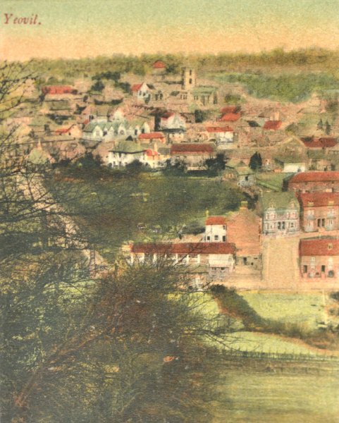
A hand-coloured postcard view from Summerhouse Hill again dating to about 1905. The large, double-fronted house in Talbot Street is seen at centre right with the first two houses of Summerhouse Terrace below it and the allotments beyond them.
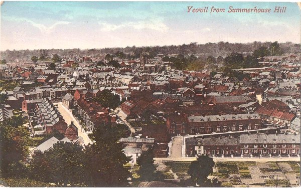
A postcard 'Yeovil from Summerhouse Hill' of around 1907 - note the allotments in front of Summerhouse Terrace at bottom right, Talbot Street behind it and Mill Lane at lower left.
Courtesy of Bill and Audrey Robertson
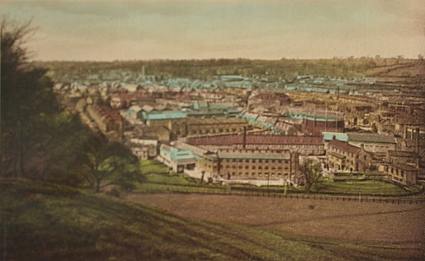
Another hand-coloured postcard view from Summerhouse Hill but dating to about 1910 and the large Blake & Fox glove factory in the middle ground has been built on the site of the old allotments.
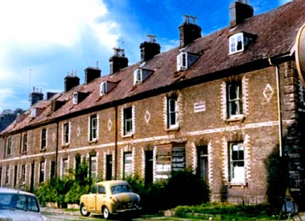
The terrace of houses known as Summerhouse Terrace, almost certainly built by Samuel Cridland in 1875, boarded up and awaiting demolition in the mid-1960s. A colourised photograph taken from Stars Lane.
The row of cottages seen here was the actual Summerhouse Terrace, from which the road gets its name, and where they stand is today the southern edge of Stars Lane car park (see below).
This colourised view, taken from Stars Lane in the early 1960s, looks along the length of Summerhouse Terrace towards its end at Mill Lane.
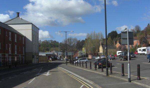
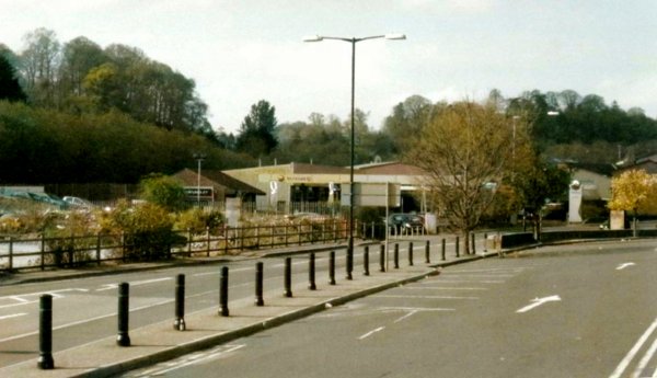
Pretty much the same view as the previous photograph (although the actual road has been slightly re-aligned). Photographed in 2013.
Courtesy of
Chris Rendell
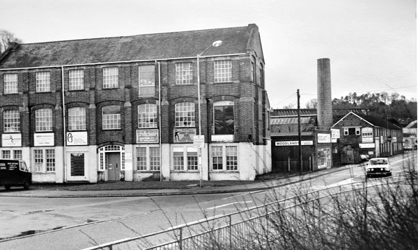
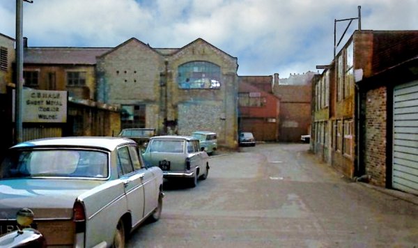
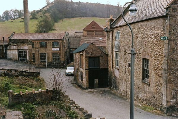
Foundry House photographed in 1985 with what became known at the Foundry House Trading Estate running off to the right along Summerhouse Terrace.
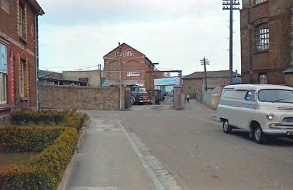
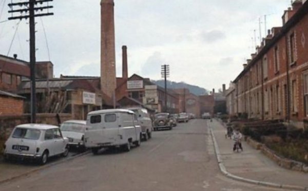
The 1960's photographer is now standing in Summerhouse Terrace, with the first house in the terrace at left and Foundry House at right, looking to the junction with Stars Lane running across the photograph. The end of scrap merchant EJ Farr's building and the entrance to his scrapyard takes up much of centre left while to its right, with the man seen walking along, is the Stars Lane end of Gas Lane.
From my
collection
EJ Farr & Co Ltd's advertisement in the 1970 edition of Kelly's Directory indicating that by this time the company had moved premises to the Pen Mill Trading Estate.
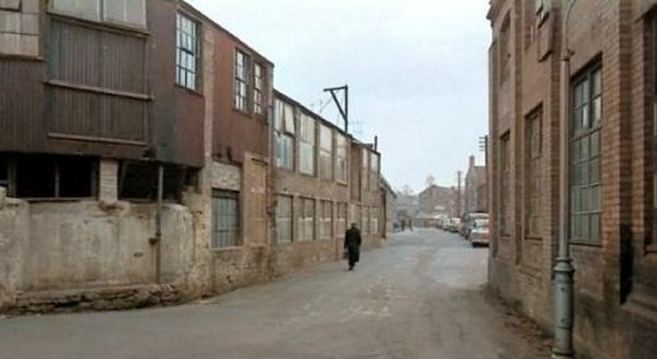
An early 1960s' view of the western end of Summerhouse Terrace as it ended by Mill Lane. The buildings at the right are seen at the left in the following photograph and the double-gabled factory building at the centre is at the right in the photo below.
This colourised view of Summerhouse Terrace was taken from the Mill Lane end and looks towards Stars Lane. Again, photographed in the early 1960s.
This colourised photograph was taken in the mid-1960s from the end of Mill Lane. The double-gabled factory building referred to in the previous two photographs is seen face-on at centre left.
The small building at centre was all that remained of the former Frogg Mill. Summerhouse Terrace ran away to the left at the end of Mill Lane. The house at right, which still stands today, is shown on Watts' map of 1806 as the only building in Mill Lane (apart form the mill).
Courtesy of
Chris Rendell
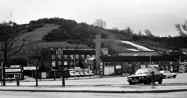
The view across Stars Lane car park after the demolition of the houses in Summerhouse Terrace. Photographed from Stars Lane in 1985. All the buildings in this photograph were demolished. At extreme left is Woodlands timber yard that was situated immediately next to Foundry House and the remaining buildings became known as Foundry House Trading Estate. At the rear is the Blake & Fox glove factory, at right background is the (now defunct) ski slope on the side of Summerhouse Hill.
Courtesy of
Chris Rendell
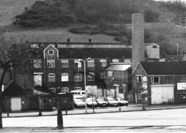
The centre section of the previous photograph enlarged to show the Blake & Fox glove factory.
Courtesy of
Colin Haine.
This photograph
features in my
book "Now
That's What I
Call Yeovil"
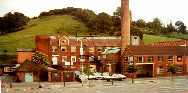
.... and photographed in colour in 1984.
Courtesy of
Vivien and John
Cornelius
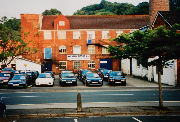
Part of the old glove factory used by Wyvern Motor Co in 2001.
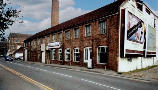
Old glove factory buildings in a colourised photograph of the late 1990s, by which time the premises were being used as shops. Foundry House, which survives today, is at extreme left.
Courtesy of
Vivien and John
Cornelius.
This photograph
features in my
book "Now
That's What I
Call Yeovil"
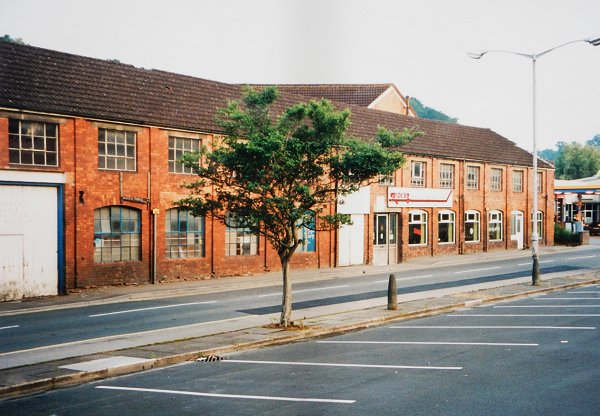
The same buildings, much of which were used by Riders motorbike sales in 2001.
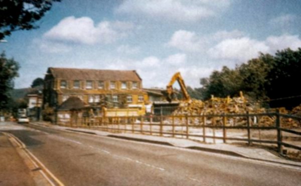
.... and being demolished in a colourised photograph of 2003.
... and post-demolition (and looking west) in a colourised photograph of 2009.