Twelve Acres
Twelve Acres
A field within the great manorial East Field
Although named Twelve Acres (Parcel 957), this large field only actually measured ten acres - the difference in area most likely due to the use of 'Statute' measurements in the Apportionment which were actually different to 'Customary' measurements, even though both used the same named units of area measure. Sloping gently from north to south, it is now fully built on.
At the time of the 1846 Tithe Apportionment Twelve Acres was owned by Robert Donn and let to James Tucker. Twelve Acres was used as arable for growing crops. It measured 10a 0r 0p.
Twelve Acres was bounded on the south by Sydling's Lane (later Rosebery Avenue), on the west by Brickyard Lane (today's St Michael's Avenue), on the north by Higher Hathermead (Parcel 956) and on the east by Sydling's Mead (Parcel 958).
Today, the former Twelve Acres is occupied by the houses and gardens of St Michael's Avenue (to the west), the southern half of Sunningdale Road (down the centre), the western half of Charles Road and the entire length of Mayfield Road (to the east) and Rosebery Avenue (to the south).
For details on historic land measurement (ie acres, roods and perches) click here.
maps

This map, based on the descriptions in the 1589 Terrier and the 1846 Tithe Map of Yeovil shows the approximate boundaries of the Manors of Kingston and Hendford as well as the manorial three-field system used in Kingston.

A map of the great medieval East Field of Kingston Manor showing conjectured locations of several fields based on descriptions in the 1589 Terrier.
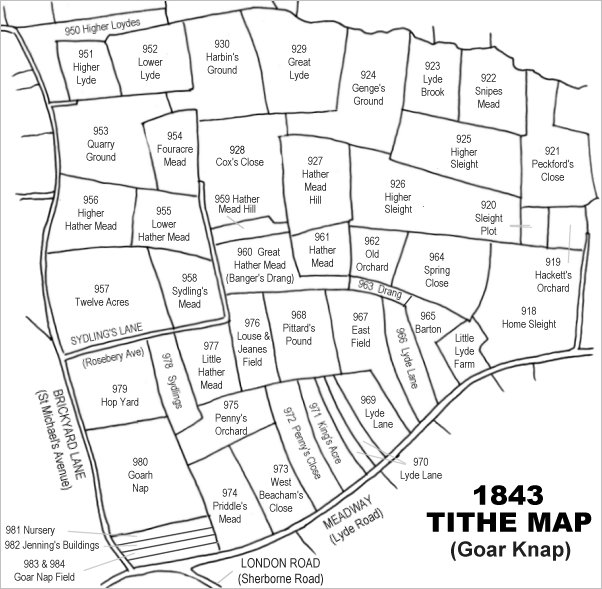
Drawn from the 1846 Tithe Map with field names added from the 1846 Tithe Apportionment, with Twelve Acres at centre left.
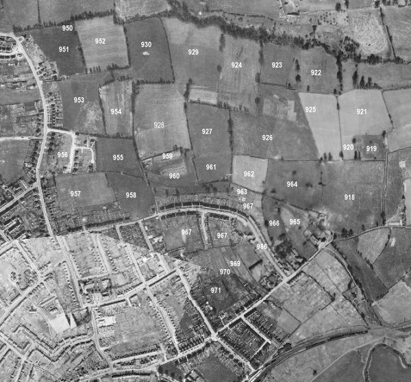
The 1946 aerial survey photograph (somewhat mis-aligned at bottom left) with parcel numbers of 1846 plotted on. By this time, Twelve Acres has been built on by houses of St Michael's Avenue and Rosebery Avenue, but Sunningdale Road, Charles Road and Mayfield Road are yet to be built.
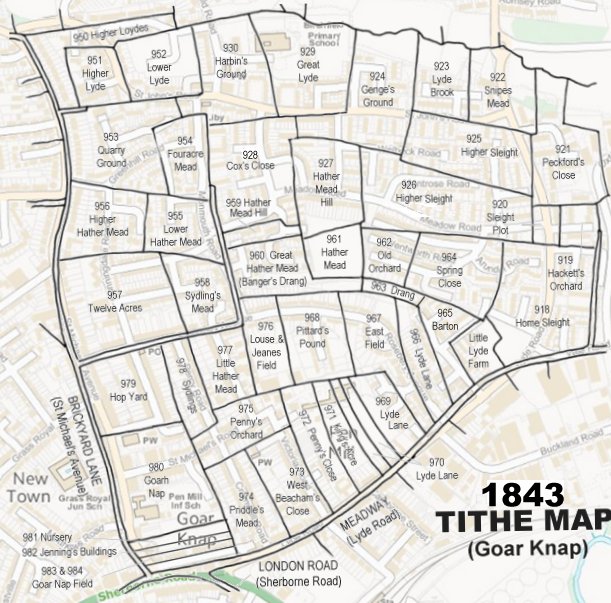
The 1843 Tithe Map overlaid onto a modern map of the area.
Gallery
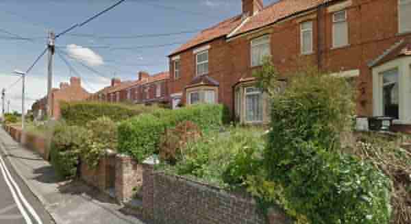
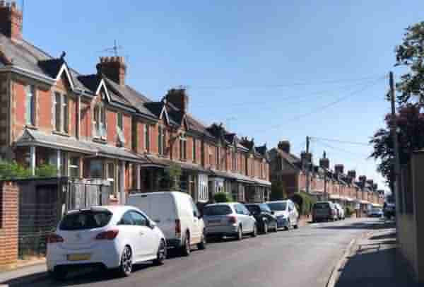
The houses in St Michael's Avenue that were built on the western side of Twelve Acres. Taken from the corner of Rosebery Avenue.
The houses in Rosebery Avenue that were built on the western side of Twelve Acres. Taken from the corner of St Michael's Avenue in 2021.
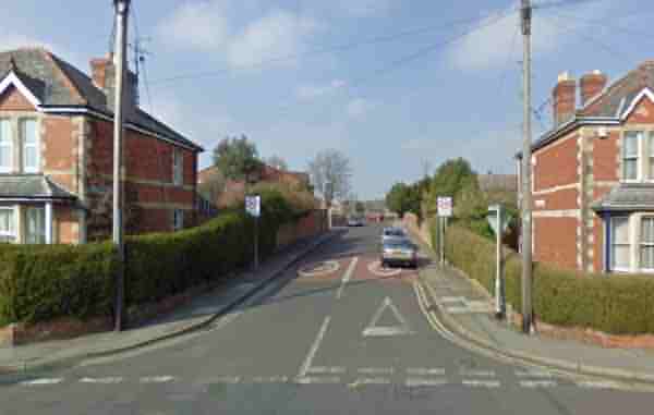
Sunningdale Road, seen here from Rosebery Avenue, ran north-south down the centre of Twelve Acres.