twenty acres
twenty acres
Yeovil's most northeastern field
Shown as two fields, the Middle North Field and the Lower North Field, on Philip Byles' map of 1653, Twenty Acres originally totalled 21a 2r 36p but minor boundary changes by Victorian times had reduced its area to 21a 1r 6p at which time it had become the combined field - Parcel 895. The 1846 Tithe Award noted that it was used as pasture to graze livestock.
The extreme northeast corner of Twenty Acres extended to the River Yeo in order to allow the livestock access to water. The field itself was bounded by the boundary of Yeovil to the north (beyond which was Mudford), to the east by Linches (894), to the south by Higher Cowleaze (905) and Nine Acres (906) and to the west by Higher Eight Acres (896).
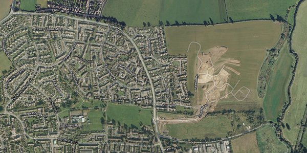
Today (2014) Twenty Acres is being built on as part of the ever-expanding Wyndham Park.
maps
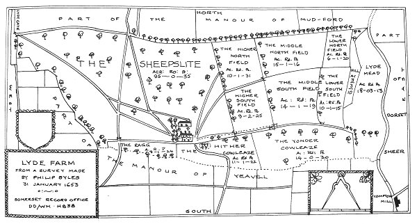
Philip Byles' map of Lyde Farm dated 31 January 1653. Twenty Acres is shown as Middle North Field and Lower South Field towards top right.
Courtesy of
Steve Wills
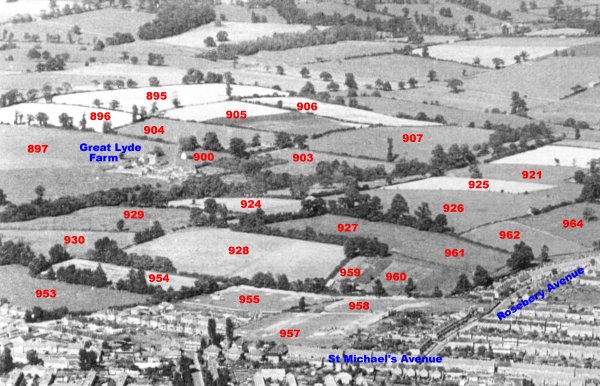
An aerial photograph of the Great Lyde area taken around 1953, with Parcel Numbers superimposed from the 1842 Tithe map.
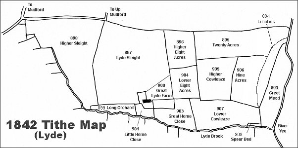
The Lyde area reproduced from the 1842 Tithe Map.
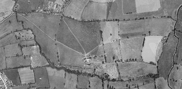
The 1946 aerial photograph of Great Lyde Farm
The same area today 'borrowed' from Google maps and taken around 2010 when the groundworks for Wyndham Park were being started. This is some twenty years after Great Home Close and Lower Cowleaze had been used as a waste disposal site and the valley leveled off.
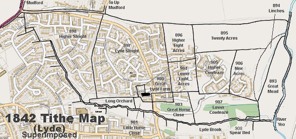
The 1842 Tithe Map superimposed over a modern map.
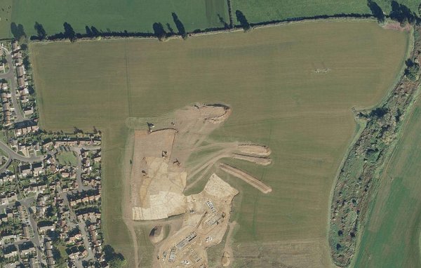
A closer Google Maps image of Twenty Acres taken during the early groundworks phase of the Wyndham park development. Twenty Acres is seen clearly at top centre and right while its boundary with Higher Eight Acres (896) at top left is visible as well as the boundary with Nine Acres (906) at lower right.