bond street
bond street
Built by Peter Daniell and originally called New Street
Until the 1820’s Grope Lane, now Wine Street, was the only direct access for a cart from High Street, the Borough and Middle Street to South Street - George Court and Tabernacle Lane both being too narrow for a cart.
The draper and mercer Peter Daniell of Penn Hill owned a mansion in Middle Street that had been built by his father. This mansion stood where the rear of the WH Smith building bordering Wine Street stands today. He also owned much land between Middle Street and South Street as seen on the first map below. In the early 1830's he planned and built (certainly after 1829 - as it isn't on Watt's map of that year) an extension to Grope Lane which became Union Street. He also built Bond Street (before 1829 as it is shown on Watts' map of that year) to connect Middle Street with South Street and then Peter Street, named after himself, to join Bond Street with Grope Lane / Union Street.
In fact, Bond Street was probably built as early as 1824 when, in its edition of 11 October, the Western Flying Post reported that a workman "was buried by a fall of masonry in New Street, Yeovil". In 1825 the marriage settlement of T Binford referred to "New Street leading from Pit Lane (today's Middle Street) to Back Street (today's South Street)". As seen above, by 1829 Watts' map referred to Bond Street.
In fact crediting Peter Daniel with 'building' Bond Street may be something of a misconception since the Minutes of the Town Commissioners of 5 November 1833 state "Ordered that our Clerk do forthwith give notice to the owners and occupiers of Houses and other Property in Bond Street to complete and make good such Street and the footpaths adjoining the same with good and sufficient materials." On 26 November the minutes stated "Ordered that the new Street called Bond Street be forthwith completed and made good with hard materials by the Owners of the several Houses Buildings Gardens Lands and Hereditaments within and abutting upon the said Street by laying down a foot pavement on both sides of the said Street from one end thereof to the other of good Keinton Stone with a border of the same material of the average width of 3 feet 6 inches throughout and by stoning the intermediate space of carriageway between such foot pavement with good dew stone properly broken and laid on 6 inches in thickness at the least and by making and completing a good and sufficient drain throughout to the said Street communicating with the Common Sewers at either end thereof for carrying off the water from the sides of the said Street and from the Houses Buildings yards and premises situated in or abutting upon the same." The list of owners of properties in Bond Street listed in the minutes are tabulated below.
| Houses and other premises | Owner |
| On the eastern side of the Street | |
| House No 1 from South Street | Francis Peach |
| House No 2 | Robert Sherring |
| House No 3 | Edward Coleman |
| House No 4 | William Coles |
| House No 5 | William Coles |
| House No 6 | William Coles |
| House No 7 | John Cox |
| House No 8 | Henry Hodges |
| House No 9 | Sarah Howe |
| House No 10 | Thomas Brailey |
| House No 11 | Henry Palmer |
| On the western side of the street | |
| House No 1 from Middle Street | John Woolmington |
| House No 2 | William Coles |
| House No 3 | Henry Harris |
| House No 4 | Henry Harris |
| House No 5 | Mary Ann Harris |
| House No 6 | Peter Daniell Esq |
| House No 7 | Peter Daniell Esq |
| House No 8 | Peter Daniell Esq |
As soon as it was laid out Bond Street began acquiring buildings but apparently in an ad-hoc manner, one building at a time and probably all domestic, resulting in a street with little architectural unity. The east side especially has an erratic mix of two- and three-storey buildings but there are one or two buildings with original features above the modern ground floor shop fronts. The Co-operative building has a good, original arch-headed stone doorway - see below.
On the southwest corner of Bond Street and South Street is the Woborn Almshouse, rebuilt at this location in the 1860's.
MAPs
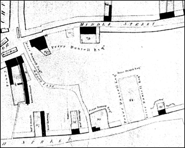
Map of 1813 drawn to show the properties owned by the Corporation (shaded black on the map) but clearly shows Grope Lane connecting the Borough with South Street and also shows the extensive lands owned by Peter Daniell.
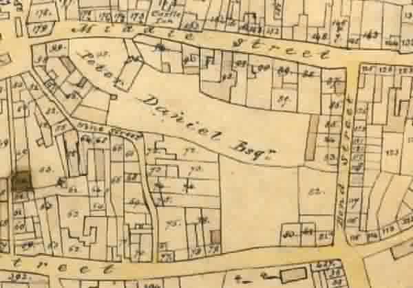
Edward Bullock Watts' map of 1831 showing the newly-built Bond Street. This was before Daniell 'improved' Wine Street by creating Union Street, and then connecting Bond Street and Union Street with Peter Street.
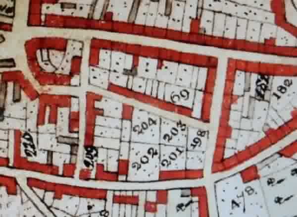
The 1842 Tithe Map, also by Edward Bullock Watts who was the Town Surveyor. During the intervening years between this map and the previous map, Union Street and Peter Street had been constructed and houses built.
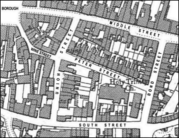
Map based on the 1901 Ordnance Survey. Bond Street connected Middle Street with South Street in the 1830's.
gallery

This
colourised photograph
features in my
book 'Yeovil From Old Photographs'.
This photograph, taken around 1905, looks along Bond Street as seen from Middle Street. The ornate arched entrance at right is the side entrance to the New Inn in what appears to be a building erected separately with its gabled roof facing the road. Today the decorative arch over the side entrance has gone and the entrance itself reduced to just a nondescript security door.
On the left, with the small canopy over the door, is the entrance to bootmaker Frederick Jenner's shop and workshop with living accommodation over.
... and moving closer to Peter Street, in a colourised photograph of around 1965.
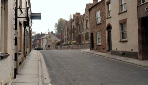
The same section of Bond Street, but looking towards Middle Street, photographed around 1984. Badgers Bookshop, at the left, and Marney's, at the right, were both well-known outlets.
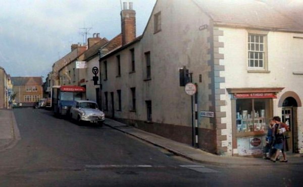
A colourised photograph of Bond Street seen from South Street in the 1960's. Mr Head's small corner shop was demolished, along with the house next to it, in order to improve vehicle access to Bond Street.
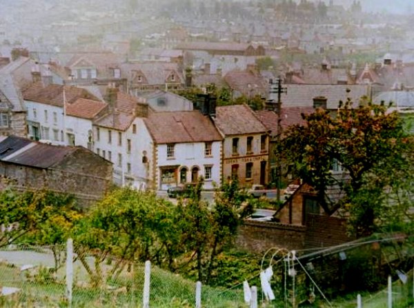
This colourised photograph of the 1960s, looks down on Eden's Fish & Chip shop and the shop on the corner of Bond Street and South Street seen from Penn Hill.

Courtesy of
Chris Rendell
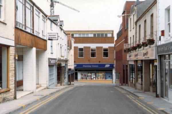
Bond Street photographed from South Street in 1984.
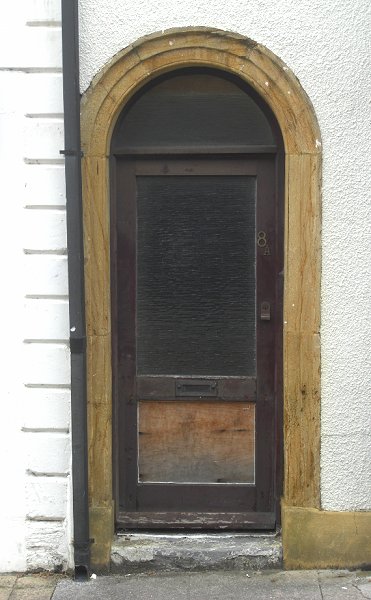
An original doorway in Bond Street - indeed, the only thing now apparent that dates back to the 1820s. Photographed in 2014.
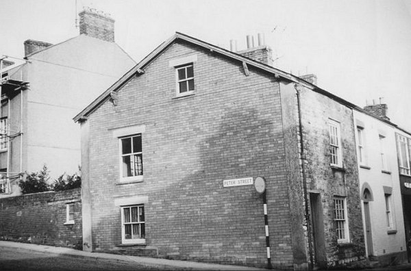
Photographed around 1965, Peter Street runs off to the left and Bond Street to the right. The corner house is now the shop Sports of Bond Street.
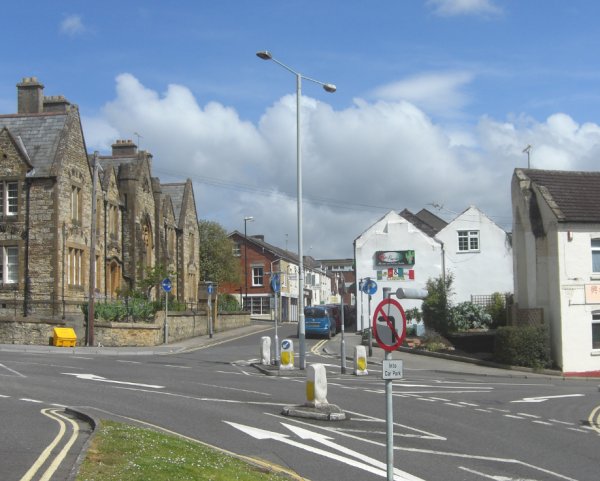
Bond Street seen from South Street, photographed in 2013, an unfortunate eyesore with a plethora of unsightly street furniture.