union street
union street
An extension to Grope Lane
Until the 1830’s Grope Lane, now Wine Street, was the only direct access for a cart from High Street, the Borough and Middle Street to South Street - George Court and Tabernacle Lane being too narrow for a cart.
The draper and mercer Peter Daniell of Penn Hill owned a mansion in Middle Street that had been built by his father. This mansion stood where the rear of the WH Smith building bordering Wine Street stands today. He also owned much land between Middle Street and South Street and much of the land on the north side of Grope Lane as seen on the first map below. In the late 1820's or early 1830's he planned and built an extension to Grope Lane which became Union Street. He also build Bond Street to connect Middle Street with South Street and then Peter Street, named after himself, to join Bond Street with Grope Lane / Union Street.
As seen in the photograph below, the entrance to Union Street from Middle Street was originally much narrower than today's road width. The lower part of Grope Lane, called Wine Street from the 1840's, remained named as such until at least the late 1870’s before becoming known as the southern half of Union Street as seen in the second map.
In the 1840s there was a building on the southeast corner of Union Street and Peter Street although this would have fronted onto Union Street. This building was replaced by a much larger building, Clarendon House, during the 1850s. This new building, with a crenellated parapet (see Gallery), projected into Union Street, significantly reducing the width of the road. Its garden ran along Peter Street and, with outbuildings, stretched as far as Trinity House. It was the home of ironmonger and Mayor of Yeovil Henry Stiby who, together with his mother, lived there for over twenty years before moving to The Park. Clarendon House was then occupied by bookseller and stationer Frederick Whitby, son of Ebenezer Whitby of Princes Street.
By 1927 Clarendon House had been demolished and the site cleared. The present run of buildings from Union Street to Trinity House was built by 1928.
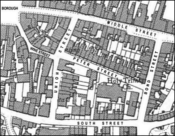
Today the northern section of Union Street has nothing of architectural merit save for the flank of the first house in Peter Street. In the nineteenth and early twentieth centuries there was a Union Hall on the east side of Union Street, seen on the second map below as sited above the 'EE' of street. Just south of this was a Meeting House and on the corner with Wine Street was a fire engine house.
The southern section of Union Street - Wine Street had the small Yeovil Mineral and Aerated Water works on the western side (from 1875 until 1900), and from 1888 the Victoria Temperance Hall on the corner with South Street. The eastern side began to get built up from the middle of the nineteenth century with Albany Court and Albany Buildings. In 1849 the Town House was built by the Improvement Commissioners to provide a police station and residence for the superintendent. On the very corner with South Street was the Portreeve's Almshouse, the site of which is now taken by the Town House car park.
MAPs
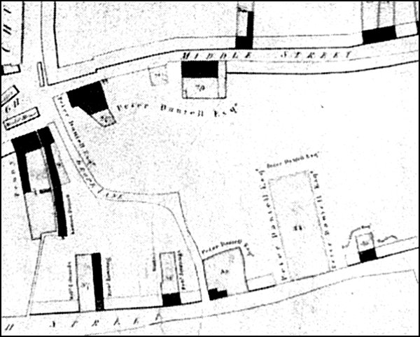
Map of 1813 drawn to show the properties owned by the Corporation (shaded black on the map) but clearly shows Grope Lane connecting the Borough with South Street and also shows the extensive lands owned by Peter Daniell.
Edward Bullock Watts' map of 1831 showing the newly-built Bond Street. This was before Daniell 'improved' Wine Street by creating Union Street, and then connecting Bond Street and Union Street with Peter Street.
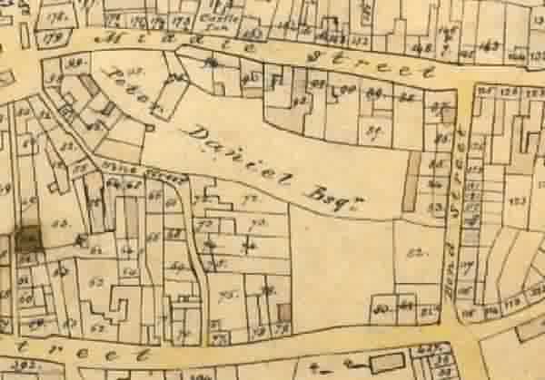
The 1842 Tithe Map, also by Edward Bullock Watts who was the Town Surveyor. During the intervening years between this map and the previous map, Union Street and Peter Street had been constructed and houses built.
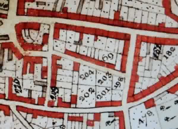
Map based on the 1901 Ordnance Survey. Originally Wine Street ran all the way to South Street as Union Street only came into existence in the 1830's and it wasn't until the 1870's that the southern half of Wine Street was renamed Union Street.
Note the large house on the southwest corner of Peter Street projecting into Union Street and reducing the width of the road by half. This was Clarendon House.
gallery
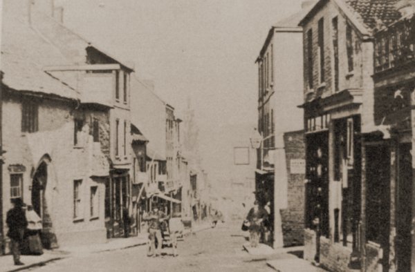
This sepia-toned photograph looking east along Middle Street dates to about 1875 and is the only photograph I know of that shows the original narrow entrance to Union Street at right, opposite the Castle Inn at left. Note also the stovepipe hat of the man pausing with his barrow in the centre of Middle Street.
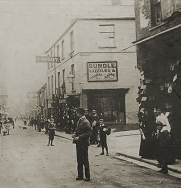
The junction of Union Street and Middle Street photographed about 1880 when John Rundle was the saddler and harness maker whose shop is on the corner of Union Street.
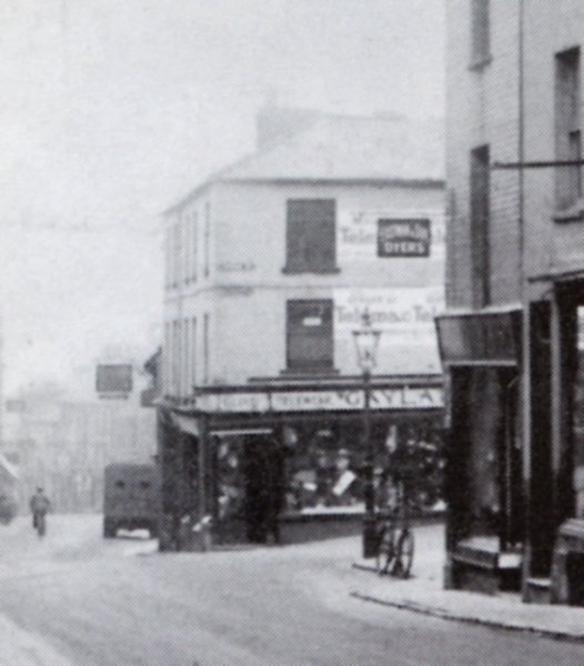
The junction of Union Street and Middle Street photographed in 1932. Rundle's shop, now Gaylard's, remains - but not for long. In this photograph the Post Office building of 1903 (now WH Smith's) is obscured by the projecting Middle Street buildings at extreme right.
From my
collection
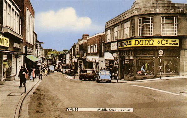
This hand-tinted postcard of Middle Street and the junction with Union Street dates to the late 1960s. The building occupied by Dunn & Co replaced the Rundle's / Gaylard's building of the previous two photos.
From the Cave
Collection,
Courtesy of South Somerset Heritage Collection
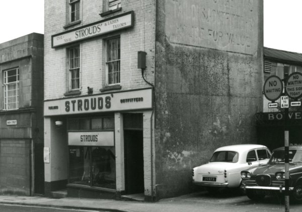
Photographed in the 1960s, this building housed Strouds' ladies & gents outfitters, started in 1896 by Henry Stroud. This building preceded the building that currently houses the William Hill premises. At the left is seen the end of Dunn & Co's premises of the previous photograph.

Photo
(colourised)
courtesy of Rob
Baker
Peter Street blocked by 'The Great Snow' of 1881 as seen from Union Street. This photograph was almost certainly taken by Henry Stiby who was a keen amateur photographer and left a good record of photographs of Yeovil - he lived in Clarendon House, the house seen at extreme right with the crenellated parapet, on the corner of Peter Street and Union Street, at the time.
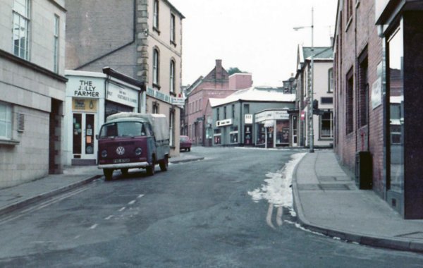
Taken from Middle Street, this photograph dates to January 1985 and looks south along Union Street.
Courtesy of
Chris Rendell
Also taken in 1985, Union Street from Middle Street. At left the jeweller's shop was Ratner's. This branch of Ratner's closed in 1991 after Gerald Ratner made his famous gaffe by saying "We also do cut-glass sherry decanters complete with six glasses on a silver-plated tray that your butler can serve you drinks on, all for £4.95. People say, "How can you sell this for such a low price?", I say, "because it's total crap." End of Ratner's.
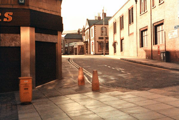
Union Street seen from Middle Street. Photographed in 2015.
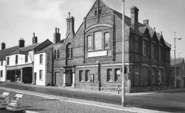
A photograph, taken in the 1960s, of the Victoria Temperance Hall with the junction of South Street and Union Street at right. At bottom left are sales display units in the forecourt of the South Yeovil Service Station.
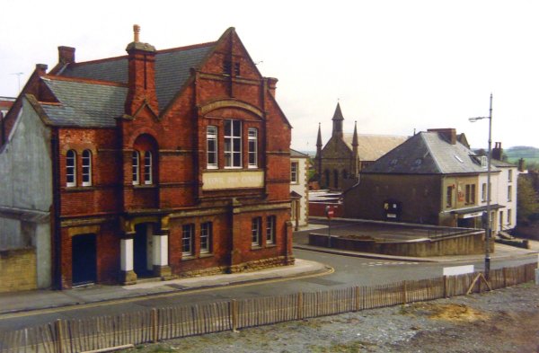
The fence is in front of what had been the South Yeovil Service Station. This photo, of about 1992, looks across South Street to the Day Centre (the former Victoria Temperance Hall) and Union Street.