higher elm path
higher elm path
An ancient field now part of the Recreation Ground
Originally part of the great medieval Middle Field of Kingston Manor, a sub-field called Pikes covered a large area in the region of Marsh Lane and Combe Street Lane. It was still called Pikes and is noted as such on an indenture dated 1800. The name changed however to become Elm Path.
At one time there was a continuous footpath from Yeovil to Yeovil Marsh and eventually to Ilchester by footpaths and lanes. It started at Kingston at Red Lion Lane, continued along Sparrow Lane to Mudford Road then crossed the road and entered a single large field called Elm Path (the field name was a corruption of an earlier name of the footpath - Hellam Path, referred to as Hillon Path in the 1589 Terrier) that ran all the way to Combe Street Lane and then onwards to Yeovil Marsh.
By Victorian times this large field, Elm Path, was part of Lower Stone Farm and had been subdivided into Higher Elm Path (1094), Middle Elm Path (1086) and Lower Elm Path (1081). Today these three fields form the Yeovil Recreation Centre, affectionately known as 'Mudford Rec', and remain the only open green area in the Hollands section.
Higher Elm Path was bounded to the north by Combe Street Lane, to the west by Higher Nobles Nap (1096), to the east by Combe Street (1093) and Stoney Field (1087) and to the south by Middle Elm Path (1086).
The 1842 Tithe Map and the 1846 Tithe Apportionment recorded Higher Elm Path as being owned by Henry Goodford of Chilton Cantelo and the tenant was John Newman Berkley. The measurement was noted as 7a 2r 10p and the use noted as arable, that is, suited to the plow and for tillage and therefore used for producing crops.
On 30 August 1849 Henry Goodford Esq. of Chilton Cantelo, leased to baker Nathaniel Bartlett of Yeovil, the following parcels of land, Land late in occupation of Mr John Newman-Birkley in Yeovil for £172 10s -
-
a cottage and garden Hundred Acres - 3a 2r 20p
-
Stoney Field and Green Cross - 8a 2r 10p
-
Higher Elm Path - 7a 2r 12p
-
Middle Elm Path - 8a 3r 35p
-
Lower Elm Path - 7a 1r 20p
-
Coombe Street - 5a 2r 10p
-
Beacon - 16a 2r 10p
-
Total - 58a 1r 26p
For details on historic land measurement (ie acres, roods and perches) click here.
maps

This map, based on the descriptions in the 1589 Terrier and the 1846 Tithe Map of Yeovil shows the approximate boundaries of the Manors of Kingston and Hendford as well as the manorial three-field system used in Kingston.
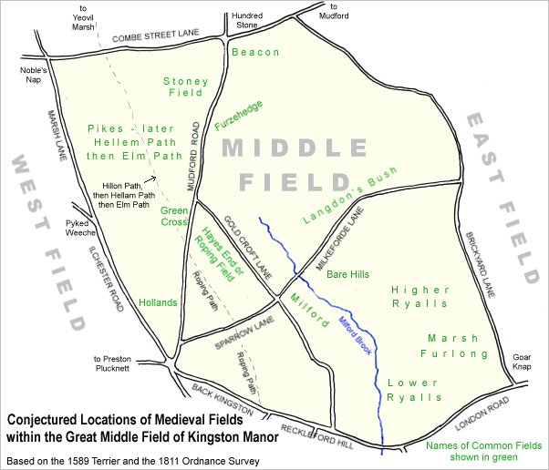
A conjectural map of the great Middle Field of Kingston Manor.
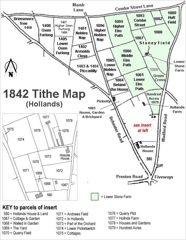
The Hollands area reproduced from the 1842 Tithe Map. Higher Elm Path is right of top centre.
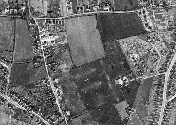
The 1946 aerial photograph showing Higher Elm Path at top centre, below Combe Street Lane.
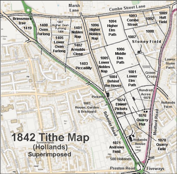
The 1842 Tithe Map superimposed over a modern map.
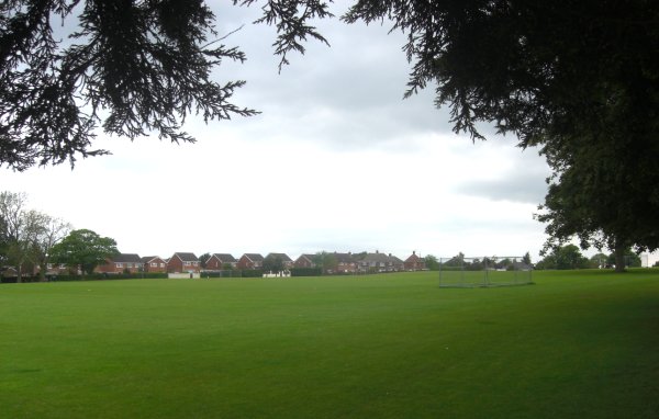
Higher Elm Path seen from the southeast corner, looking northwest. Photographed in 2014.
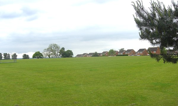
Higher Elm Path seen from the northeast corner, looking southwest. Photographed in 2014.