St Michael's hall
St Michael's hall
Large enough to house a barrage balloon
St Michael's Hall was built as a community hall to serve the St Michael's Road / Goar Knap / Pen Mill area. It was completed in 1908 - as indicated by the date on the weathervane surmounting the ornate clock tower.
Probably its main claim to fame is that during the Second World War it was the only available structure large enough for a fully-inflated barrage balloon to be inflated inside it in order for repairs to the balloons to be undertaken.
St Michael’s Hall has been leased by the council for several years to provide a venue for daytime leisure activity in the town. The council leases St Michael’s Hall from the Bath and Wells Diocesan Board of Finance and the lease is due to expire in October 2018. The council has decided to close St Michael's Hall, moving its provision to the Westland Centre. The owners are yet to decide its future.
gallery
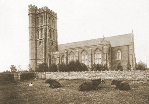
Cows await the rain in the field to the south of the church that would, in 1908, have St Michael's Hall built on it.
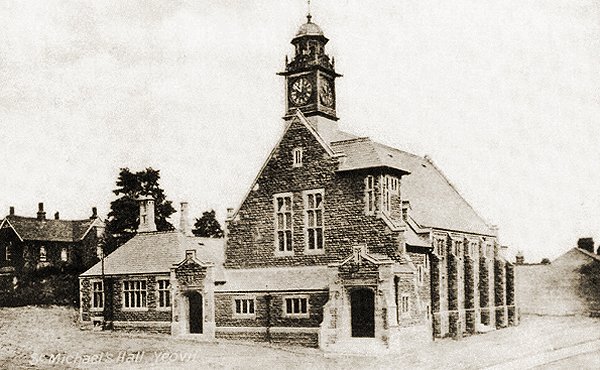
A commemorative postcard, dated 1908, of the newly-erected St Michael's Hall.
From my
collection
-
This
image
features in my
book 'Yeovil
- The Postcard
Collection'.
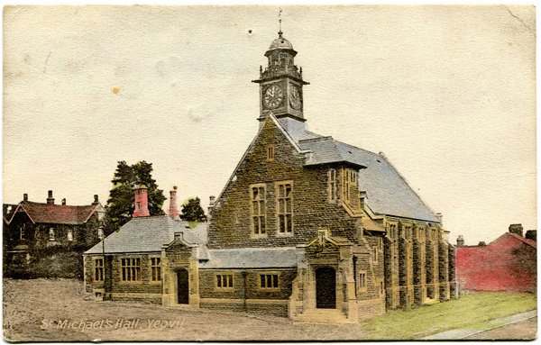
.... and the same postcard, but hand-tinted and posted the following year.
Courtesy of
Roger McElliott
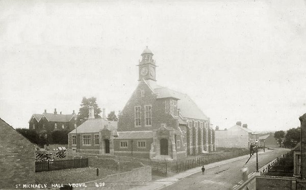
A postcard of around 1910. Note the gas lamp lighter at bottom right.

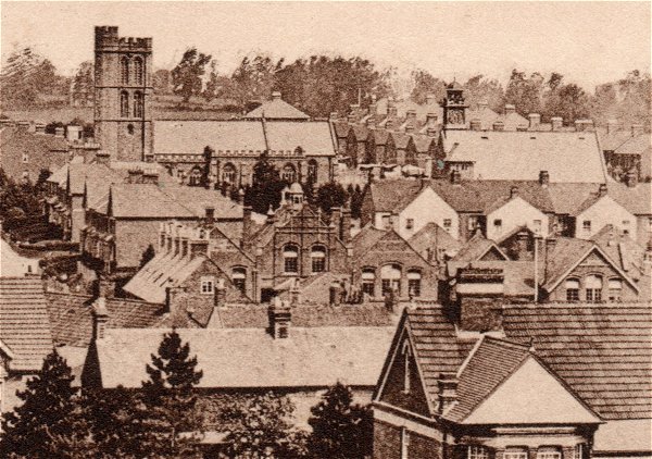
This colourised photograph dates to 1912 and shows St Michael & All Angels’ church tower at left, new houses in St Michael's Avenue at centre and the newly-built St Michael's Hall in the newly-built St Michael's Road at right.
From my
collection
Enlarged from a postcard, this photograph was taken in 1913 from the top of Wyndham Hill. Across the bottom of the photograph are the roofs of houses on the south side of Sherborne Road, at top left is St Michael's church and at top right is St Michael's Hall. At centre and running to centre right is the Pen Mill Elementary School.
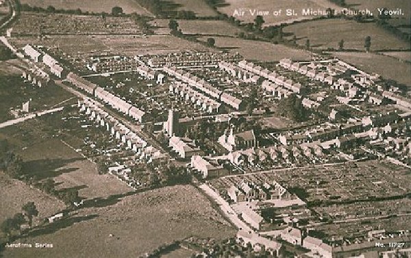
An aerial postcard of the very early 1920s with St Michael's Hall just right of centre. This photograph demonstrates remarkably well how isolated this part of Yeovil was at the time; St Michael's Avenue runs diagonally across the image from bottom right to top left, the first road off to its right is St Michael's Road, the last road off to the right towards the top of the photo is the partly-built Rosebery Avenue and the three roads between are, from left to right, Glenville Road, Percy Road and Alexandra Road.
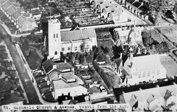
A postcard dating to 1927 and giving an aerial view of St Michael's church at upper left of centre, the vicarage at upper right, St Michael's Hall lower right and St Michael's Avenue at left.
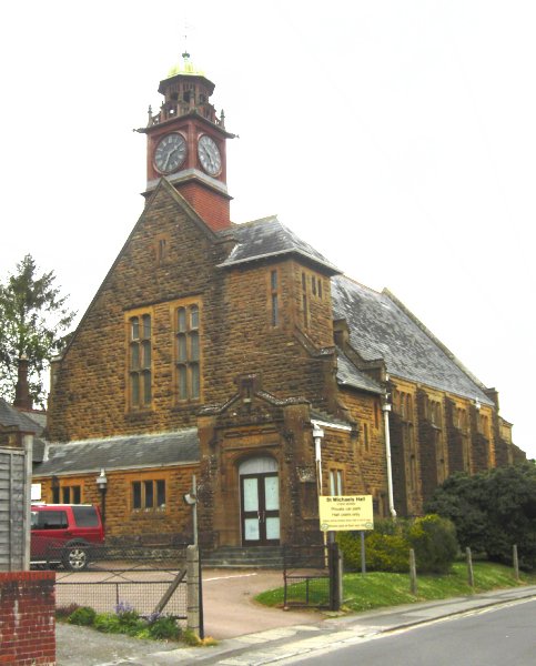
St Michael's Hall, photographed in 2013.
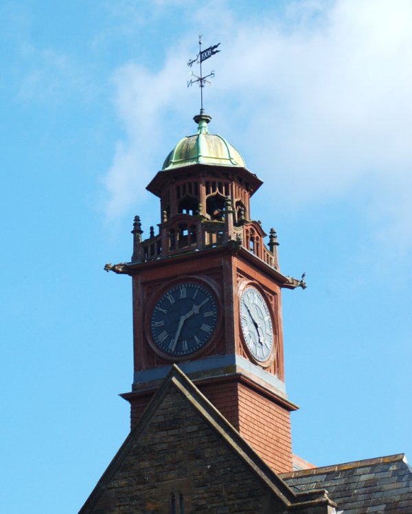
The magnificent ornate clock tower is surmounted by a weather vane with the date 1908. Photographed in 2013.
Courtesy of Al
Cobb
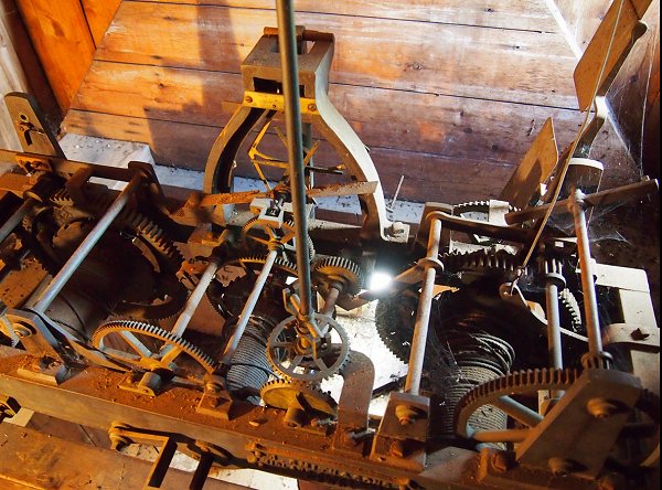
The movement of the clock, photographed in 2012.