St Michael & All Angels’ church
St Michael & All Angels’ church
A new church for the new Pen Mill parish
St Michael & All Angels’ church was designed by Yeovil architect J. Nicholson Johnston in a uniform early fifteenth century style with touches of Art Nouveau. Largely paid for by the Cole family, it cost in the region of £10,000 (about £2 million at today's value) and opened in 1897 to serve the newly-formed Pen Mill parish. Interestingly the architect referred to the new church as "The Cole Memorial Church of St Michael". The vicarage next door was built at the same time. Both were built in the former field called Goar Knap (Parcel 980).
As seen from the 1901 Ordnance Survey below, St Michael & All Angels’ church and vicarage, together with the Pen Mill Board School of 1894, were the only buildings north of New Prospect Place along the track known as Brickyard Lane that ran north from Goar Knap and the Sherborne Road. Brickyard Lane was to take the name of the church to become St Michael's Avenue.
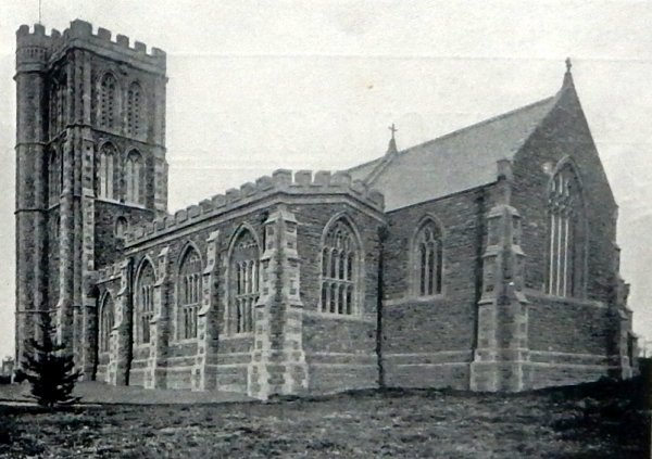
St Michael & All Angels’ church is built of squared random coursed Ham stone with ashlar dressings under a Welsh slate roof. It has a short chancel, a 5-bay nave and north aisle, a 3-bay Lady Chapel on the south side, with a short south aisle, all with fifteenth century style traceried windows. The tower, at the west end of the south aisle, has offset corner buttresses and is of four stages with a pointed arched doorway to the south with a rectangular carved panel above.
Originally built with a large number of crocketted pinnacles surmounting the tower and stair turret, a violent storm in October 1896 blew two pinnacles down; one crashed through the church roof and the other nearly struck a man passing by.
MAP
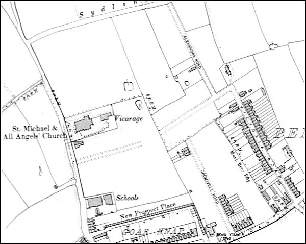
The 1901 Ordnance Survey showing St Michael & All Angels’ church, almost completely alone along Brickyard Lane, later St Michael's Avenue. St Michael's Road is only in the planning stages to its south.
gallery
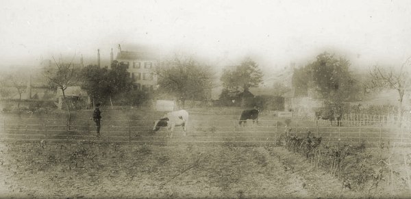
Photographed around 1890 and looking towards Brickyard Lane (today's St Michael's Avenue), this is a photograph of the field called Goar Knap (Parcel 980) on which the new church would shortly be built.
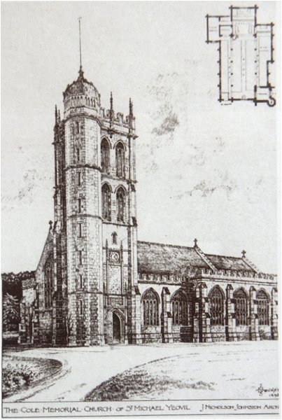
The architect J Nicholson Johnson's sketch of the church published in the 10 May 1895 edition of The Building News. Note that he refers to it as 'The Cole Memorial Church of St Michael'.
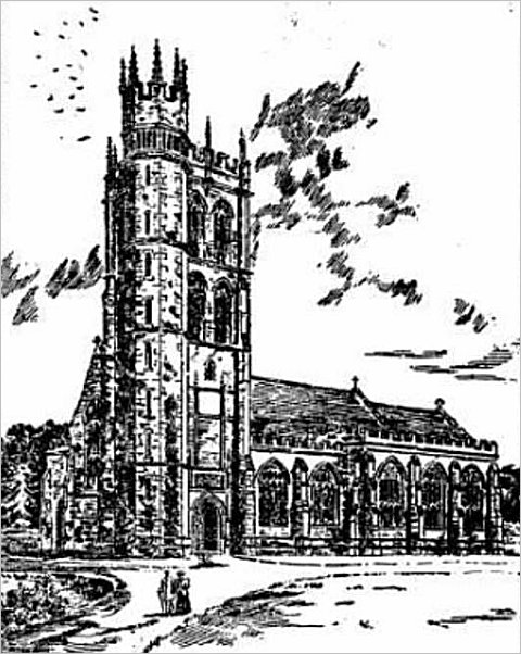
An artist's impression of the new church made before it opened in 1898. The tall crocketted pinnacles surmounting the tower and tower turret were removed after two pinnacles were brought down by a storm in October 1896, causing much damage and nearly killing a passer-by.
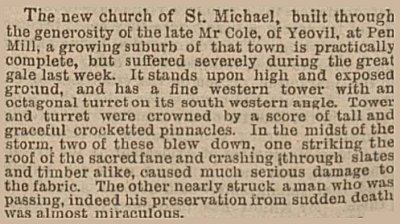
A report from the 13 October 1896 edition of the Western Gazette concerning the storm that brought down the two pinnacles.
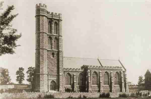
This photograph was taken by Yeovil Photographer Jarratt Beckett and published in his 1897 book "Somerset viewed through a Camera".
From my
collection
-
This colourised photograph
features in my
book 'Yeovil
From Old
Photographs'
The newly-built St Michael's church is seen from the field Marsh Furlong (Parcel 980) the other side of St Michael's Avenue (at the hedge-line) around 1897, before this section of the road became built-up after 1912.
Courtesy of
Colin Haine
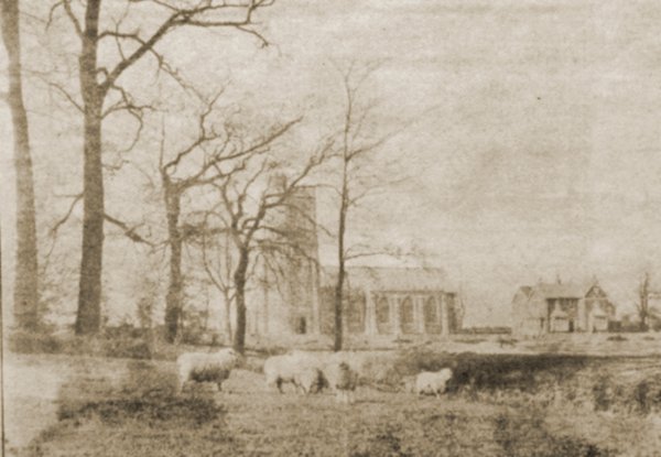
Another view of the newly-built church and vicarage showing how truly rural the area was at the time. Taken from a newspaper cutting.
Courtesy of Bill and Audrey Robertson
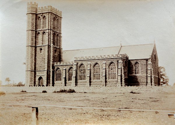
Photographed around 1898 from the field Goar Knap (Parcel 980) to the south of the church.
St Michael's church, photographed by Whitby & Sons and published in their 'Views of Yeovil'.

The children and teachers of St Michael's Sunday School, Class 2, photographed in 1907.
From my
collection
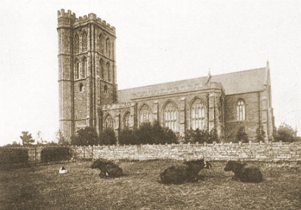
Cows await the rain in the remainder of the field Goar Knap (Parcel 980) to the south of the church that would, in 1908, have St Michael's Hall built on it. This image was used in several different versions (see next postcard) including one on which the stamp box on the reverse reads "Affix Halfpenny Stamp" which dates the postcard to before 3 June 1918, when the price rose to one penny.
From my
collection.
This photograph
features in my
book "A-Z
of Yeovil"
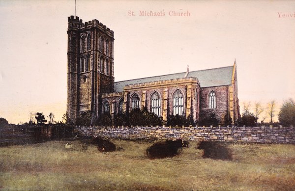
.... and the same photograph used in a colourised postcard of 1908. I also have another postcard sent in 1913 and an unused one with a hand-coloured sunset sky.
From my
collection
-
This
image
features in my
book 'Yeovil
- The Postcard
Collection'.
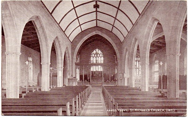
A postcard, probably from around 1900, showing the interior of St Michael's church.
From my
collection
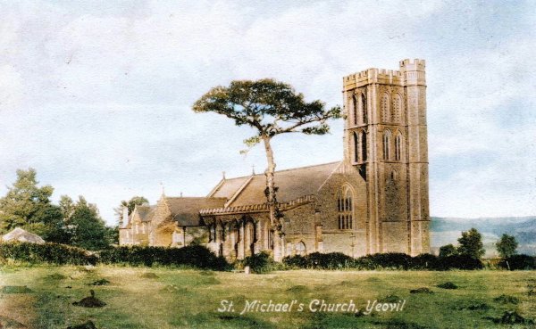
This colourised postcard is undated and, comparing it with the next two postcards, it seems to predate the building of the vicarage. Having said that, the houses in St Michael's Avenue seen in the background have now been built (and they were built after the vicarage) - so it's just a trick of perspective. This postcard was used for years since I have another that was posted in 1935.
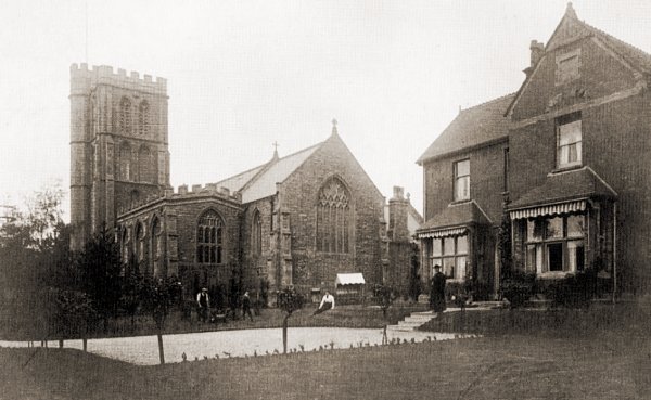
St Michael & All Angels’ church and its vicarage, seen from the southeast around 1910 - whether or not this shot came first or the next I'm not sure. Perhaps the ivy grew all over the vicarage after this shot, or perhaps this is the later shot after all ivy had been removed???
From my
collection.
This
image
features in my
book 'Yeovil
- The Postcard
Collection'.
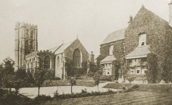
St Michael & All Angels’ church and its vicarage, seen from the southeast around 1910.
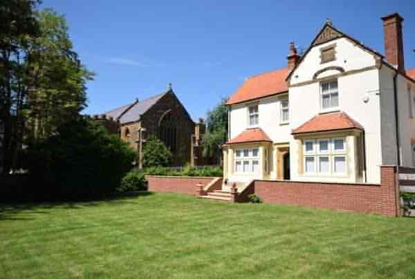
St Michael & All Angels’ church and its vicarage, from the sale details of the vicarage in 2018.

This colorised photograph dates to 1912 and shows St Michael & All Angels’ church tower at left, new houses in St Michael's Avenue at centre and St Michael's Hall (completed in 1908) in the newly-built St Michael's Road at right.
From my
collection
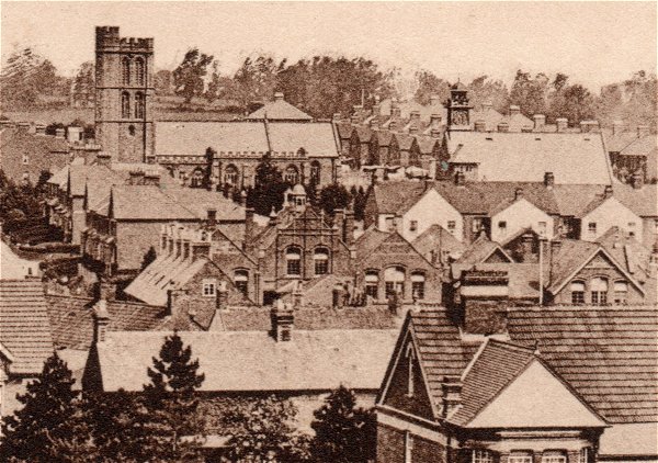
Enlarged from a postcard, this photograph was taken in 1913 from the top of Wyndham Hill. Across the bottom of the photograph are the roofs of houses of Sherborne Road, at top left is St Michael's church and at top right is St Michael's Hall. At centre and running to centre right is the Pen Mill Elementary School.

From my
collection
-
This colourised photograph
features in my
book 'Yeovil From Old Photographs'.
A postcard of 1920 looking south down St Michael's Avenue towards the church.
This
image
features in my
book 'Yeovil
- The Postcard
Collection'.
An aerial postcard of the very early 1920s with St Michael's church at centre. This photograph demonstrates remarkably well how isolated this part of Yeovil was at the time; St Michael's Avenue runs diagonally across the image from bottom right to top left, the first road off to its right is St Michael's Road, the last road off to the right towards the top of the photo is the partly-built Rosebery Avenue and the three roads between are, from left to right, Glenville Road, Percy Road and Alexandra Road.
From my
collection
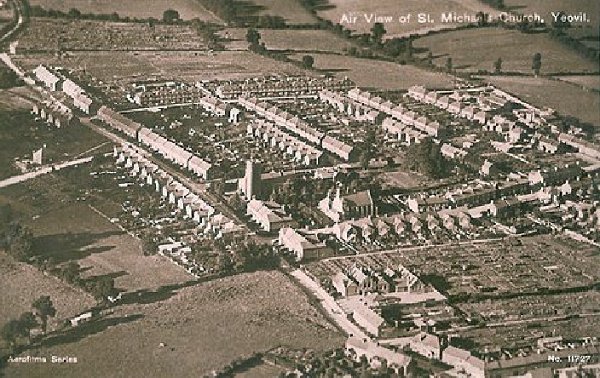
A postcard dating to 1927 and giving an aerial view of St Michael's church at centre, the vicarage at far right and St Michael's Avenue at left.
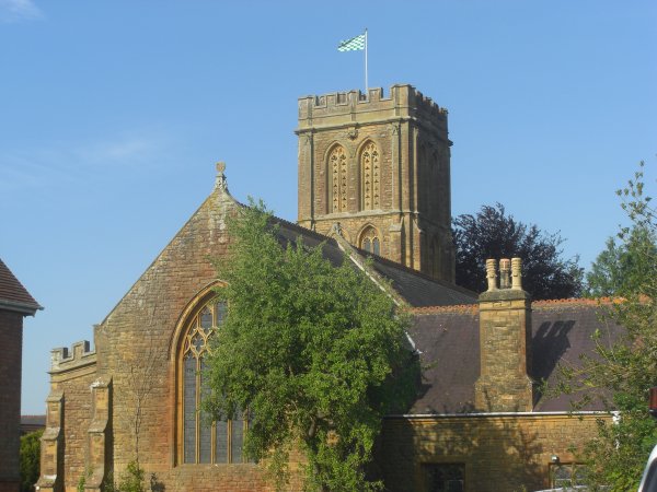
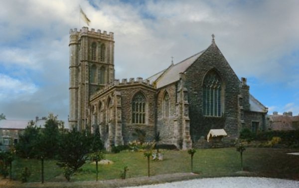
St Michael & All Angels’ church seen from the east. Photographed in 2013.
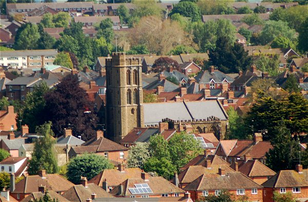
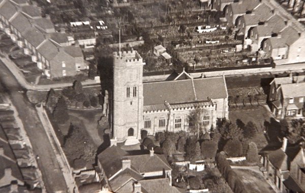
St Michael & All Angels’ church, now completely engulfed by housing. Photographed from Summerhouse Hill in 2013.