beer street
beer street
Named for its developer, Levi Beer
Beer Street was a development started along the very edge of the municipal boundary in the late 1890s by local businessman, town councillor and local 'character' Levi Beer. He, of course, named Beer Street after himself. He was also responsible for building Orchard Street, named after Daniell's Orchard on which it was built.
Beer Street was built on two former fields called Leache's Mead (Parcel 312) and Priddle's Mead (Parcel 611). The word 'mead' comes from the Old English 'maed'. Before grass seeds were obtainable this was the only hay land of the community. It usually consisted of land near streams (the western boundary of both Leache's Mead and Priddle's Mead was the stream that marked the boundary with the parish of Preston Plucknett) since that was the only kind of land on which hay grew in any quantity.
The 1846 Tithe Apportionment noted that Leache's Mead was owned by Edwin Newman, a Yeovil solicitor, and was occupied by John Lush Cayme. The Apportionment recorded that Leache's Mead measured 1a 1r 22p (for details on historic land measurement - ie acres, roods and perches - click here) and was used as meadow - signifying grassland mown annually in the summer for making hay.
Levi Beer was fervently against party politics; he was locally famous for his election slogans such as "Don't vote for water, vote for Beer" and, on standing for election in Queen Victoria's Jubilee Year of 1887, his election slogan was "No cold-water Jubilee - vote for Beer".
Beer Street appears on the
1901 Ordnance
Survey (shown
below) but
mostly shown as
a dotted line
indicating that
it was under
construction
with only
scattered
housing along
its west side.
At this time
Orchard Street
was also under
construction and
nearing
completion but
Westland Road,
of course,
didn’t exist. As
a consequence
Beer Street
continued north
to join up with
Huish which
ended at the
junction with
Grove Avenue
with fields
beyond. This
northern section
of Beer Street,
between Orchard
Street and Huish
was later to
become
West
Street.
MAP
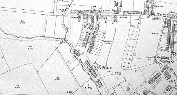
The 1901 Ordnance Survey showing Beer Street running from its junction with Huish at top to West Hendford, just off the bottom of the map.
gallery
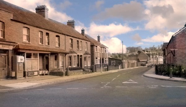
Beer Street seen from the junction with Orchard Street / Westland Road in a colourised photograph of the mid-1960s. Mr Holland's shop at extreme left.
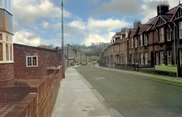
This colourised photograph was taken at the same time as the one above but just a few yards further into Beer Street itself.
Courtesy of
Tony Robins
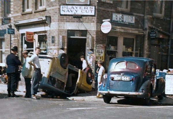
A colourised photograph taken outside Harold Robins' shop on Wednesday 9 July 1958. The West Hendford / Beer Street / Horsey Lane crossroads was a bit of a racetrack at the time and this car ended up on its roof outside the shop. The driver of the upturned vehicle was Peter Unwin (then a teacher at Yeovil School) and his passenger was another teacher, Miss Whelan, who taught music. The car was driven by Mr R Cobner of 15 Kingston. Tony Robins recalled "There was petrol pouring out of the car and that bloke was standing there with a lighted cigarette in his hand!"
|
Many thanks to Barry Rawlings for passing on this snippet from the Western Gazette's edition of 18 July 1958 - “CROSS-ROAD CRASH Mr PR Unwin, 2 Yeovil-road, Montacute, writes thanking all those kind people who were so helpful after the accident at the Horsey-Lane—West Hendford cross roads on Wednesday week. Mr Unwin was driving a small utility-type vehicle which was involved in a collision with a car driven by Mr R Cobner of 15 Kingston.” |
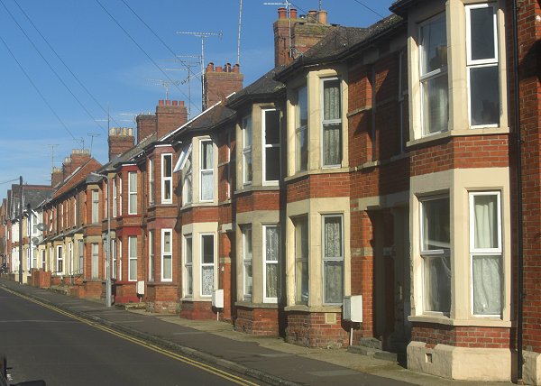
.... and Beer Street houses on the other side of the road, again photographed in 2013.