West Hendford
West Hendford
Formerly Horsey Lane
Originally West Hendford was known as Horsey Lane, sometimes referred to as Horses Lane, and ran from its entrance opposite the Three Choughs in Hendford to the catchpool (now the junction of West Hendford and Beer Street) before turning sharply left to Hendford Bridge by today's Railway Hotel.
Today's West Hendford appeared as Salthouse Lane on E Watts' map of 1806 and as Horsey's Lane on E Watts Jnr's map of 1831.
At the southern end of today's Salthouse Lane was a tan yard owned by John Perrott and facing today's West Hendford. Perrott was in dispute with the Town Commissioners and threatened to 'indict' the road unless they would put it into good repair. The authorities refused to be threatened but a compromise was reached in 1835 when it was agreed that the road, from the Three Choughs to today's Beer Street, was to be put into good repair at the expense of the private residents (of which there were very few), but after February 1836 the responsibility for maintenance of the road would be assumed by the Commissioners.
West Hendford was a rural lane bounded both sides by fields and orchards and in the 1841 Census it was listed as both Horsy’s Lane and Horsey’s Lane but only contained three households with a total of twelve people. In the mid-nineteenth century Horsey Lane was re-named West Hendford, apart from the final short stretch between the catchpool and Hendford which remains Horsey Lane to this day.
In a complete change, and for no currently-apparent reason, today's West Hendford was named Cricket Lane in the 1901 census. In fact Cricket Lane was a colloquial name used simply because a field used for cricket was situated off West Hendford, at the time a simple track beyond Beer Street, between the allotments and the Westland factory complex. This was later the Somerset County Cricket ground for five First-class matches between 1935 and 1939.
Although a few more houses had appeared by the time of the 1901 Ordnance Survey in the area of Manor Road, fields still bounded the north of West Hendford from Salthouse Lane to Beer Street. Most of the remaining houses, including The Crescent, were built in the late 1930s, just before the Second World War.
West Hendford was bisected by the construction of Queensway in the 1970s.
map
s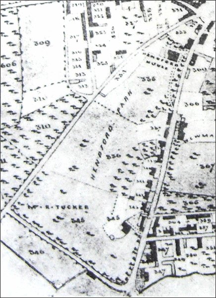
This section of Bidder's map of Yeovil of 1843 shows the extent of Hendford Park - the grounds of Hendford House (today's Manor Hotel) - all but filling the space between today's West Hendford, seen running from top right to lower left, and Hendford, running down the right hand side of the map. At the bottom, in the land marked as 'Mr R Tucker' was Hendford Lodge, the lodge to Hendford House.
The map also shows the length of the original Horsey Lane running from top right diagonally to lower left then running diagonally down to just right of centre at the bottom.
gallery
This
colourised photograph
features in my
book "Lost Yeovil"
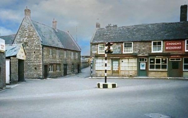
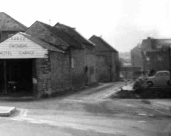
This photograph is the view from Hendford, with the photographer's back against the Three Choughs Hotel. At extreme left is the Three Choughs Hotel's guest's garage, then the narrow entrance to West Hendford. The building at left is the former Oxford Inn and at right is Mr Banfield's Cottage Café and the Chough's Restaurant (previously the Chough's Tap) above what would become Modelkits, owned by Mr Banfield's son, Bob, later Verger at St John's church. Photograph taken about 1960.
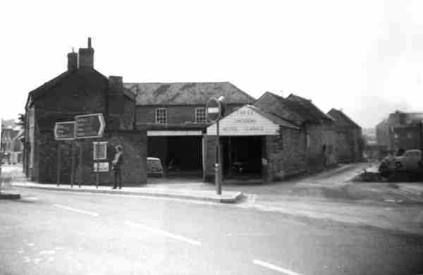
The quaint roundabout with the traffic light had gone by the early 1970's - in fact when I moved to Yeovil in 1973 there were no traffic lights in the town whatsoever. Those were the days!
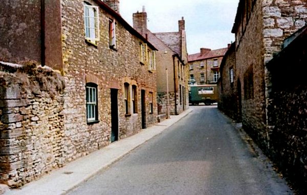
This photograph, taken around 1960, shows the very narrow entrance to West Hendford running alongside the Oxford Inn. Note that the Three Coughs Hotel (standing immediately behind the photographer) had a garage for patrons. This was the former livery stables of the Three Choughs Hotel.
Courtesy of
Garth Baker
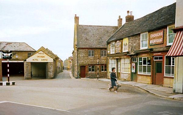
Taken a few years later, in the 1960s, after the Oxford Inn had been demolished and its site used as a temporary car park.
Courtesy of
Garth Baker
A section of the previous photograph, enlarged to show the 'top' of West Hendford.
The entrance to West Hendford seen in 2012, now blocked to vehicular access. The site of the former Chough's stables / garages now occupied by a massive block of flats.
Looking back to the entrance of West Hendford and its junction with Hendford opposite the Three Choughs in 1956. This colourised photograph shows how narrow West Hendford was at its junction with Hendford. At the end of the road the Three Choughs Hotel faces West Hendford..
Moving back a little, this colourised photograph of the eastern end of West Hendford was taken around 1961.
A similar (colourised) view of the early 1960s. At the end of West Hendford, on the left just before the van is the Oxford Inn and all along the right hand side are the former livery stables and later garaging of the Three Choughs Hotel. Everything, apart from the Three Choughs, is now gone - including the van.
From the Cave
Collection
(colourised),
Courtesy of South Somerset Heritage Collection
Demolition of the cottages begins, around 1965.
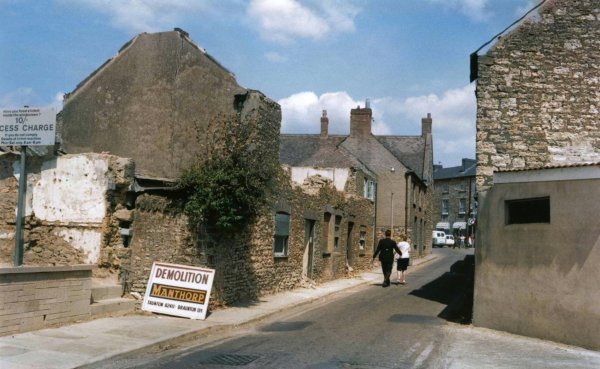
Today, apart from the width of the road, everything has changed. Photographed in 2012.
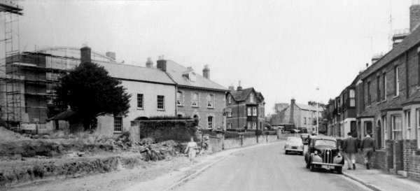
Judging by the scaffolding around the new swimming pool in the background at the left, I'd say this photo of West Hendford was taken in 1961 or early 1962.
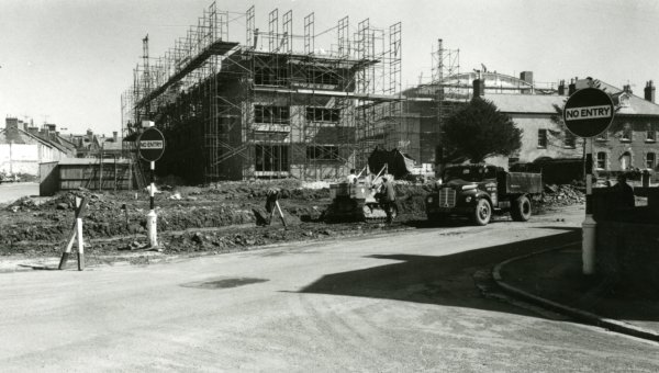
The construction of Wellington Flats, seen from the junction of West Hendford and Hendford Grove in the 1960s.
Moving west along West Hendford, at extreme left is the corner of Morley House and at centre the houses of Felix Place. Photographed in the 1960s.
.... and a little further west, again in the 1960s.
Photographed in the 1970s. With the demolition of the houses in West Hendford and Felix Place to the east of Morley House, a new large car park (colloquially known as the 'Swimming Pool Car Park') was provided for the ever-increasing number of cars in the town.
Looking east along West Hendford from outside Morley House, again in the 1970s. The new car park is seen at the left, and the back of the Manor Hotel complex is to the right. Judging by the lack of cars, this must have been taken on a Sunday morning.
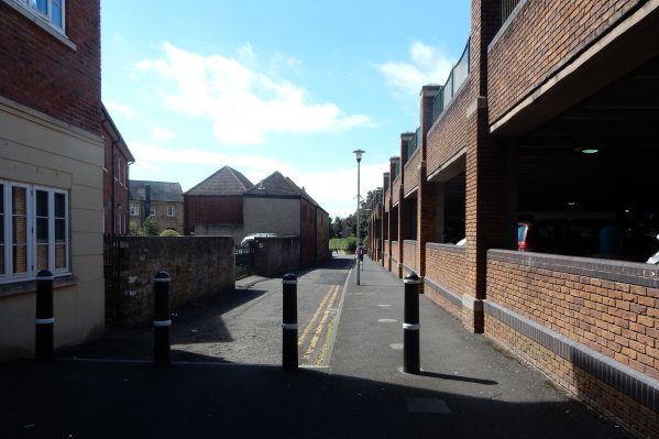
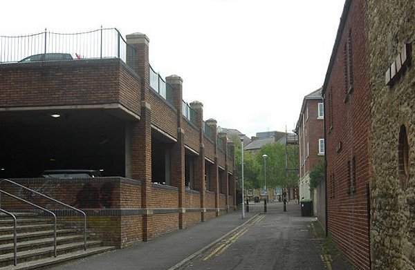
The eastern end of West Hendford, looking west. The two-storey car park at the right was built on the old Swimming Pool Car Park. Photographed on 22 August 2016.
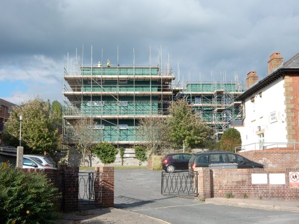
The view from West Hendford alongside Morley House, at the right, of the new flats that would dominate the area. Photographed on 12 October 2016.
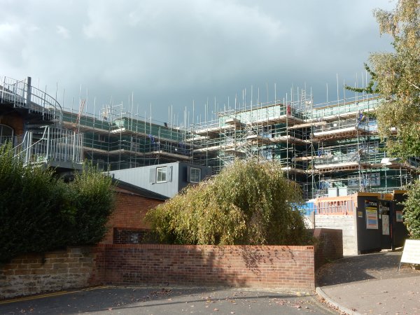
The view from West Hendford seen from the other side of Morley House. The new flats were built on the site of the old swimming pool and the Swimming Pool Car Park. Photographed on 12 October 2016.
Courtesy of
Vivien and John
Cornelius. This
photo features
in my book 'Now
That's What I
Call Yeovil'.
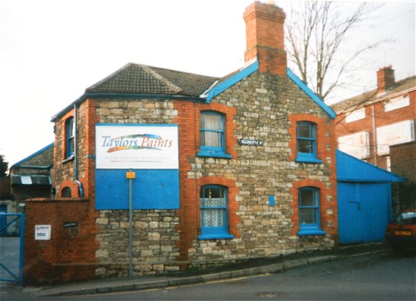
The last remaining building from the original Wellington Street seen from West Hendford. Photographed in 1998 at which time it was the premises of Taylor's Paints, who had taken over what had originally been the old candle factory at the junction of Salthouse Lane and Wellington Street with West Hendford.
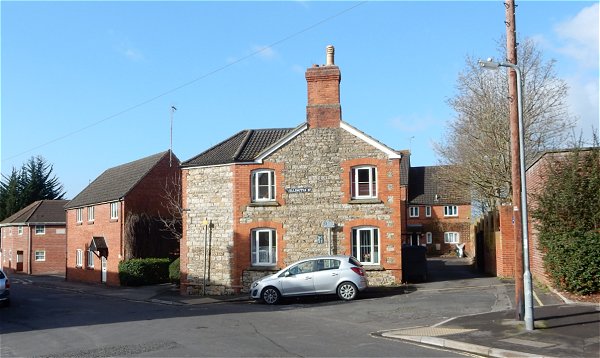
The same building seen from West Hendford and, photographed in 2015.
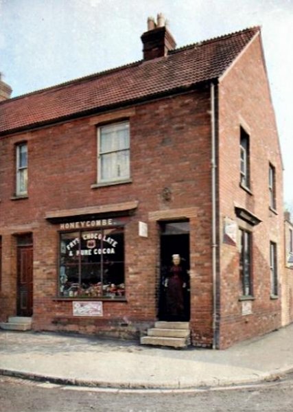
William Henry Honeycombe (b1870, St Cleer, Cornwall) bought this shop at 61 West Hendford, on the corner of Manor Road, around 1900 when it was newly-built, and ran it with his wife Eliza née Bowden (3 July 1859-1952). She was the daughter of George Bowden (1829-1902) and his wife Sarah Ann née Moors. Sadly, William died on 23 March 1902, aged 31. They had a daughter, May (1895-1972). Eliza then ran the shop on her own and lived above it with May. Her mother came to help her - and that is her mother, Sarah Ann Bowden, in the doorway above, in a colourised photograph of around 1905. Around 1909, Eliza, May and Sarah were living in Sparkford, and in the 1911 census, 51-year-old Eliza gave her occupation as a shop keeper and 15-year-old May gave hers as an apprentice dressmaker. (By 1911, the West Hendford shop was run by Mrs Burrows). Eliza, May and Sarah soon returned to live in Yeovil, where Sarah died in 1913, aged 77.
In September 1920, May married Ernest Frank Symes (1894-1932) at Yeovil. The 1939 England a Wales Register recorded Eliza and May at 51 Seaton Road, both were listed as widows. May gave her occupation as a grocery dealer and Eliza gave hers as 'unpaid domestic duties'. Eliza died in 1952 and May in 1972, both in Yeovil.
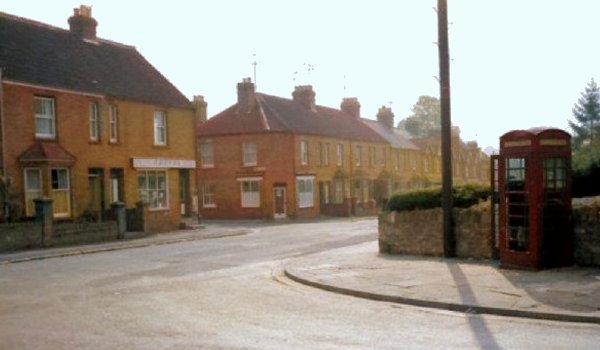
West Hendford seen from The Crescent and looking across to the junction of Manor Road with the former Honeycombe's shop at left and Mike Loveless' betting shop on the other corner. Photographed around 1965.
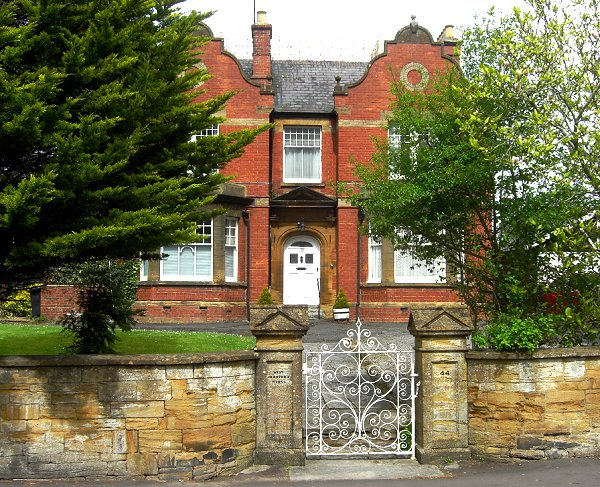
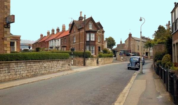
West Hendford House is on the north side of West Hendford next to the junction with Berkeley Road. It is a fine, double-fronted, two-storey large residence typical of its period. It was built in 1896 by Levi Beer and was built on the former field known as Hibbard's Orchard (Parcel 311). Photographed in 2013.

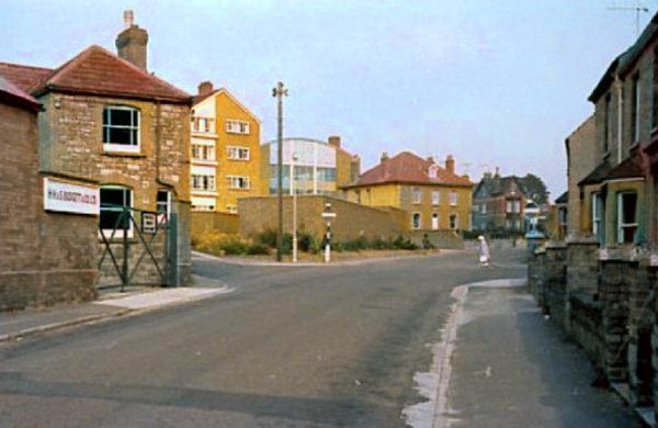
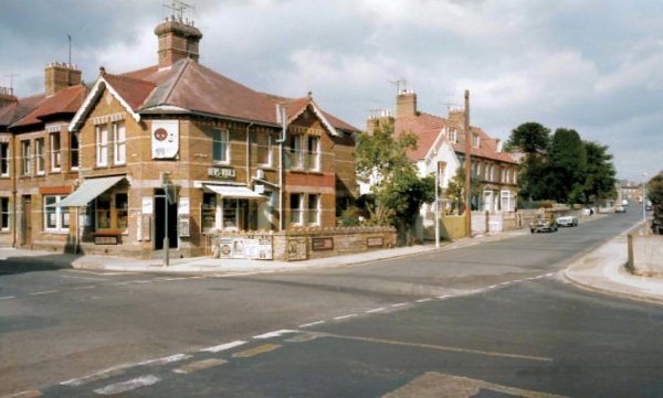
Now further west, the Brunswick Glove Co's glove factory in West Hendford is the white building with the car outside. The junction with Horsey Lane and Beer Street is seen left of centre. A colourised photograph of the 1960's. I remember this well as the photograph was taken from outside the front of my house.
Courtesy of
Tony Robins
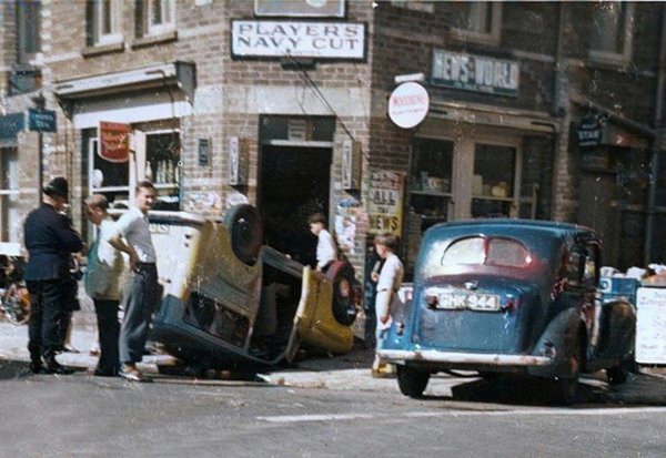
A colourised photograph taken outside Harold Robins' shop on Wednesday 9 July 1958. The West Hendford / Beer Street / Horsey Lane crossroads was a bit of a racetrack at the time and this car ended up on its roof outside the shop. The driver of the upturned vehicle was Peter Unwin (then a teacher at Yeovil School) and his passenger was another teacher, Miss Whelan, who taught music. The car was driven by Mr R Cobner of 15 Kingston. Tony Robins recalled "There was petrol pouring out of the car and that bloke was standing there with a lighted cigarette in his hand!"
|
Many thanks to Barry Rawlings for passing on this snippet from the Western Gazette's edition of 18 July 1958 - “CROSS-ROAD CRASH Mr PR Unwin, 2 Yeovil-road, Montacute, writes thanking all those kind people who were so helpful after the accident at the Horsey Lane - West Hendford cross roads on Wednesday week. Mr Unwin was driving a small utility-type vehicle which was involved in a collision with a car driven by Mr R Cobner of 15 Kingston.” |
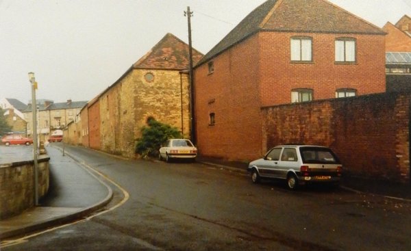
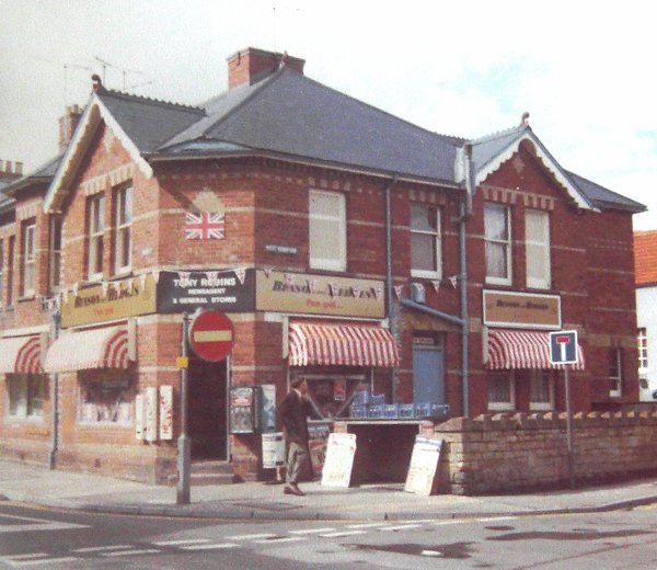
A colourised photograph of the 1960s, from the junction of Beer Street (bottom left) and Horsey Lane (bottom right) while West Hendford runs off to centre right, towards the town centre. The corner shop was run by Harold Robins who bought it in 1927. The building had been purpose-built as a shop in 1888 and Harold bought it from the previous shopkeeper, Mrs Palmer.
Courtesy of
Tony Robins
The Robins' shop on the corner of Beer Street (left) and West Hendford (running across the photograph). It was built, more or less, on the site of the earlier catchpool. Photographed in the 1980s it was, by this time, being run by Harold Robins' son, Tony.
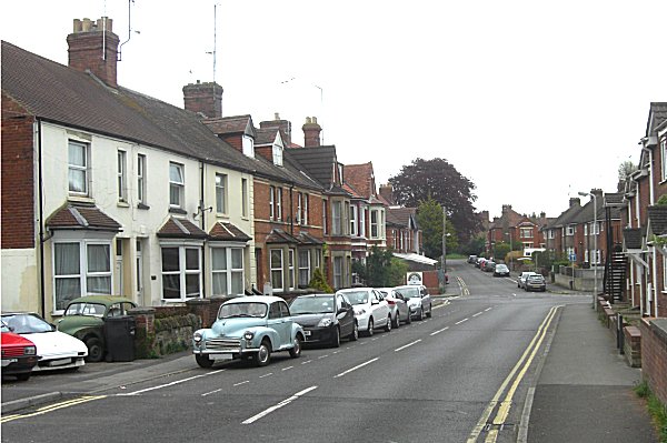
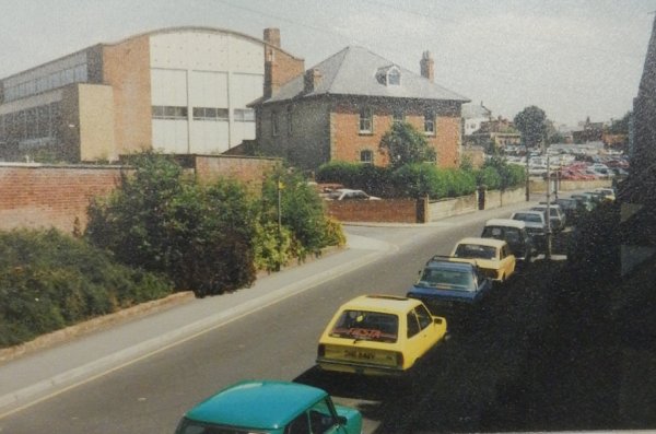
Looking east along West Hendford, back to the junction with Horsey Lane and Beer Street, right of centre. Photographed in 2015.
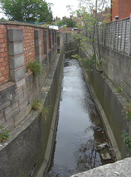
Dodham Brook is channelled behind the back gardens of Beer Street (at right). Seen from West Hendford and photographed in 2013.
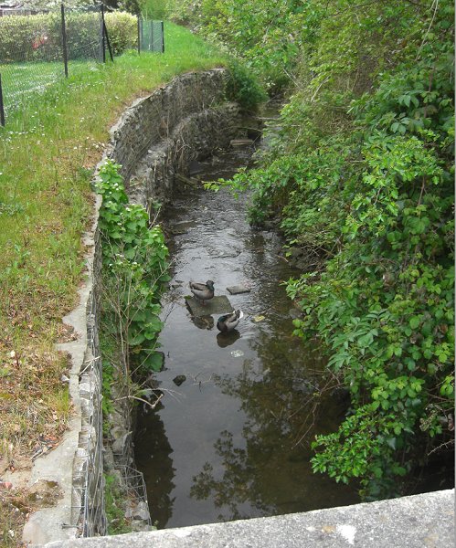
Seen from the southern side of West Hendford, Dodham Brook provides a quiet shelter for local wildlife. Photographed in 2013.
Courtesy of John
Cornelius. This
photograph
features in my
book "Now
That's What I
Call Yeovil"
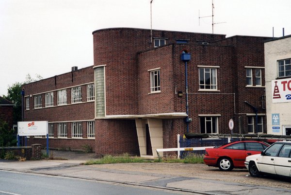
This Art Deco-inspired light industrial unit was built in 1954 for the electricity board. It was empty by 2008 and demolished in 2010.

Courtesy of Paul
Rimmer
Douglas Seaton's petrol filling station in West Hendford. A colourised photograph of the 1970s.
Courtesy of John
Cornelius. This
photograph
features in my
book "Now
That's What I
Call Yeovil"
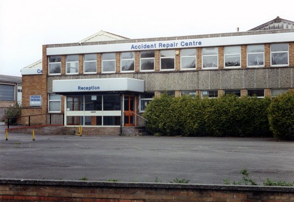
This building in West Hendford (on the opposite side of the road to the building in the previous photo) was Douglas Seaton's Accident Repair Centre. It was built for the Modeq washing machine company in the 1960's. After Modeq went into liquidation, the building lay empty for several years until taken over by Douglas Seaton Ltd. It is now replaced by blocks of flats.