East Field
East Field
A field within the great manorial East Field
East Field (Parcel 967) was a five-acre field, rising steadily from south to north, originally within the great East Field of the Manor of Kingston.
At the time of the 1846 Tithe Apportionment, East Field was owned by John Tanner Whiteley Pitcher (Pitcher was the 'natural' son of William Row and lived at East Chelborough, Dorset) and let to John Brook the Younger. East Field was used as arable for growing crops. It measured 5a 2r 0p.
East Field had a wide access strip from Meadway (today's Lyde Road) to the south and running between Lyde Lane (Parcel 966) and Lyde Lane (Parcel 970). It was bounded on the west by Pittard's Ground (Parcel 968) and on the north by Banger's Drang (Parcels 960 and 963).
Today the former East Field is occupied by the eastern end of Rosebery Avenue, including the green open space, located at the half-way bend (see Gallery).
For details on historic land measurement (ie acres, roods and perches) click here.
maps

This map, based on the descriptions in the 1589 Terrier and the 1846 Tithe Map of Yeovil shows the approximate boundaries of the Manors of Kingston and Hendford as well as the manorial three-field system used in Kingston.

A map of the great medieval East Field of Kingston Manor showing conjectured locations of several fields based on descriptions in the 1589 Terrier.
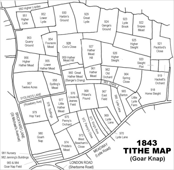
Drawn from the 1846 Tithe Map with field names added from the 1846 Tithe Apportionment, with Pittard's Ground just below the centre (yes, I know I spelt it Pittard's Pound on the map).
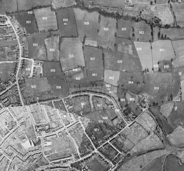
The 1946 aerial survey photograph (somewhat mis-aligned at bottom left) with parcel numbers of 1846 plotted on. By this time, however, Sydling Road had been built and completely occupied the former Pittard's Ground.
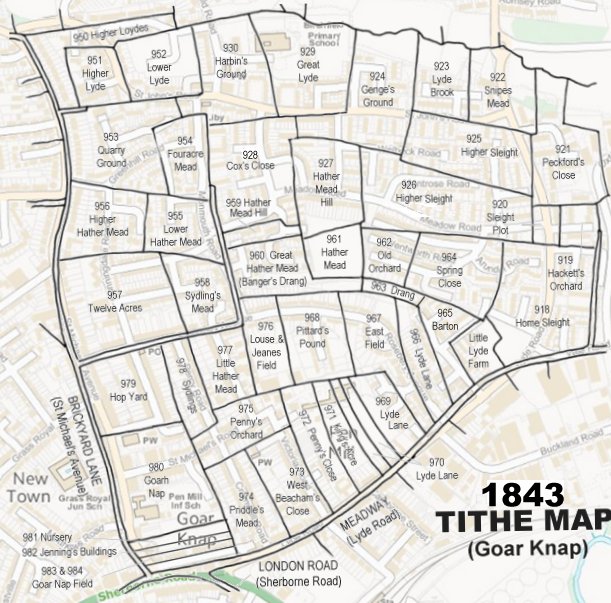
The 1843 Tithe Map overlaid onto a modern map of the area.
gallery
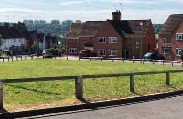
Formerly part of East Field, this is the Rosebery Avenue green open space. During the Second World War this was the site of an emergency water tank. Photographed in 2021.