Genge's Ground
Genge's Ground
A field within the great manorial East Field
Genge's Ground (Parcel 924) was a large field, with a spur running west at its southwest corner, within the great East Field of Kingston Manor. The 1743 Terrier recorded "Genge's two grounds" which may have meant that the field and spur were separate at this time.
At the time of the 1846 Tithe Apportionment it was one field owned by William Hawker Helyar and let to John Longman as part of Great Lyde Farm. Measuring 8a 3r 30p, it was used as pasture for grazing animals.
Genge's Ground was bounded on the north by Lyde brook (now piped underground) and separating it from Long Orchard (Parcel 899). It was bounded on the west by Great Lyde (parcel 929), to the south by Hather Mead Hill (Parcel 927) and Higher Sleight (Parcel 926) and to the east by Higher Sleight (Parcel 925) and Lyde Brook (Parcel 923).
At the time of the 1946 aerial photograph, seen below, Genge's Ground remained an open field with the spur more or less merged with Great Lyde. Today Genge's Ground contains houses and gardens of Chatsworth Road to the north, at centre houses of St John's Road either side of Hawthorn Road and, at the south, houses of the western end of Welbeck Road.
For details on historic land measurement (ie acres, roods and perches) click here.
maps

This map, based on the descriptions in the 1589 Terrier and the 1846 Tithe Map of Yeovil shows the approximate boundaries of the Manors of Kingston and Hendford as well as the manorial three-field system used in Kingston.

A map of the great medieval East Field of Kingston Manor showing conjectured locations of several fields based on descriptions in the 1589 Terrier.
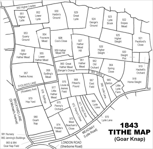
Drawn from the 1846 Tithe Map with field names added from the 1846 Tithe Apportionment, with Genge's Ground at top, right of centre.
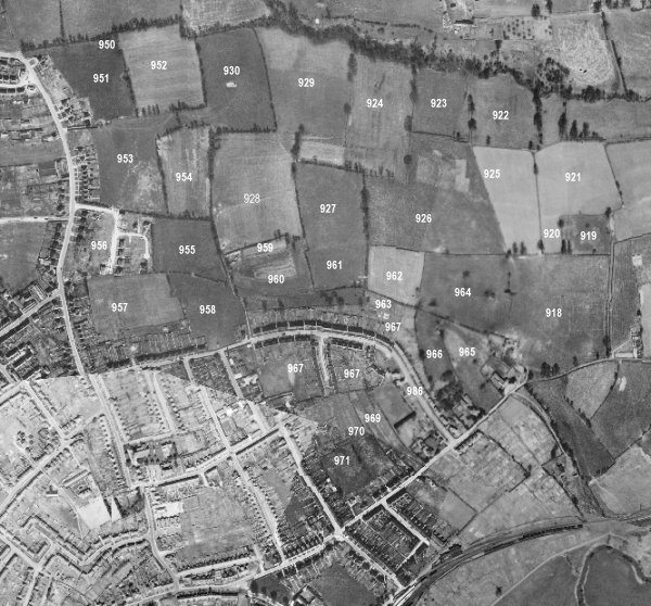
The 1946 aerial survey photograph (somewhat mis-aligned at bottom left) with parcel numbers of 1846 plotted on.
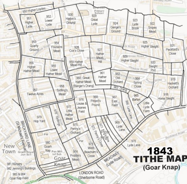
The 1843 Tithe Map overlaid onto a modern map of the area.
Gallery
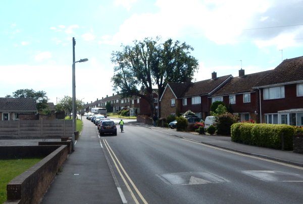
Photographed in 2016 from outside the Yellow Wagtail and looking west along St John's Road. The top of the hill (the houses to the right of the bus) was the highest point of Hather Mead Hill. The road and the bungalows to the left were built on Great Lyde (Parcel 929) and the houses to the right of the road were built in the spur of Genge's Ground (Parcel 924).