Lyde Brook
Lyde Brook
A field within the great manorial East Field
Lyde Brook (Parcel 923) was a small field within the great East Field of Kingston Manor. Its northern boundary lay against Lyde brook from which it took its name.
Lyde Brook (Parcel 923), Snipe's Mead (Parcel 922) and the northern part of Peckford's Close (Parcel 921) are thought to have originally been the area known as Stoneylake which the 1589 Terrier refers to "the bounding of Stonylake and from Stonylake down by Lidegurl". The 'stoney' part of the name is self-evident, whereas the 'lake' part of the name comes from the Old English lacu, meaning a slow-flowing stream and in this case referring to the Lyde brook.
Although drawn and numbered on the 1843 Tithe Map, Lyde Brook is not recorded in the 1846 Tithe Apportionment.
Lyde Brook was bounded on the north by Lyde brook (now piped underground) from which it took its name. It was bounded on the west by Genge's Ground (Parcel 924), to the south by Higher Sleight (Parcel 925) and to the east by Snipe's Mead (Parcel 922).
Although not forming part of (Little) Lyde Farm in 1846, it became part of the farm by the time of its sale in 1863 (see Gallery)
At the time of the 1946 aerial photograph, seen below, Lyde Brook remained an open field. Today it contains houses and gardens of the northern side of St John's Road east of Blenheim Road, built in 1975 on what was, at the time, waste ground.
For details on historic land measurement (ie acres, roods and perches) click here.
maps

This map, based on the descriptions in the 1589 Terrier and the 1846 Tithe Map of Yeovil shows the approximate boundaries of the Manors of Kingston and Hendford as well as the manorial three-field system used in Kingston.

A map of the great medieval East Field of Kingston Manor showing conjectured locations of several fields based on descriptions in the 1589 Terrier.
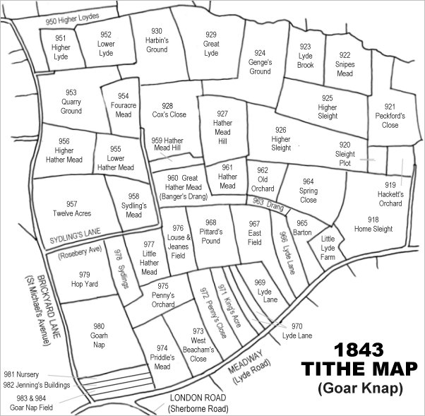
Drawn from the 1846 Tithe Map with field names added from the 1846 Tithe Apportionment, with Lyde Brook towards top right.
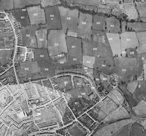
The 1946 aerial survey photograph (somewhat mis-aligned at bottom left) with parcel numbers of 1846 plotted on.
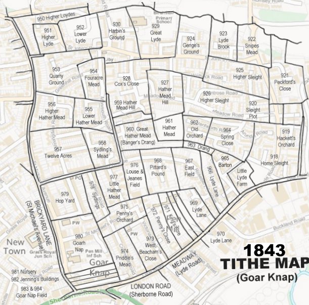
The 1843 Tithe Map overlaid onto a modern map of the area.
Gallery
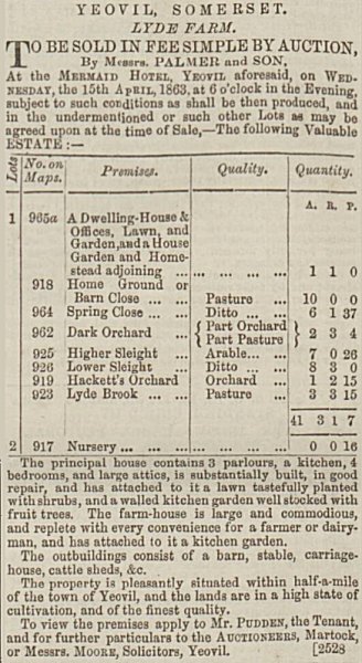
This notice of the sale of (Little) Lyde Farm was placed in the 9 April 1863 edition of the Dorset County Chronicle. Lyde Brook had only recently been added to the farm's field compliment.
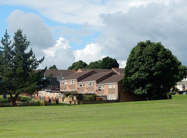
Photographed in 2016 from across Birchfield playing fields. The houses were built on the north-facing and steeply sloping ground of Lyde Brook. (As a sidenote - I designed the houses in 1975 and the steep slope of the field made for an 'interesting' project). The playing fields are made up ground covering what had been the open refuse tip of the 1960s and early 1970s. The actual brook the field Lyde Brook takes its name from, was several yards below the current level of the playing field.
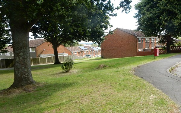
.... and seen from the top of the former Lyde Brook, now the edge of St John's Road. The ground fell away from here down to the actual brook. Photographed in 2016.