Snipe's Mead
Snipe's Mead
A field within the great manorial East Field
Snipe's Mead (Parcel 922) was a small field within the great East Field of Kingston Manor.
Snipe's Mead, together with the northern part of Peckford's Close (Parcel 921) and Lyde Brook (Parcel 923), are thought to have originally been the area known as Stoneylake which the 1589 Terrier refers to " the bounding of Stonylake and from Stonylake down by Lidegurl". The 'stoney' part of the name is self-evident, whereas the 'lake' part of the name comes from the Old English lacu, meaning a slow-flowing stream and in this case referring to the Lyde brook.
In his will of 1828 William Row stated ".... one other Close of Meadow Ground called Snipes Mead now in Exchange of George Bragge Prowse Esquire containing about six acres....". Although drawn and numbered on the 1843 Tithe Map, Snipe's Mead is not recorded in the 1846 Tithe Apportionment. It is known to have measured 4a 3r 4p and, since it was next to water was a meadow used for growing hay.
Snipe's Mead was bounded on the north by Lyde brook (now piped underground), on the west by Lyde Brook (Parcel 923), to the south by Higher Sleight (Parcel 925) and to the east by Peckford's Close (Parcel 921).
At the time of the 1946 aerial photograph, seen below, Snipe's Mead remained an open field. In the mid-1970s, as the Lyde Gurl valley was being used as an open waste disposal site, this was the northern end of Lyde Road. A gate across the road, located beside what is now the last house on the west side of Lyde Road before the roundabout, gave access to the waste disposal site. In former times the land had simply dropped steeply away at this point, down to Lyde Gurl. Indeed the three feet high, half-brick thick garden wall of the last house mentioned above has foundations fifteen feet deep simply because solid ground could not be found when it was being built in 1975.
Today the former Snipe's Mead contains houses and gardens of the eastern side of Lyde Road to the immediate north of St John's Road, the eastern end of St John's Road itself, Lyde Road from just before the St John's Road junction as far as the last house on the west approaching the new roundabout. It also contains the small block of flats on the east of Lyde Road just before the roundabout.
For details on historic land measurement (ie acres, roods and perches) click here.
maps

This map, based on the descriptions in the 1589 Terrier and the 1846 Tithe Map of Yeovil shows the approximate boundaries of the Manors of Kingston and Hendford as well as the manorial three-field system used in Kingston.

A map of the great medieval East Field of Kingston Manor showing conjectured locations of several fields based on descriptions in the 1589 Terrier.
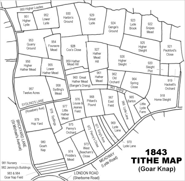
Drawn from the 1846 Tithe Map with field names added from the 1846 Tithe Apportionment, with Snipe's Mead at top right.
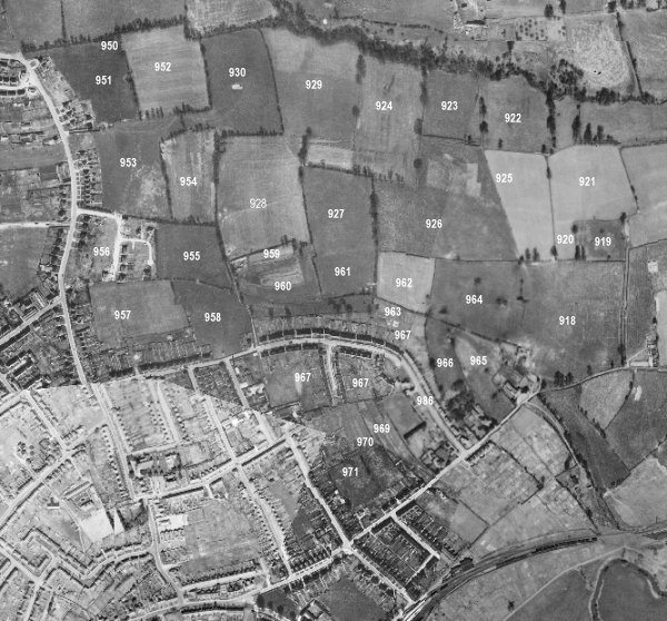
The 1946 aerial survey photograph (somewhat mis-aligned at bottom left) with parcel numbers of 1846 plotted on.
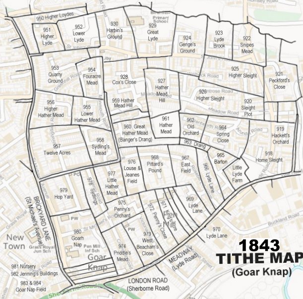
The 1843 Tithe Map overlaid onto a modern map of the area.
Gallery
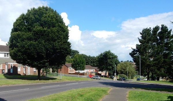
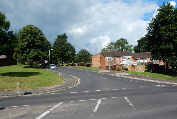
This photograph of 2016 takes in much of the former Snipe's Mead. It looks down Lyde Road to the junction of St John's Road (with the red car) and continues down to the new roundabout just concealed behind the trees at right.
Looking from Lyde Road to the junction of St John's Road in 2016. The grass area at left and the first block of houses at right were built on the former Snipe's Mead, which continued off the photograph to the right.