Hanging Coppice
Hanging Coppice
A wood of the Newton Surmaville Estate
Hanging Coppice (Parcel 822), was a small strip of woodland forming part of the Newton Surmaville Estate that was not leased out as Newton Farm. The name 'Hanging' derives from the Old English hangende meaning land on a steep slope, while a coppice is an area of woodland in which the trees or shrubs are periodically cut back to ground level to stimulate growth and provide firewood or timber.
At the time of the 1846 Tithe Apportionment, Hanging Coppice was owned and occupied by George Harbin. It was recorded as a wood and measured 0a 3r 36p.
Hanging Coppice (Parcel 822) was bordered on the east by Newton Road, on the west by the access track to the Roundhouse and to the north by Newton Copse (Parcel 817).
For details on historic land measurement (ie acres, roods and perches) click here.
maps

This map, based on the descriptions in the 1589 Terrier and the 1846 Tithe Map of Yeovil shows the approximate boundaries of the Manors of Kingston and Hendford as well as the manorial three-field system used in Kingston.
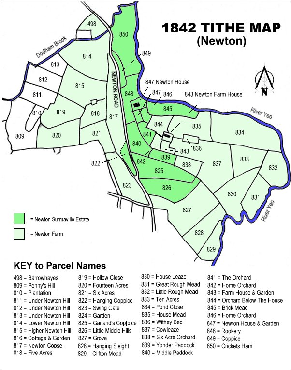
The 1842 Tithe Map showing the Newton Surmaville Estate shaded mid-green and the parcels of Newton Farm shaded light green. Hanging Coppice (Parcel 822) is left of centre.