Hillside Terrace - Hill View - Penfield
Hillside Terrace - Hill View - Penfield
On the northern flank of Wyndham Hill
The development of the area encompassing today's Hillside Terrace, Hill View and Penfield on the northern flank of Wyndham Hill, is a little confusing, but is made clearer by a brief study of the maps below.
The earliest map of the area (Map 1) is Edward Bullock Watts' map of 1806 which shows Sun House Farm as the only property along London Road (today's Sherborne Road).
A long building at a right-angle to London Road is shown on Christopher Greenwood's map of 1822 and Day's map of 1831, although it is unclear on both maps. However, Edward Bullock Watts' map of 1831 (Map 2) shows this range of buildings, Pen Field, much clearer.
The Tithe Map of 1842 (Map 3), again by Edward Bullock Watts, shows Parcel 518 (containing the Pen Field terrace of houses) and the Tithe Apportionment shows it to have been described as 'Cottages & Garden' owned by George Ellis and occupied by William Phelps. Phelps was possibly the agent who let the houses. The parcels that would eventually become Hill View and Hillside Terrace - Parcels 519, 520 and 521 were listed as follows -
Parcel 519 - 'Old Nursery' was owned by Rebecca Eason and occupied by Joel Hardy.
Parcel 520 - 'Withey Bed' was owned by George Harbin and occupied by James Fox.
Parcel 521 - 'Brewery & Garden' owned by George Ellis and occupied by William Phelps.
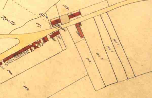
Hickes & Isaac's map of 1858 (Map 4) shows the terrace of Pen Field, lying at a right-angle to Sherborne Road, and to its west was Pen Field House - which was demolished during the next two decades and replaced with Pen Field Terrace that ran along London Road as far as the junction of Reckleford and Townsend.
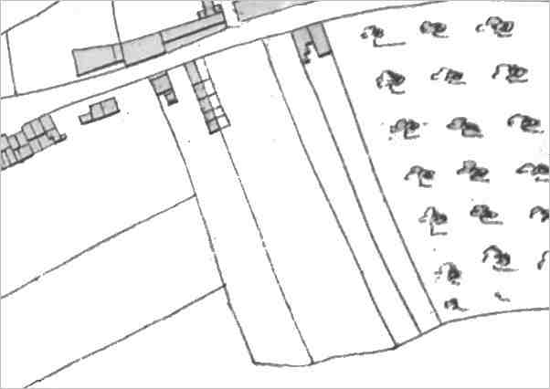
The 1886 Ordnance Survey (Map 5) shows Pen Field Terrace facing Sherborne Road and Pen Field at right-angles to Sherborne Road. However, the land to the southeast remains undeveloped at this time.
From the notes below, in 1888 CH Partridge built 19 houses - Hill View and Hillside Terrace.
The 1901 Ordnance Survey (Map 6) shows, for the first time on any map, Hill View and Hillside Terrace. However, note the confused names - Penfield instead of Hill View and Hill View instead of Hillside Terrace. Was this a mistake by the cartographer? or were the names changed later?
The final map (Map 7) is a modern map showing the current names.
Hillside Terrace is a private road (and remains so). Consequently, the residents surfaced the road themselves in the 1970s, and re-surfaced in 1999, both as shown in the series of photographs below.
![]()
The following notes are courtesy of John Cornelius.
1873 - Penfield sold by Samuel Marsh to Yeovil solicitors Thomas Moore and his son Joseph Chaffey Moore (Penfield House and five tenanted houses).
1883 - land sold to carpenter and builder CH Partridge, who built nineteen houses in Hill View and Hillside Terrace with a mortgage from the Moores.
1910 - CH Partridge died and his widow, Emily, sold the properties to John Stacey Trowbridge of Lindfield, Sussex, with a mortgage from Henry Stiby.
John Trowbridge gradually sold off all the previously-tenanted properties as follows -
24 Dec 1920 -
1 Penfield sold
to FW & RH
Drayton
31 Dec 1920 - 8
Hillside Terrace
sold to Henry
Seymour
31 Mar 1921 - 6
Hill View sold
to Alfred Tilley
25 Mar 1922 - 2
Penfield sold to
Joseph Hayman
25 Mar 1922 - 3
Penfield sold to
Thomas Coles
25 Mar 1922 - 1
Hillside Terrace
sold to John
Hann
21 Aug 1923 - 1
Hill View sold
to Walter John
Hull
2 Jul 1928
- 8 Hill
View sold to
James Glover
2 Dec 1930
- 4 Penfield
sold to William
Henry Somerfield
Featherstone
24 Apr 1931 - 2
Hillside Terrace
sold to Henry
Herbert Moore
7 Nov 1931
- 10 Hillside
Terrace sold to
Stanley Charles
Jannay
21 Jan 1938 - 5
Hillside Terrace
sold to Francis
George North
26 Oct 1944 - 3
Hill View sold
to Muriel Avril
Brooks
27 Oct 1944 - 4
Hill View sold
to Ronald Dads
7 Oct 1946
- 6 Hillside
Terrace sold to
Ernest and
Dorothy Drew
14 Oct 1946 - 9
Hill View sold
to Amy Standing
18 Oct 1947 - 5
Penfield sold to
George Mock
21 Feb 1948 - 3
Hillside Terrace
sold to Reginald
Ernest Lane
21 Feb 1948 - 7
Hillside Terrace
sold to Leonard
Frederick Wills
21 Feb 1948 - 9
Hillside Terrace
sold to
Frederick Lewis
Pope
Feb 1949 - 4 Hillside Terrace sold to William George Wittes
5 Sep 1950
- 2 Hill View
and 5 Hillside
Terrace sold to
Arthur and Lily
Rundle
1932 - John Trowbridge paid off his mortgage to Henry Stiby.
Maps
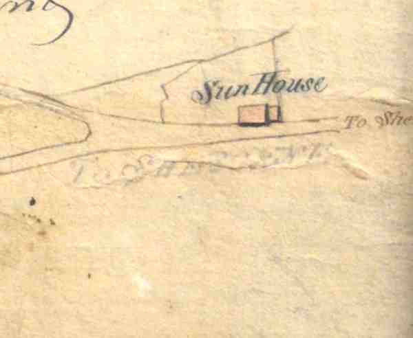
Map 1 - a section of Edward Bullock Watts' map of 1806, showing Sun House farmhouse as the only building east of Reckleford - seen joining with Townsend at the left.
Map 2 - a section of Edward Bullock Watts' map of 1831, showing that Pen Field has been built by this time opposite Sun House farmhouse. The land to the east, the northern slopes of Windmill Hill (today's Wyndham Hill) had been divided into separate parcels at this time.
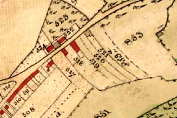
Map 3 - The Tithe Map of 1842, also by Edward Bullock Watts, showing Penfield in Parcel 518 and the parcels 519 to 521 that would later become the site of Hill View and Hillside Terrace.
Map 4 - Hickes & Isaac's map of 1858 showing Sherborne Road running from centre left to top centre. The terrace of Pen Field is seen lying at right-angle to Sherborne Road, with the houses to the left of the boundary line and their gardens to the right. To its left, is Pen Field House - which was demolished during the next two decades and replaced with Pen Field Terrace shown on the next map.
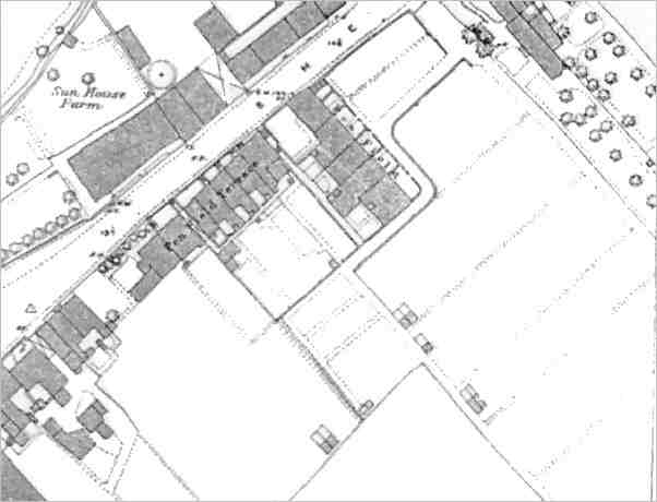
Map 5 - based on the 1886 Ordnance Survey showing Pen Field Terrace facing Sherborne Road and Pen Field at right-angles to Sherborne Road.

Map 6 - based on the 1901 Ordnance Survey showing the confused names - Penfield and Hill View. This was the first time these terraces were shown on any map.
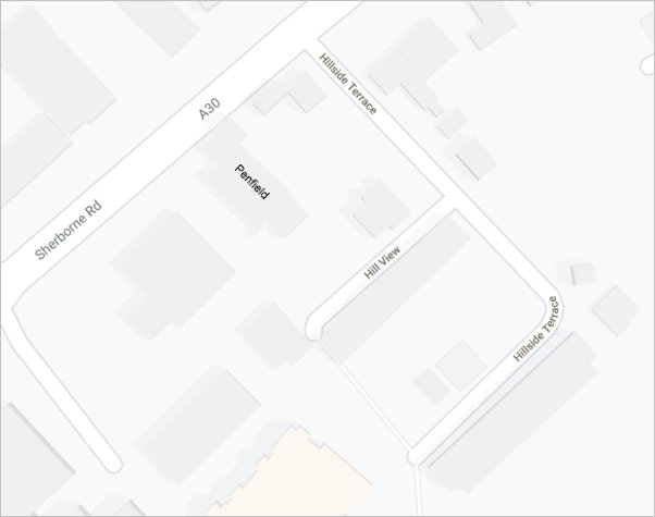
Map 7 - a modern map showing the current naming of the terraces.
gallery
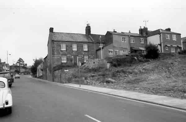
Looking east along Sherborne Road during the 1960s. At right are the houses of Penfield, leading to Hillview and Hillside Terrace - all on the northern slopes of Wyndham Hill - earlier known as Kingston Penn.

Looking west along Sherborne Road, with the entrance to Hillside Terrace at the bottom, left of centre. A colourised photograph of the 1960s.
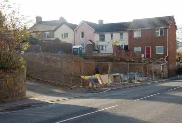
A relatively clear view of Penfield, photographed from the east in 2014, shortly after the removal of the old huts on the corner of Hillside Terrace. Clearly the terrace has been extensively modified and rebuilt over the years and I would suggest that the beige and pink dwellings with gables facing Hillside Terrace are the original design for what would probably have been the entire terrace.
![]()
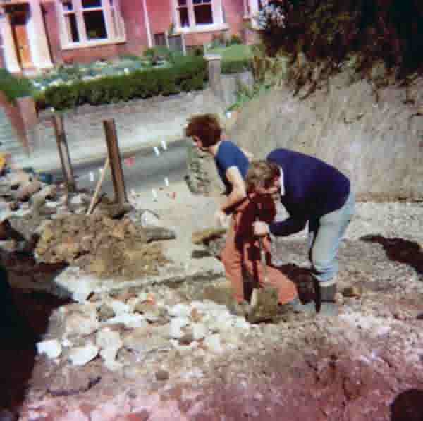
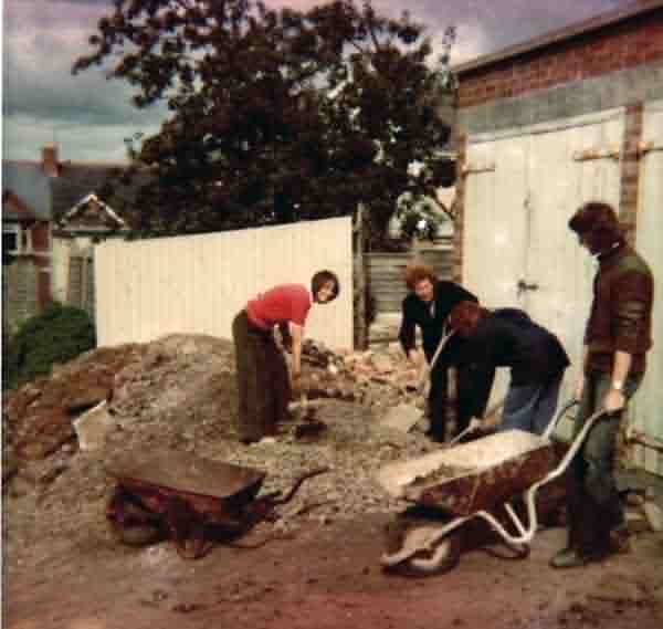
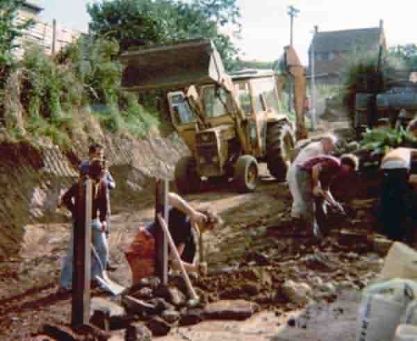
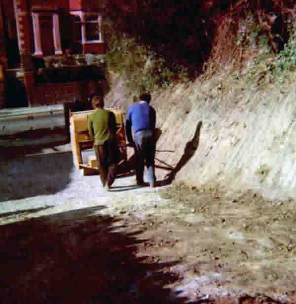
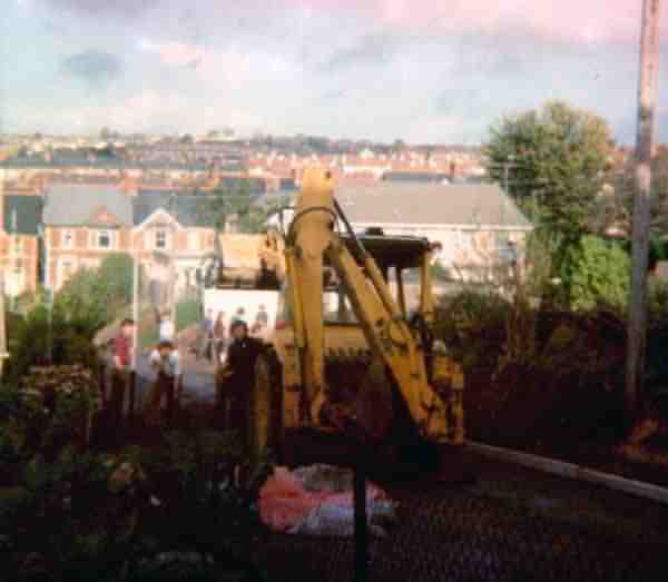
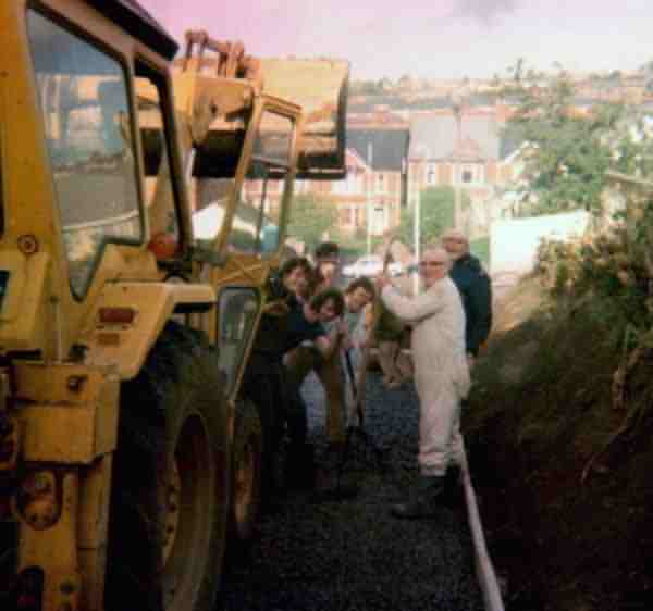
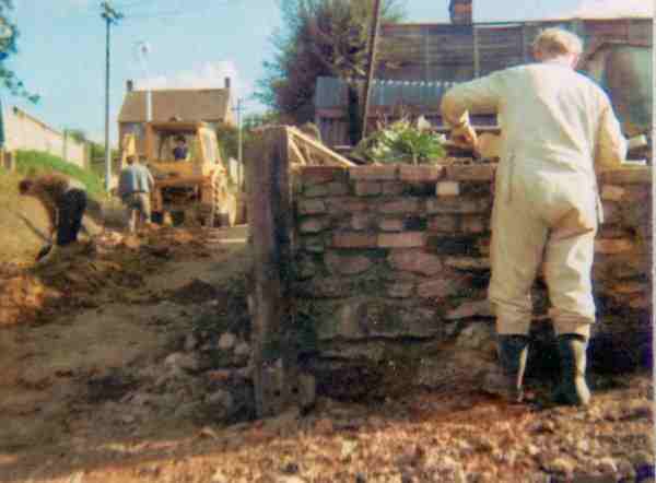
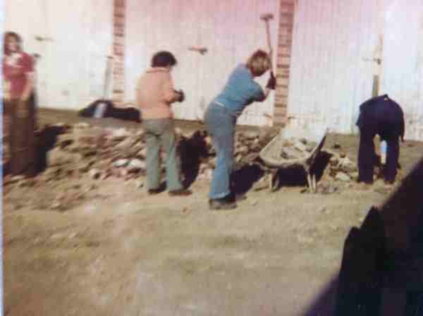
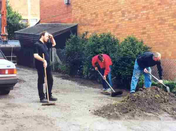
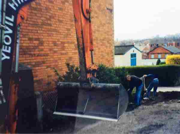
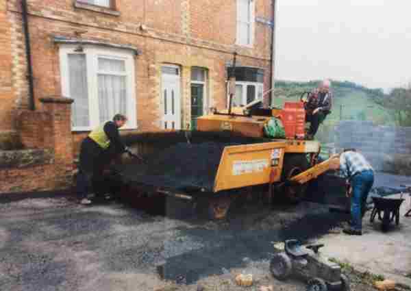
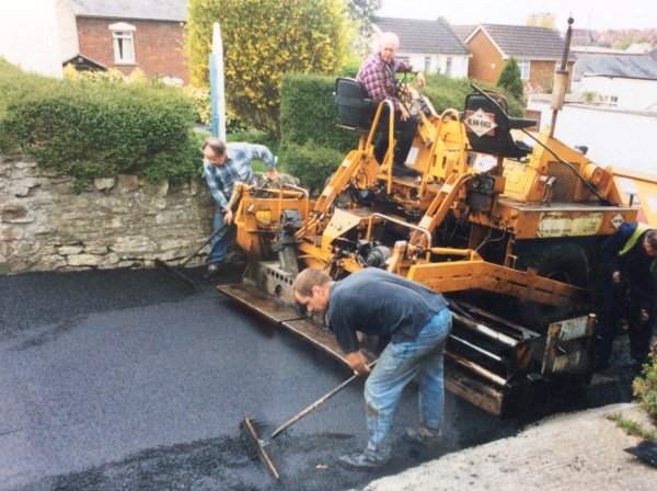
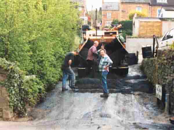
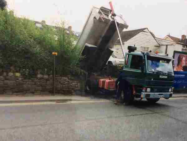
Hillside Terrace has always been a private road and not, therefore, the responsibility of the County Council as Highways Authority or the District Council as their agents for the Yeovil Excepted Area. As such, the responsibility for the upkeep of the road surface fell to the residents. The following set of photographs (the first eight courtesy of Alan Glasspoole and then three courtesy of Helen Wills) show Hillside Terrace being surfaced by the residents around 1974-75. It didn't require resurfacing for at least another twenty years afterwards.

![]()
The next three photographs, also of the 1970's resurfacing, are courtesy of Helen Wills.
Helen said "When Hillside Terrace etc was first resurfaced it was because of the poor condition and the milk deliveries were refusing to come up the road because they were having crates tip off, so the residents got together and did the job themselves (the council wouldn’t do it because it is a private road), this included women and children. Residents clubbed together and raised the money needed and Bob Holland organised all the plant that was needed, with him driving the digger. Preparation work took several weeks of weekend and evening work and the resurfacing one long day."
![]()
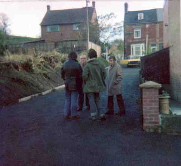
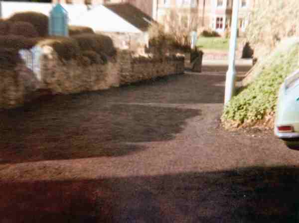
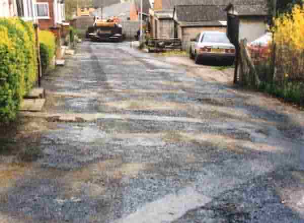
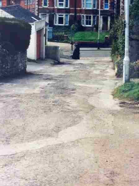
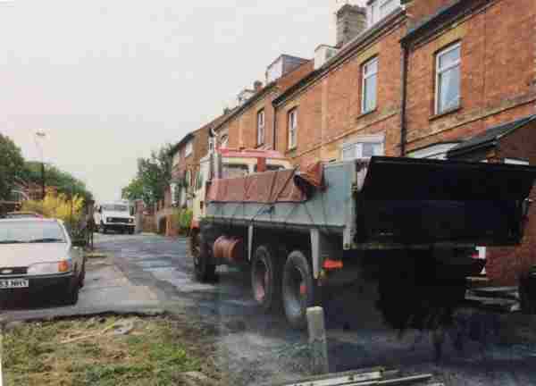
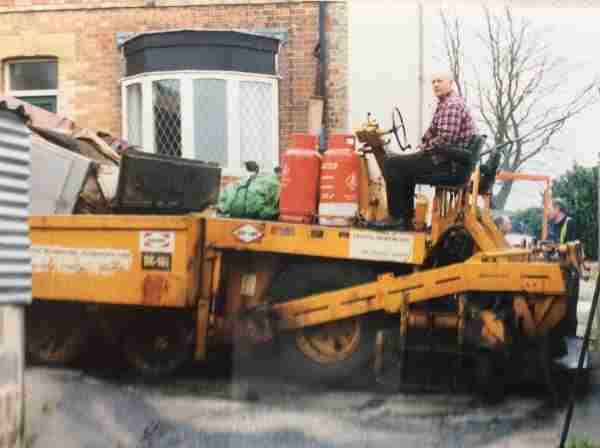
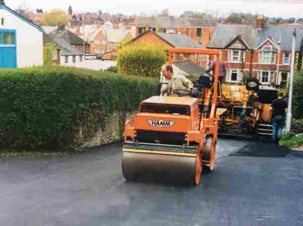
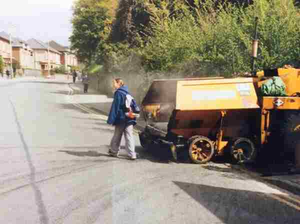
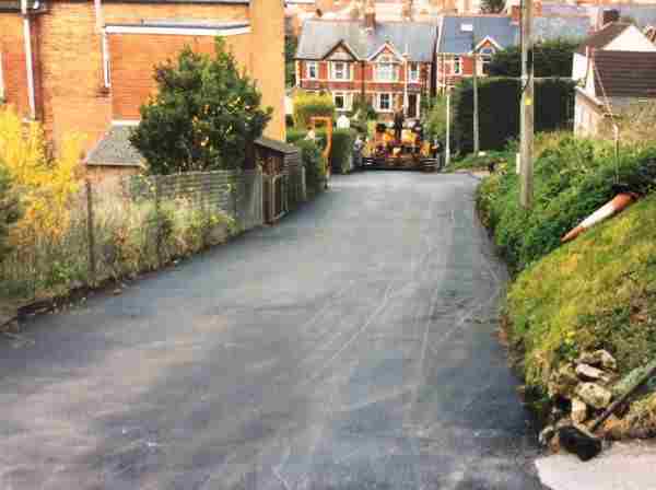
The following fifteen photographs, are of the 1999 resurfacing, and are courtesy of Helen Wills.
Helen said "The second lot of resurfacing was done in 1999. The road was in poor condition due to the services digging up the road at various times to repair water, gas, electric etc. Again, the residents raised the money. This time the residents helped with the preparation and Bob Holland was on the digger, then Glen from Yeovil Surfacing came in with a machine to resurface the roads."
Hillside Terrace.

Hill View.
Hillside Terrace.
At the junction of Hill View.
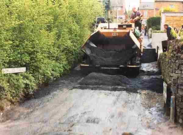
The last load of tarmac being tipped.
![]()
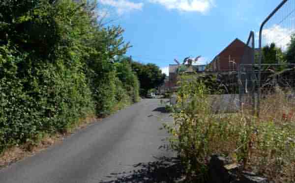
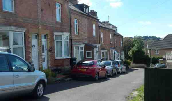
Hillside Terrace seen from Sherborne Road. Photographed in 2016.
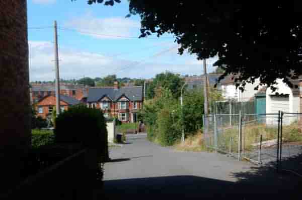
Hillside Terrace, looking back down to Sherborne Road. Photographed in 2016.
Courtesy of John
Cornelius
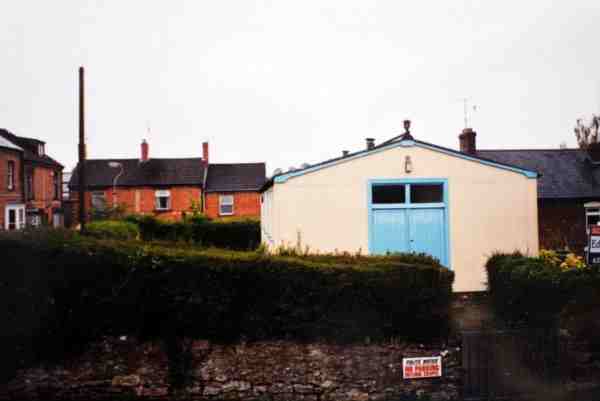
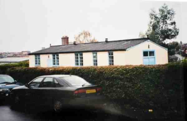
Penfield Hall, seen from Hillside Terrace in 2002, shortly before demolition. The houses of Hill View are seen at the left.
Courtesy of John
Cornelius
Penfield Hall, seen from Hill View in 2002.
Courtesy of John
Cornelius
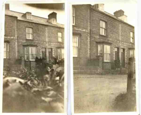
A house in Hill View, photographed and reproduced as postcards - possibly 1920s or 1930s.
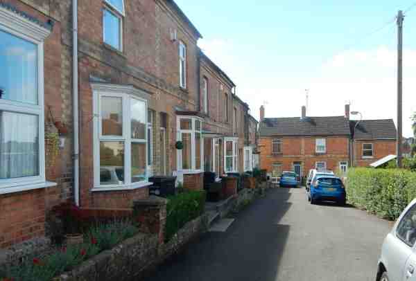
The L-shaped terraces of Hill View, photographed in 2016.
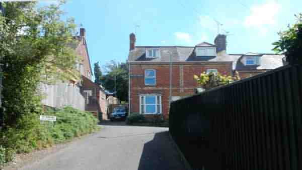
The 90-degree turn at the top of Hillside Terrace, photographed in 2016.
... and around the 90-degree turn at the top of Hillside Terrace, photographed in 2016.