Sherborne Road
Sherborne Road
The main road east from Yeovil
Sherborne Road has always been the main road approaching Yeovil from the east. It's eastern end was always Yeovil Bridge but the western end is debatable. Some would argue that the western end is at the junction with Wyndham Street, although from here to where Reckleford joins today's Sherborne Road has traditionally been known as Townsend - named for a small triangular field of that name which was literally at the end of the town.
Originally, and for obvious reasons, the name of the road was London Road. There were no houses at all, on either side of the road, at the time of Edward Bullock Watts' map of 1831, except Sun House Farm (north side) and Penfield House (south side), both close to the Reckleford junction.
During the 1860s and 1870s Yeovil, which effectively ended at the junction of Reckleford and Sherborne Road, was dirty and smelly as a result of the huge amount of leather dressing that went on in the town. As a consequence, those who could afford them, built new villas along Sherborne Road so they might enjoy cleaner air. This continued slowly into the twentieth-century with the construction of ever more houses.
maps
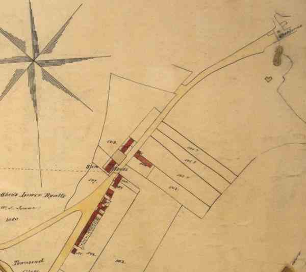
A portion of Edward Bullock Watts' map of 1831 showing the whole of London Road (today's Sherborne Road) from Townsend in the lower left quadrant, to the toll gates across London Road by Brickyard Lane (today's St Michael's Avenue) at top right. Sun House and Penfield House, the only two buildings at this time, are shown red at centre.
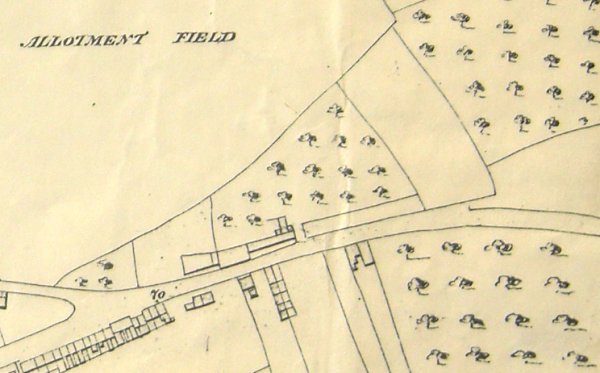
Hickes & Isaac's map of 1858 shows just two more houses have been added on the south side.
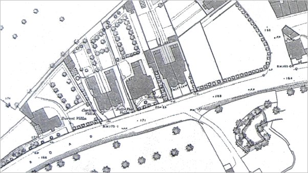
The 1886 Ordnance Survey showed the new 'villas' that had been built in the 1860s and 1870s. From left to right, they were Dorset Villa, Carlton Villa and Belle Vue Villa, Hillside and Fairview (see below). At right is seen Brickyard Lane (today's St Michael's Avenue).
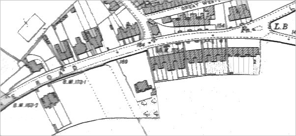
Between 1890 and this 1901 Ordnance Survey map, a pair of villas had been built opposite Dorset Villa, a few on the corner of St Michael's Avenue and a row on both sides of Sherborne Road from St Michael's Avenue as far as Lyde Road.
The mid-Victorian Villas of Sherborne Road
During the 1850s and 1860s Yeovil, which effectively ended at the junction of Reckleford and Sherborne Road, was a dirty and smelly town resulting from the huge amount of leather dressing carried on in the town. The following are the villas, built for the richer Yeovilians, that were constructed along the Sherborne Road during this period in an attempt to get into cleaner, less smelly and more salubrious surroundings. They are shown, as in the final map above, from west to east.
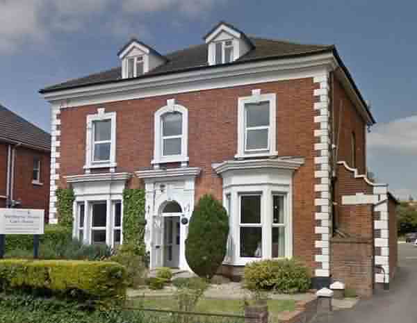
Dorset Villa. Photographed in 2016.
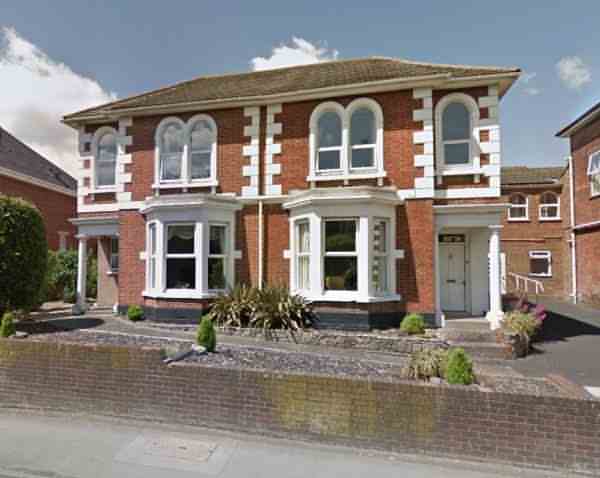
Carlton Villa (left) and Belle Vue Villa. Photographed in 2016.
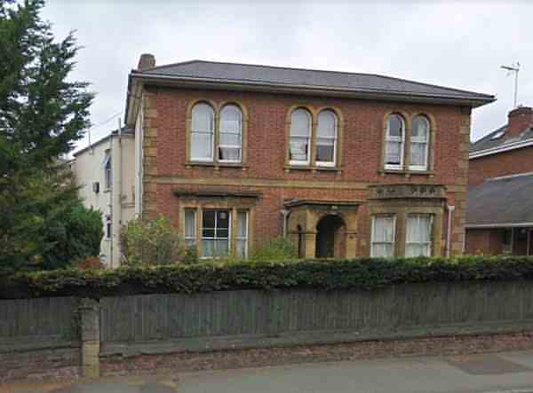
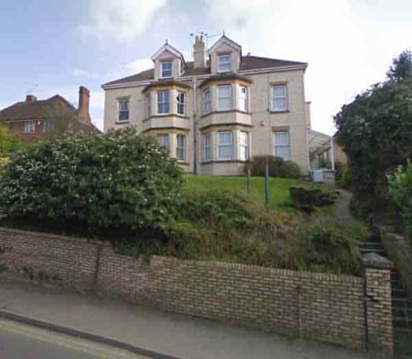
Hillside, now a care home. Photographed in 2016.
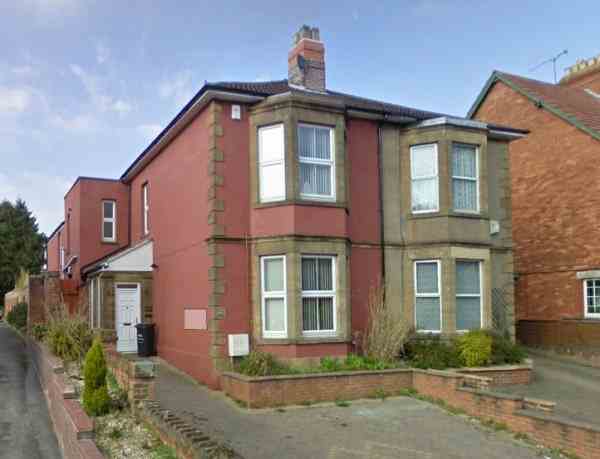
The final pair of villas on the north side of Sherborne Road, Fairview. Photographed in 2016.
![]()
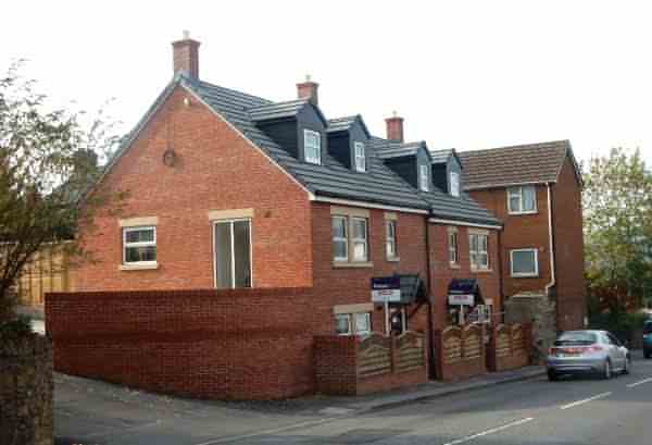
These two houses, constructed opposite Dorset Villa, were the first to be built on the south side of Sherborne Road. They were built during the 1890s.
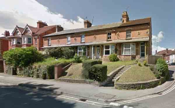
The run of five houses on the corner of Sherborne Road and St Michael's Avenue were built in 1885. The plaques containing cherub heads suggest these were built by local builder Lyndall Pomeroy (1868-1938) who had used the same plaques on the houses of Jubilee Terrace in Eastland Road. The pair of houses at left were built between 1901 and 1910.
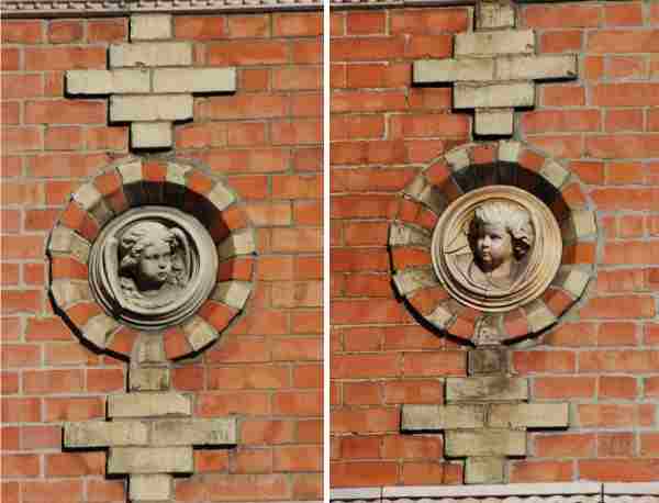
The cherub plaques, referred to above. Photographed in 2018.
Gallery
This
colourised photograph
features in my
book 'Yeovil From Old Photographs'.
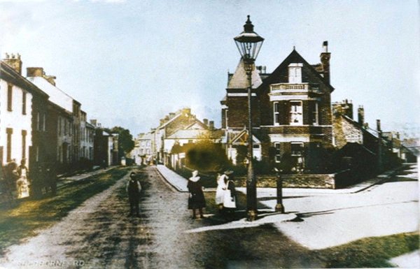
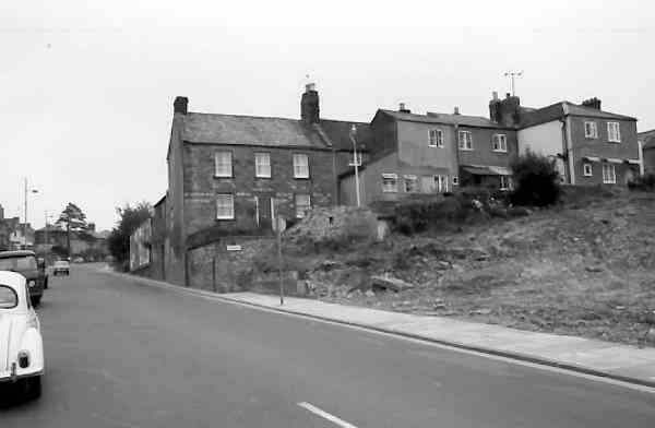
This is the western end of today's Sherborne Road. This is probably the earliest photograph of the Townsend / Reckleford / Sherborne Road junction and dates to about 1890. It is taken from Sherborne Road with that part of the old London Road, known as Townsend, running off to the left and Reckleford runs off to the right. This view is completely unrecogniseable today with the large house on the corner now the site of gardens, pedestrian walkways and traffic lights, while the row of houses at left were demolished in the 1970s. Note the single, large Sugg lamp.

A colourised view to the junction of Townsend (off to the left) and Reckleford (off to the right) from Sherborne Road in the mid-1960s.
.... and pretty much the same view in 2018. The old Pankhurst's garage building is now the gaudy red and yellow National Tyres.
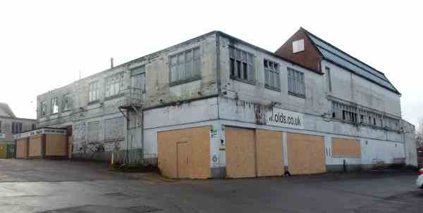
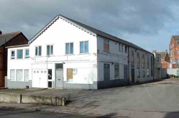
The former glove factory, used for many years by Olds Ltd as a car sales showroom, closed, boarded up and awaiting demolition. Photographed in 2017.

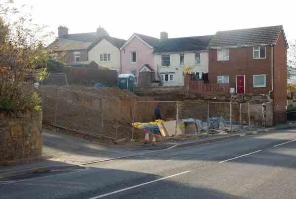
The site of the demolished glove factory / car showroom. Photographed in 2018.
Looking east along Sherborne Road during the 1960s. At right are the houses of Penfield, leading to Hillview and Hillside Terrace - all on the northern slopes of Wyndham Hill - earlier known as Kingston Penn.

Looking west along Sherborne Road, now with Penfield at left. A colourised photograph of the 1960s.
In 2017 the old hut (see previous photo) on the corner of Hillside Terrace was demolished and the site cleared in readiness for two new houses.
... and these are the two new houses. Photographed in 2018.

A colourised photograph of the 1960s, this view is from Penfield but showing the buildings on the northern side of Sherborne Road. The building at centre, also shown in the next photograph, was originally built as a small glove factory for Charles Pittard, but at the time of this photograph it was the premises of Charles Dye & Co, selling car parts. It had a range of occupiers (mostly in the auto trade) afterwards, including (and not necessarily in this order) Affiliated Factors, Yorfactors, Lucas, Top Gear and Aardvark Auto Services.
The old glove factory is now Yeovil Mosque. Photographed in 2018.
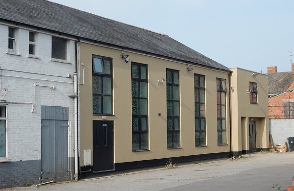
It is so nice to see an old glove factory renovated and re-used rather than being pulled down to make way for even more blocks of flats. Photographed in 2018.
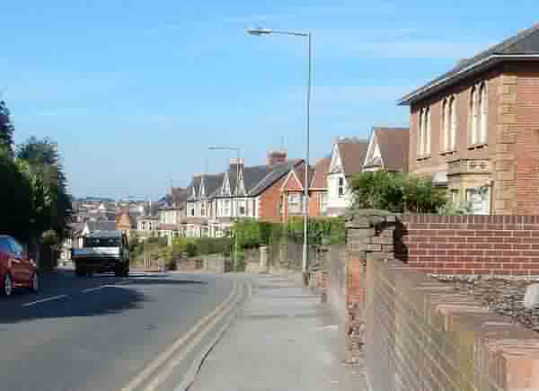
Looking west, down the rise between Penfield and St Michael's Avenue. Photographed in 2016.
From my
collection
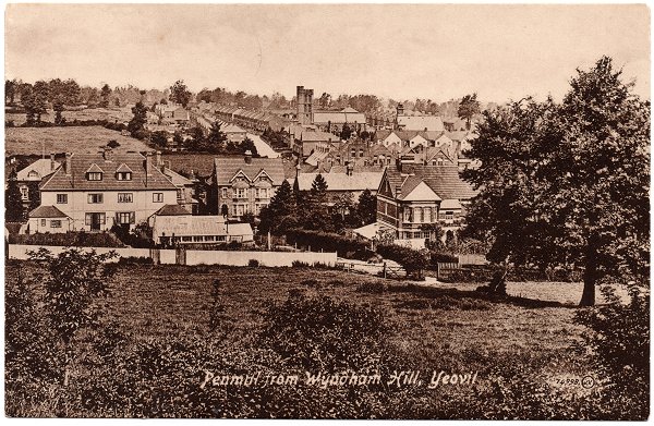
The photograph of this postcard was taken in 1913 from the top of Wyndham Hill. Across the centre of the photograph are the houses of Sherborne Road, at top centre is St Michael's church and to its right is St Michael's Hall. At centre and running to centre right is the Pen Mill Elementary School.
From my
collection
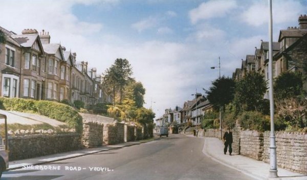
A colourised 1960's postcard of Sherborne Road taken from close to the junction with St Michael's Avenue and looking west towards the town.
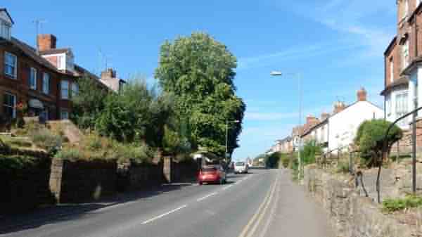
Almost the same view in 2016.
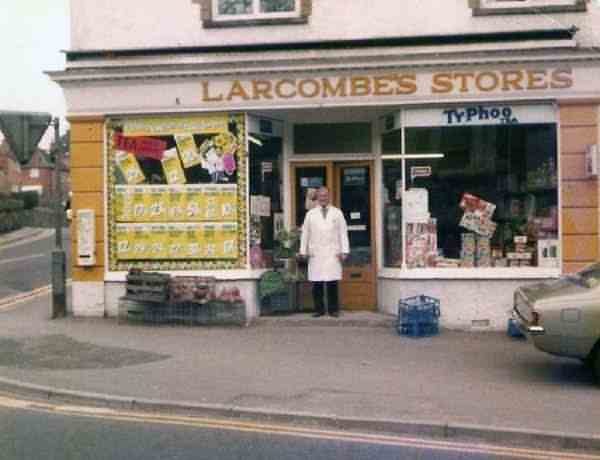
Larcombe's Stores on the corner of St Michael's Avenue, photographed in the 1980s. For a generation of Yeovilians this was known as Larcombe's Corner. Standing in the doorway is Bill Abbott who, together with his wife Dorothy, owned the shop until his retirement in the 1980s.

This
colourised image
features in my
book 'Yeovil
- The Postcard
Collection'.
A photograph of around 1904, looking west to the junction with Lyde Road (in the distance).

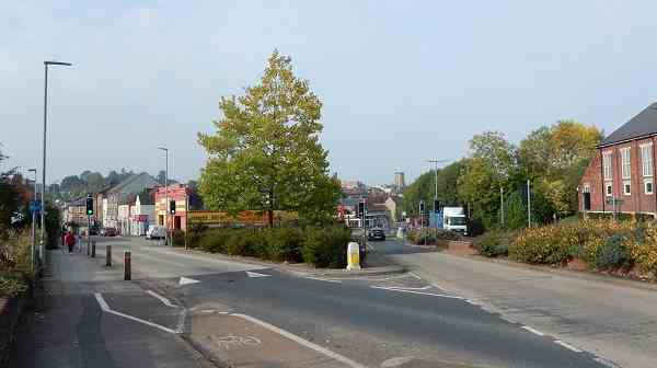
Looking east and approaching the Sherborne Road / Lyde Road junction before the traffic light system was introduced. Photographed in 2016.
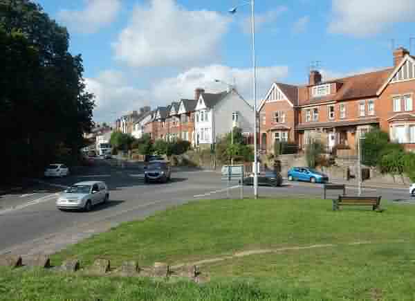
Looking west along Sherborne Road from the junction with Lyde Road (at right), before this junction was changed forever with new layout and traffic lights. Photographed in September 2016.

By October 2016 the grass bank at the junction had disappeared and work on the new junction layout was well underway.
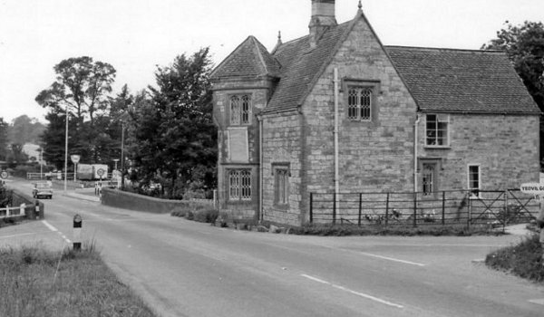
A photograph of the early 1960s looking towards Yeovil from the eastern end of Sherborne Road, with Yeovil Bridge at left and the toll house at right.
The original of
this photograph
features in my
book 'Yeovil
From Old
Photographs'
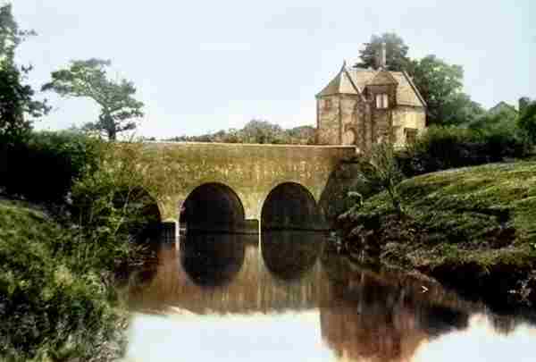
A colourised photograph dating to the 1880s showing Yeovil Bridge and the toll house. The River Yeo is the boundary between Somerset and Dorset and is the eastern end of Sherborne Road before becoming the dual carriageway of Babylon Hill.