Little Hather Mead
Little Hather Mead
A field within the great manorial East Field
Little Hather Mead (Parcels 977 and 977a) was a small field, rising steadily from south to north, originally within the great East Field of the Manor of Kingston.
At the time of the 1846 Tithe Apportionment Little Hather Mead was owned by William Jones Prowse and the tenant was Thomas Frost. Little Hather Mead was used as meadow, for making hay, and measured two acres.
Little Hather Mead was bounded on the north by Sydling's Lane (originally called Selling's Lane in the 1589 Terrier, but around 1895 it was extended and named Rosebery Avenue), on the east by Louse and Jeanes Ground (Parcel 976) on the south by Penny's Orchard (Parcel 975) and on the west by Sydlings (Parcels 977 and 977a).
Today the former Little Hather Mead is occupied by the houses and gardens of the northern two-thirds of Alexandra Road - laid out in 1901 and built around 1910 - and the small trading estate formerly the glove factory of Edwin Robbins Ltd and the Yeovil Degreasing Co.
For details on historic land measurement (ie acres, roods and perches) click here.
maps

This map, based on the descriptions in the 1589 Terrier and the 1846 Tithe Map of Yeovil shows the approximate boundaries of the Manors of Kingston and Hendford as well as the manorial three-field system used in Kingston.

A map of the great medieval East Field of Kingston Manor showing conjectured locations of several fields based on descriptions in the 1589 Terrier.
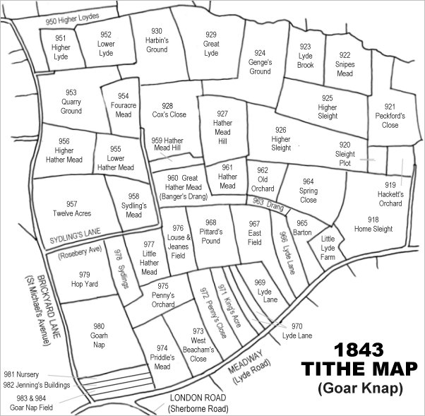
Drawn from the 1846 Tithe Map with field names added from the 1846 Tithe Apportionment, with Little Hather Mead (Parcel 977) in the lower left quadrant.
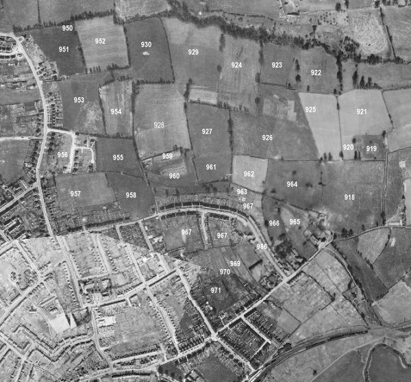
The 1946 aerial survey photograph (somewhat mis-aligned at bottom left) with parcel numbers of 1846 plotted on. By this time, however, Hop Yard has been built on and contained the houses and gardens of St Michael's Avenue and the whole of Glenville Road (mostly built around 1912).
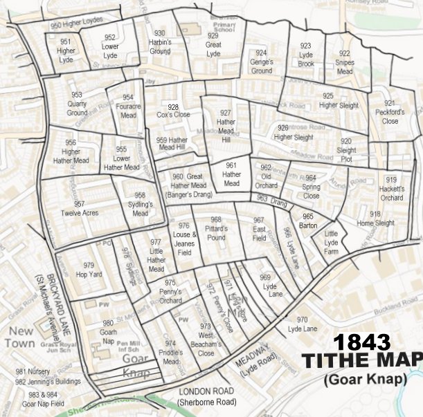
The 1843 Tithe Map overlaid onto a modern map of the area.
gallery
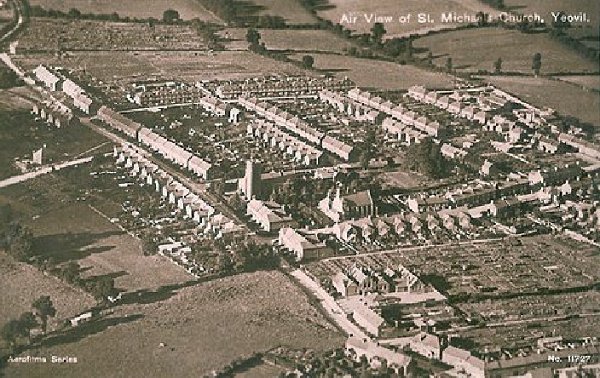
An aerial postcard of the very early 1920s with St Michael's church at centre. This photograph demonstrates remarkably well how isolated this part of Yeovil was at the time; St Michael's Avenue runs diagonally across the image from bottom right to top left, the first road off to its right is St Michael's Road, the last road off to the right towards the top of the photo is the partly-built Rosebery Avenue and the three roads between are, from left to right, Glenville Road, Percy Road and Alexandra Road.
The former Little Hather Mead was that part bounded by Rosebery Avenue at the top, and included the northern two-thirds of Alexandra Road.
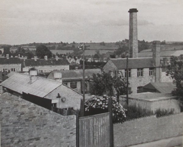
A photograph probably dating to the 1940s of the Yeovil Degreasing Co / Edwin Robbins Ltd premises at Alexandra Road. It was built in the north-eastern corner of Little Hather Mead. The tall chimney survives today, but the glove factory has been partially demolished and is now shortened.
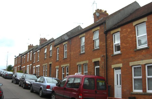
The terrace photographed here were the first houses to be built in Alexandra Road, around 1910. Photographed 2013.