Lower Perrythorne
Lower Perrythorne
A former part of the great West Field of Kingston Manor
Originally part of the great medieval West Field of Kingston Manor, Perrythorne was a large field running along the eastern side of Larkhill Lane (today's Larkhill Road). The name derived from pear orchard (perry) and thorn bushes (thorne). By the end of the eighteenth century the field had been subdivided into several smaller parcels (see Cribhouse Perrythorne (Parcel 1446), Higher Perrythorne (Parcel 1445) and Perrythorne (Parcels 1447 & 1448).
Lower Perrythorne became a small field to the south of Higher Perrythorne and north of Lockyer's Mead (Parcel 1451). By the time of the 1846 Tithe Apportionment Lower Perrythorne had itself been subdivided into two smaller fields (Parcels 1449 and 1450). Both parcels were fields of Larkhill Farm.
Lower Perrythorne was bounded on the north by Cribhouse Perrythorne (Parcel 1444) and Higher Perrythorne (Parcel 1445), to the west by Perrythorne (Parcel 1448), to the south by Shore's Close (Parcel 1453) and Lockyer's Mead (Parcel 1454) and to the east by Drang Ground (Parcel 1442).
Today the western part of former Lower Perrythorne (Parcel 1449) is occupied by houses and gardens of the northern section of post-war Burroughs Avenue, while the eastern part (Parcel 1450) is occupied by houses and gardens of the northern section of Cedar Grove.
For details on historic land measurement (ie acres, roods and perches) click here.
maps & Aerial Photographs

This map, based on the descriptions in the 1589 Terrier and the 1846 Tithe Map of Yeovil shows the approximate boundaries of the Manors of Kingston and Hendford as well as the manorial three-field system used in Kingston.
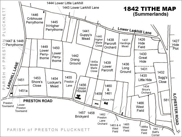
The Larkhill area reproduced from the 1842 Tithe Map. Lower Perrythorne is centre left.
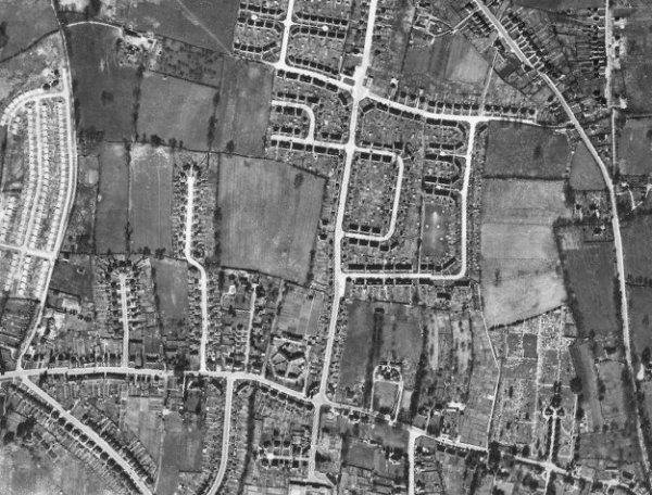
The 1946 aerial photograph - Lower Perrythorne is centre left. At this time Burroughs Avenue was yet to be built and the western part of Lower Perrythorne remained as pasture at this time while the northern section of Cedar Grove had been built on the eastern part of Lower Perrythorne.
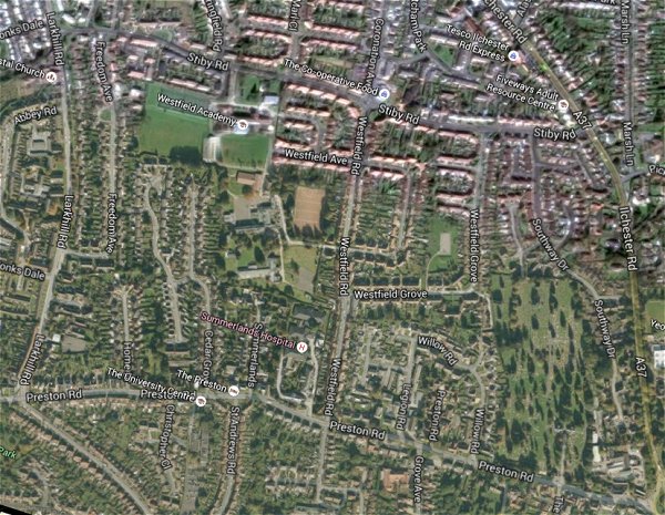
The same area today 'borrowed' from Google maps.
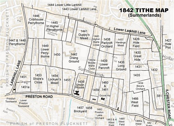
The 1842 Tithe Map superimposed (only very slightly out at the bottom) over a modern map.