Spear Bed
Spear Bed
Now a small patch of waste ground
Spear Bed (Parcel 908) was a small rectangular field formed from the southeastern corner of Lower Cowleaze (907) and nestled at the bottom of the valley of the Lyde Brook. The 1842 Tithe Map showed that Spear Bed was bounded on its south by the Lyde Brook, to the west and north by Lower Cowleaze (907) and to the east by Great Mead (893). The 1846 Tithe Award noted that it was used as meadow but did not give its area. Leslie Brooke postulated that it may have been used to grow a range of 'spear' crops but, because of the likely original wet nature of the ground that ran alongside the brook, I think the most likely candidate is spearmint (Mentha spicata) since it is native to England and its preference is for wet soils. Spearmint was, and still is, often cultivated especially for its oil of spearmint (which prevents formation of gas in the gastrointestinal tract or facilitates the expulsion of said gas, thereby combatting flatulence).
In the late 1960s and 1970s the Lyde Brook valley was used as a landfill waste site. When the valley was all but filled, earth was brought in to level this and the adjoining fields - forming the flat field surface we see today. Since there is a danger of gas build-up from the rotting waste below, a small complex for combatting this problem was constructed on the site of Spear Bed and now sits alongside the path to the River Yeo amid an expanse of waste ground.
maps
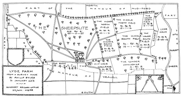
Philip Byles map of Lyde Farm dated 31 January 1653. Spear Bed was later partitioned out of the southeast corner of 'Yonder Cowleaze' at bottom right.
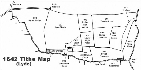
The Lyde area reproduced from the 1842 Tithe Map.
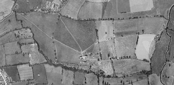
The 1946 aerial photograph of Great Lyde Farm
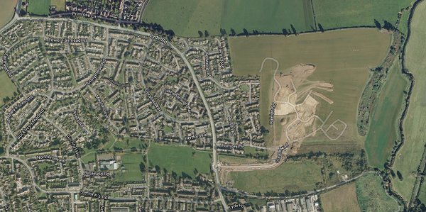
The same area today 'borrowed' from Google maps and taken around 2010 when the groundworks for Wyndham Park were being started. This is some twenty years after Great Home Close and Lower Cowleaze had been used as a waste disposal site and the valley leveled off.
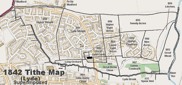
The 1842 Tithe Map superimposed over a modern map.
gallery
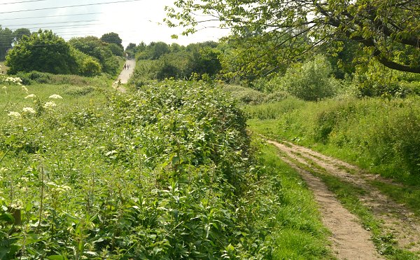
This photograph was taken from close to the Rive Yeo and looking west. The hill seen in the distance with people walking up the track is chiefly made-up ground after the valley was used as landfill. To the right of where the people are seen is where Spear Bed would have been, albeit at an elevation close to that where I stood to take this photograph. To the immediate right of this photograph the remnants of Lyde Brook runs into the River Yeo, and further right is the southern end of Great Mead (893). Photographed in 2014.
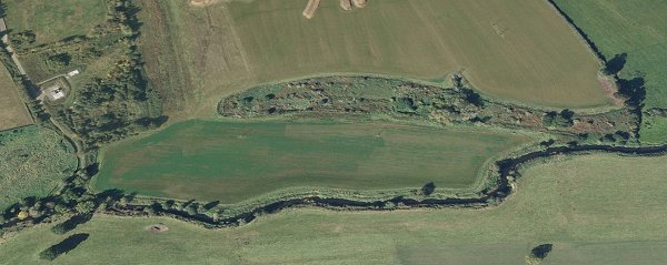
A Google Earth view of Great Mead (893) at centre, looking west. The River Yeo runs along the bottom of the photograph and Linches (894) is the steep, rough ground to its immediate west. Beyond that, from left to right, are the gas-venting buildings on the site of Spear Bed (908), the remnants of Lower Cowleaze (907), Nine Acres (906) and Twenty Acres (895).