Swing Gate
Swing gate
A field atop Newton Hill
Swing Gate (Parcel 823), also recorded as Newton Swang Gate, is a long field at the southern slope of the top of Newton Hill (although today we tend to call it Summerhouse Hill), wedged in between Newton Road and Two Tower Lane.
In the Turnpike Minutes of 1753 to 1810 it is referred to as 'Newton Swang Gate'.
At the time of the 1846 Tithe Apportionment, Swing Gate was owned by George Harbin and let to William Pope as part of Newton Farm. It was recorded as arable for growing crops and measured 10a 1r 0p.
Swing Gate (Parcel 823) was bordered on the north by Six Acres (Parcel 821), on the east by Newton Road and the access drive to the Roundhouse. To the south it was bounded by Two Tower Lane and to the west by Barwick parish.
For details on historic land measurement (ie acres, roods and perches) click here.
maps

This map, based on the descriptions in the 1589 Terrier and the 1846 Tithe Map of Yeovil shows the approximate boundaries of the Manors of Kingston and Hendford as well as the manorial three-field system used in Kingston.
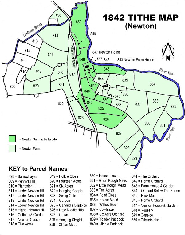
The 1842 Tithe Map showing the Newton Surmaville Estate shaded mid-green and the parcels of Newton Farm shaded light green. Swing Gate (Parcel 823) is at the centre bottom.