Turnpike Orchard
Turnpike Orchard
A field and orchard named for the Turnpike gate and house
Originally part of the great medieval Middle Field of Kingston Manor, Turnpike Orchard was a large field on the western corner of Brickyard Lane and London Road (today's St Michael's Avenue and Sherborne Road), opposite Goar Knap. It was named for the Turnpike gate and house sited here.
By the time of the 1846 Tithe Apportionment, the field had been split into two parcels (987 and 988). The former, on the very corner of the road junction, was recorded as 1a 3r 16p and noted as pasture for grazing livestock while the latter was recorded as 4a 3r 20p and was noted as an orchard. Turnpike Orchard was owned by John Tanner Whiteley Pitcher (Pitcher was the 'natural' son of William Row and lived at East Chelborough, Dorset) and let to John Brook the Younger.
Turnpike Orchard was bounded on the east by Brickyard Lane, on the south by London Road, to the west by Thomas' Cross (989) and on the north by the three parcels of Marsh Furlong (990, 991 and 992).
By 1890 the smaller, corner plot had been built on but the larger field was still undeveloped in 1912 as seen on the map below. Today, Turnpike Orchard is occupied by houses and gardens of St Michael's Avenue and Sherborne Road on its eastern and southern edges while the north is occupied by the southern half of Matthews Road and the western part by the recently-built Turn Pike Orchard (with a mysterious space in the middle of the word 'turnpike') - itself named after the field on which it was built.
maps

This map, based on the descriptions in the 1589 Terrier and the 1846 Tithe Map of Yeovil shows the approximate boundaries of the Manors of Kingston and Hendford as well as the manorial three-field system used in Kingston.
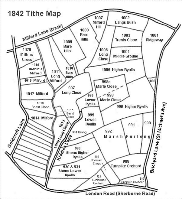
This map is based on the 1842 Tithe Map with field names added from the 1846 Tithe Award.
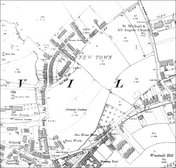
The 1912 Ordnance Survey showing the fledgling New Town surrounded by fields.
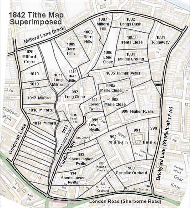
The 1842 Tithe Map superimposed (roughly) over a modern street map showing where several modern roads, for example Gordon Road, Grass Royal and Highfield Road, follow former field boundaries.
Gallery
From my
collection
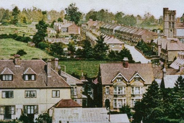
Enlarged from a postcard, this photograph was taken in 1913 from the top of Wyndham Hill, looking north. Across the bottom of the photograph are the houses of Sherborne Road, at top right is St Michael's church and running from top centre to centre right is St Michael's Avenue. At centre, by this time devoid of its apple trees, is just glimpsed Turnpike Orchard.