victoria road
victoria road
Named to celebrate the Queen's Diamond Jubilee
 Victoria
Road does not
appear in the
1891 census and
it is
Victoria
Road does not
appear in the
1891 census and
it is
most likely that
it was laid out
and built up
around 1897 to
be named in
honour of Queen
Victoria
(reigned
1837-1901) at
the time of her
Diamond Jubilee.
The road was built on a field called West Beacham's Close (Parcel 973).
The development
of Victoria Road
was one of the
projects
initiated by
William Tucker,
glove
manufacturer and
publican of the
Glover's Arms.
After Tucker's
death in 1899
the development
was continued by
his son William
Earle Tucker who
later became
Mayor of
Yeovil.
By the time of
the 1901
Ordnance Survey
Victoria Road
had been almost
completed and
built up along
both sides of
the road. The
end of the road
that would join
with St
Michael’s Road
(at this time
only planned)
was incomplete.
In 1901 Victoria
Road was outside
the Municipal
Borough Boundary
but came inside
when the
boundary was
extended on 11
June 1904.
MAP
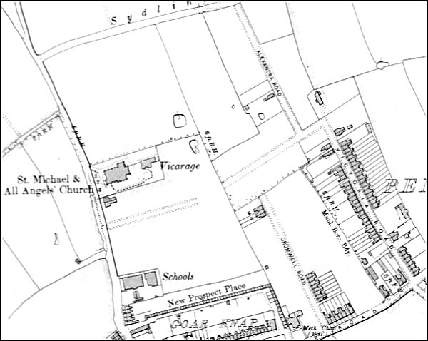
The 1901 Ordnance Survey showing Victoria Road, almost completely built up, at bottom right.
gallery
This
colourised
postcard
features in my
book 'Yeovil
- The Postcard
Collection'.
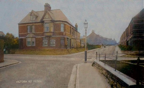
A 1904 postcard of Victoria Road, seen from Camborne Grove with Lyde Road running across the photograph. The corner shop, first opened in 1899 as the second branch outlet of the Yeovil & District Co-operative Soc Ltd, is now a private dwelling as seen below.
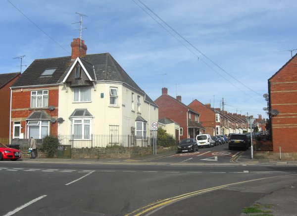
The same scene photographed in 2013.

Photo
(colourised) courtesy of Mike
Cannon
Seymour's bakery and shop in Victoria Road, photographed probably in the 1930s. The bakery was behind the house, as were the stables for the delivery horse and cart as well as the driver's accommodation.