West Beacham's Close
West BEACHAM's Close
A field within the great manorial East Field
Referring to West Beacham's Close (Parcel 973) the 1589 Terrier referred to "lands of Francis Beacham on the west side bounding to Stoneylake" and "From Stone Lake between the lands of Thomas Phelps and Francis Beacham aforesaid upward to Lidegate in Francis Beacham's Close there".
At the time of the 1846 Tithe Apportionment West Beacham's Close by Captain William Jones Prowse of Enham House, Southampton, Retired Captain RN, son of George Bragge Prowse of Kingston Manor House and Lord of the Manor of Kingston. West Beacham's Close was let to Thomas Frost as part of Pen Mill Farm. West Beacham's Close was used as arable for growing crops. It measured 4a 2r 15p.
West Beacham's Close was bounded on the south by Meadway (today's Lyde Road), on the west by Priddle's Mead (Parcel 974), on the north by Penny's Orchard (Parcel 975) and on the east it was bounded by Penny's Close (Parcel 972).
Today the houses and gardens of Victoria Road occupy the former West Beacham's Close.
For details on historic land measurement (ie acres, roods and perches) click here.
maps

This map, based on the descriptions in the 1589 Terrier and the 1846 Tithe Map of Yeovil shows the approximate boundaries of the Manors of Kingston and Hendford as well as the manorial three-field system used in Kingston.

A map of the great medieval East Field of Kingston Manor showing conjectured locations of several fields based on descriptions in the 1589 Terrier.
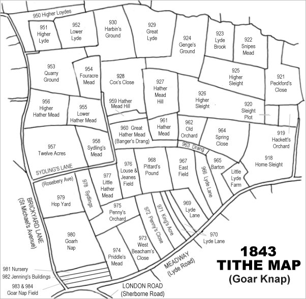
Drawn from the 1846 Tithe Map with field names added from the 1846 Tithe Apportionment, with West Beacham's Close at centre bottom.
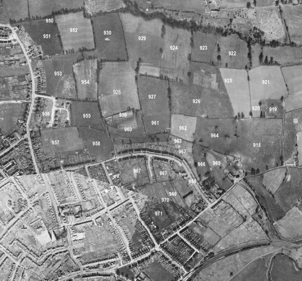
The 1946 aerial survey photograph (somewhat mis-aligned at bottom left) with parcel numbers of 1846 plotted on. By this time, West Beacham's Close has been built on with Victoria Road.
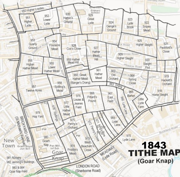
The 1843 Tithe Map overlaid onto a modern map of the area.
Gallery
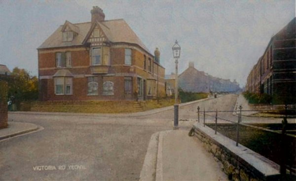
This
colourised
postcard
features in my
book 'Yeovil
- The Postcard
Collection'.
A 1904 postcard of Victoria Road, seen from Camborne Grove with Lyde Road running across the photograph. The corner shop, first opened in 1899 as the second branch outlet of the Yeovil & District Co-operative Soc Ltd, is now a private dwelling.