Penny's Close
Penny's Close
A field within the great manorial East Field
Penny's Close (Parcel 972) was a long, narrow two-acre field, originally within the great East Field of the Manor of Kingston. It was later part of Pen Mill Farm.
At the time of the 1846 Tithe Apportionment Penny's Close was owned by Captain William Jones Prowse of Enham House, Southampton, Retired Captain RN, son of George Bragge Prowse of Kingston Manor House and Lord of the Manor of Kingston. Penny's Close was let to Thomas Frost. Penny's Close was used as pasture for grazing livestock. It measured 2a 3r 20p.
Penny's Close was bounded on the south by Meadway (today's Lyde Road), on the west by West Beachams Close (Parcel 973) and Penny's Orchard (Parcel 975), on the north by Louse and Jeanes Ground (Parcel 976) and Pittard's Ground (Parcel 968). On the east it was bounded by King's Acre (Parcel 971).
In the nineteenth-century, certainly from the 1840s, the farmhouse of Thomas Frost's Pen Mill Farm occupied the southern end adjoining Lyde Road.
Today the former Penny's Close is occupied by a few houses and gardens of Lyde Road at its southern end, and the western half of the playing field of Fiveways School occupying the bulk of the former King's Acre.
For details on historic land measurement (ie acres, roods and perches) click here.
maps

This map, based on the descriptions in the 1589 Terrier and the 1846 Tithe Map of Yeovil shows the approximate boundaries of the Manors of Kingston and Hendford as well as the manorial three-field system used in Kingston.

A map of the great medieval East Field of Kingston Manor showing conjectured locations of several fields based on descriptions in the 1589 Terrier.
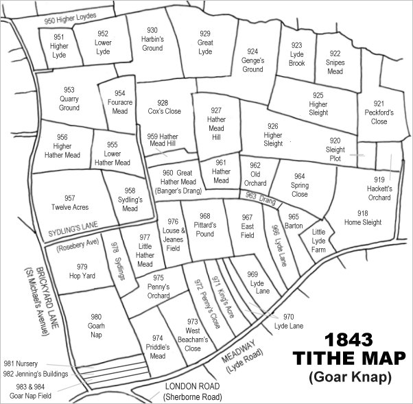
Drawn from the 1846 Tithe Map with field names added from the 1846 Tithe Apportionment, with Penny's Close at centre bottom.
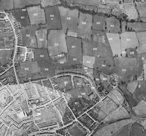
The 1946 aerial survey photograph (somewhat mis-aligned at bottom left) with parcel numbers of 1846 plotted on. By this time, King's Acre has been built on along its border with Lyde Lane while the open area to the north (marked with '971' on this photograph) remains as the playing field of Fiveways School.
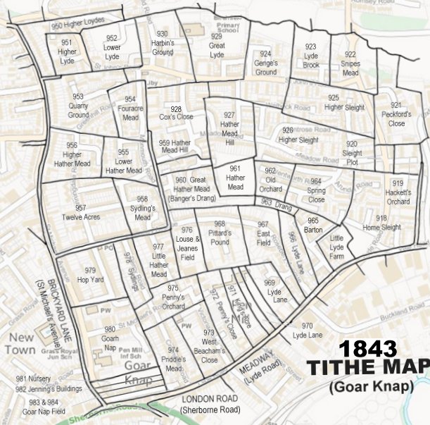
The 1843 Tithe Map overlaid onto a modern map of the area.
Gallery
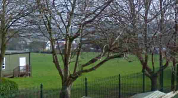
The former Penny's Close is now mostly occupied by western half of the playing field of Fiveways School and several gardens and houses of Lyde Road, seen in the background.