Goldcroft
Goldcroft
Former Gold Croft Lane and Milford Lane
Today's Goldcroft has clearly been around for centuries although little more than a farm track until the latter part of the nineteenth century. E Watts' map of 1806 shows today's Goldcroft from Reckleford to Milford Cross was bounded for its entire length by fields with no houses whatsoever. At this time it was called Gold Croft Lane, but only about as far as today's Crofton Avenue, after which it was called Milford Lane (see map below).
In his will dated 15 March 1725, John Jeanes wrote "... I give devise and bequeath the same to my Nephews Thomas Burford of [word illegible] Clerke Office in the County of Middlesex Gentleman and John Burford one of the Fellows of Kings Colledge in Cambridge Gentleman and their heires dureing the naturall life of my daughter Mary together with one ground called Milford and two acres in Gold Croft One acre in Goare feild and Yeovill Bridge Mead together with all those foure peices of ground called Ryalls in the parish of Yeovill aforesaid In trust to apply and dispose of the rents issues and profitts thereof to the proper hands of my said daughter or as she shall appoint ...".
Watts' map shows that the lane continued on "To Bicking". The 1743 Terrier refers to a field of some six acres owned by a Mr Forbes Bicken and the 1846 Tithe Apportionment refers to a field called Bicking - both are thought to be the result of the local pronunciation of 'Beacon'. The locality of Beacon, recalling the earlier signal fires of Elizabethan times, was the name of several fields off Mudford Road near the Hundred Stone.
The 1841 census listed three families living in Gold Croft but these were by the junction with Reckleford. Goldcroft remained flanked by fields until the end of the nineteenth century and the 1886 Ordnance Survey only shows one or two small cottages and a timber yard - its location now occupied by today's Goldcroft car park.
On the 1901 Ordnance Survey Goldcroft, then named Gold Croft, had been built up only just beyond Colmer Road. Beyond the junction with Sparrow Lane (now Sparrow Road), at Milford Cross, it continued as a lane called Gold Croft Lane.
map
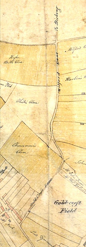
E Watts' map of 1806 shows the entire length of today's Goldcroft from Reckleford at the bottom left corner to Milford Cross at the top. At this time it was called Gold Croft Lane only about as far as today's Crofton Avenue, after which it was called Milford Lane.
gallery

This
colourised photograph
features in my
book 'Yeovil From Old Photographs'.
A postcard of 'Gold Croft' dating to about 1910. Thirty years earlier none of the houses existed and the lane was flanked by open fields. The view in this photograph is, of course, almost the same today. The photographer was standing in Goldcroft by Crofton Park looking north (King Street is the turning at right in the photograph). In 1806 this would have been the end of Gold Croft Lane and the lane would have continued as Milford Lane.
Courtesy of South Somerset Heritage Collection
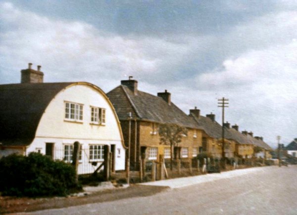
Goldcroft in a colourised photograph of the early 1950s, looking south from the junction with Milford Road, with the Nissen-Petren houses in the left foreground.
Photograph
(colourised) by
Geoff Bowler,
courtesy of Sue
Bowler
Goldcroft, photographed in 1969.

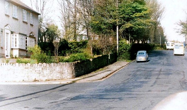
Goldcroft, looking north from Milford Cross (the junction of Sparrow Road, left, and Milford Road, right). Photographed in 2016.
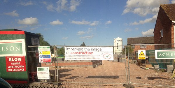
Work begins on Newcroft Court. Photographed May 2015.
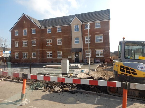
.... and nearing completion in March 2016.
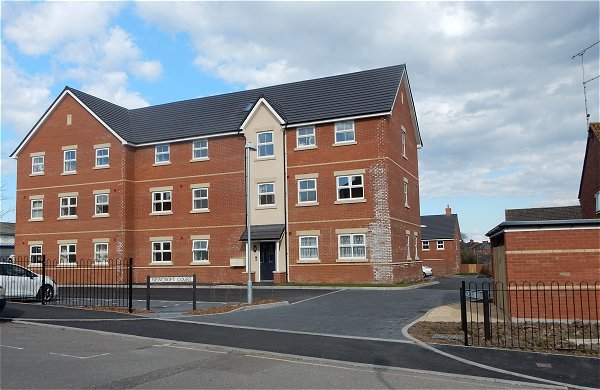
Finished - April 2016.