burial grounds (19th century)
burial grounds - st john's
Dealing with burials in 19th century Yeovil
The first reference in the records concerning the churchyard of St John's church was in 1407 when John Ganvill, the Rector, mentioned in his will "the path in front of the Lord's Cross standing in the churchyard as one goes from the Church to the town". The reference to the Lord's Cross probably refers to the fifteenth century carved cross head which was found in the Chantry of St John's church and now resides in the Church of the Holy Ghost in Higher Kingston. In the sixteenth century John Walle wished to be buried "within the churchyard of St John the Baptist on the right side of the broad alley before the great yew tree".
As the population of the town slowly increased so space in the churchyard was at a premium and as new graves were dug earlier graves were frequently disturbed and the bones from these were placed in the church's crypt, known as the charnel house. The churchwardens accounts recorded a payment of sixpence in 1572 for "one day's work for burying of the skulls and bones that were in the charnel house".
As the town grew, the problem only became worse. In 1825 the Vestry investigated the possibility of digging catacombs on the side of the church yard facing Silver Street. This idea was abandoned and instead the churchyard was extended by buying a piece of ground between Church Terrace on the east, North Lane to the north and the present North Lane car park to the west. This land was purchased from Peter Daniell for £525, the money being lent to the churchwardens by Thomas Dampier of Kingston Manor. Further space was gained in the churchyard in 1854 when the Chantry was pulled down and rebuilt in its present position in Church Path.
In 1856 Daniel Vickery wrote "The annual mortality in Yeovil, estimated upon the seven years 1844 to 1850, presents an average (including the deaths in the Union, which average 19 yearly,) of 190 persons, which, upon a population of 7,751, gives 24.6 per thousand. In the latter four years the number was much higher, being 218 per annum. The deaths under five years of age were a third of the whole number of deaths ; the deaths from endemic and contagious diseases were at the average rate of 60 per annum, or 1 in 129 of the population." (Vickery, 1856)
In 1852 in his Report to the General Board of Health concerning, among other items, Yeovil's burial sites, Thomas Rammell wrote the following concerning burials in St John's churchyard which I include here almost in its entirety as it gives a fascinating insight into Yeovil's primary 19th century burial ground.
The parish church is situated near the centre of the town, and the burial ground surrounds it on the north, east, and south; the west side is chiefly occupied by the entrance into the grammar school. The ground is placed on a high level with respect to the town generally, and is considerably above the adjacent streets on the north and east sides. The extent of the churchyard is 1 acre 1 rood 20 perches, including the site of the church. It is very much occupied with graves, particularly on the south and east sides, which having been ancient ground, is preferred by the inhabitants. The churchyard was enlarged about 20 years ago, as an expense of about £500. The number of burials in the 7 years 1845-52 was 966, being an increase of 138 yearly.
John Watts, who had been Sexton for the last 30 years, states "The ground is yellow earth for about 4 feet down, when a sort of gravel or soft stone is arrived at. It is everywhere dry; I never saw water in a grave. I go 10 feet deep with some graves, with some 8 feet and some we do not take more than 6 feet. We do not often put more than one body in a grave; and when we do, the gravies dug an extra depth on purpose.... There is no map of the ground. I know most of the places well. I keep an iron rod for feeling where there is room, and sometimes have to try several places before fixing upon the spot. Sometimes, but very seldom, in making new graves, I come against an old coffin."
Burials within the church take place very seldom. The last was two years ago.
Dr Tomkins says
"I consider that
the state of the
churchyard is,
most
unquestionably,
prejudicial to
the health of
the town. My
attention was
more
particularly
called to it by
the existence of
a fever in
Vicarage Street,
Silver Street,
etc. two years
ago. There were
as many as 9 or
10 cases in one
or two houses in
vicarage Street
at that time.
Three fatal
cases occurred
in one house,
and two in
another. I found
previous to the
outbreak of that
fever that the
wind, occasioned
by a moist
atmosphere, had
been blowing
over the
churchyard
towards Vicarage
Street for
weeks; and
animal
decomposition is
apt, under such
circumstances,
to produce very
injurious
effects. I
entertain not
the slightest
doubt that the
churchyard
contributed to
the production
of that fever.
The churchyard
is extremely
overcrowded,
more
particularly on
the south side.
The soil had
risen to such a
height about
sixteen years
ago, that many
feet of it were
removed. It is
on a very high
ground, as
regards Vicarage
Street and
Silver Street.
There is a
public well
immediately
under the wall;
there is a
prejudice
against the
water, well or
ill founded I
cannot say."
Mr Coles said
"With respect to
the malignant
fever which
broke out in
Vicarage Street
and Silver
Street two years
ago, it is very
possible in my
opinion that it
might have
originated from
the noxious
effluvia
emanating from
the churchyard.
They were
malignant cases,
certainly. I
should say that
the churchyard
was more
probable cause
than some open
drains at the
back of the
houses in
Vicarage Street,
although they
were some of the
worst in the
town."
gallery
Courtesy of Jack
Sweet
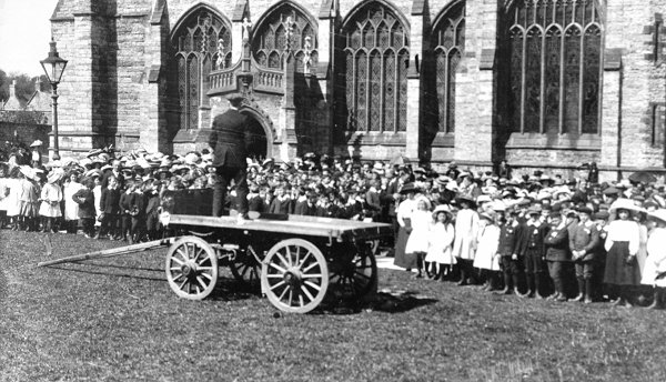
Children contestants of the South Somerset Music Competition, in 1912, assemble outside St John's church.
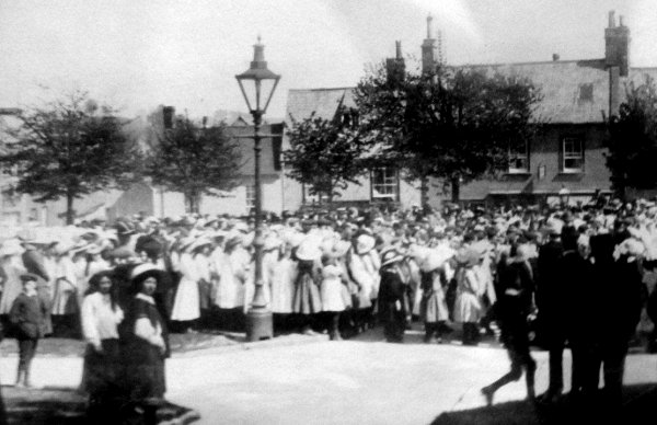
A different view, looking towards Silver Street, of the children gathered for the 1912 South Somerset Music Competition.
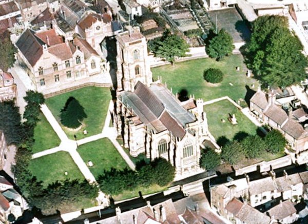
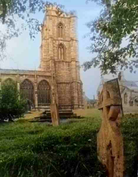
A colourised aerial photograph of 1928 showing that most headstones had been removed from the churchyard by this date.
From my
collection
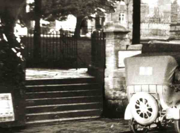
A 1920s photograph of the wrought iron gates and railings at the Silver Street end of Church Street. The railings were removed for the war effort in the 1940s.
From my
collection
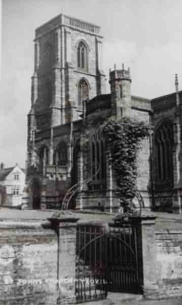
A late 1950s photograph of St John's church with its wrought iron gates by HA 'Jack' Cooper.

The original of
this photograph
features in my
book 'Yeovil
From Old
Photographs'
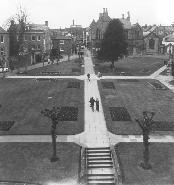
A colourised photograph of St John's churchyard photographed in the mid-1960s. Church Street is at centre and runs off to bottom left while Church path runs from centre to right, past St John's schoolrooms and the Chantry.
St John's churchyard, south side, photographed in the 1970s.
A colourised photograph of St John's churchyard, north side, photographed in the 1970s.
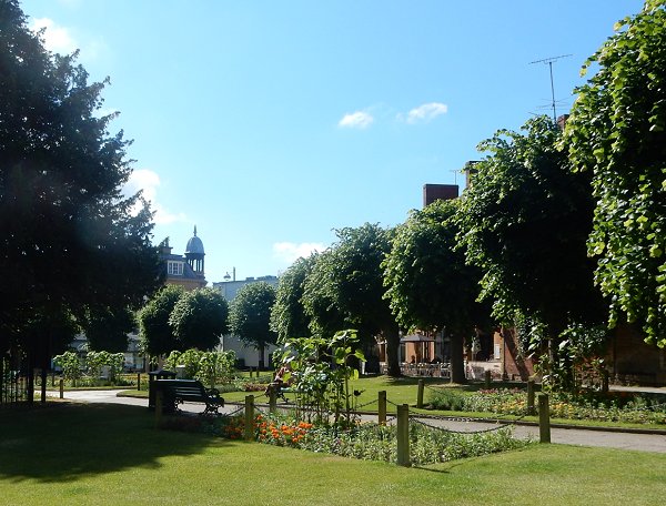
St John's churchyard - known locally as 'the Beach' - photographed in 2015.
This photograph
features in my
book 'Now
That's What I
Call Yeovil'.
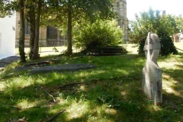
In the northern corner of the churchyard, next to Church Terrace, there are still about a dozen gravestones. This was in the 1825 extension to the churchyard of land bought from Peter Daniel. Photographed in May 2020.
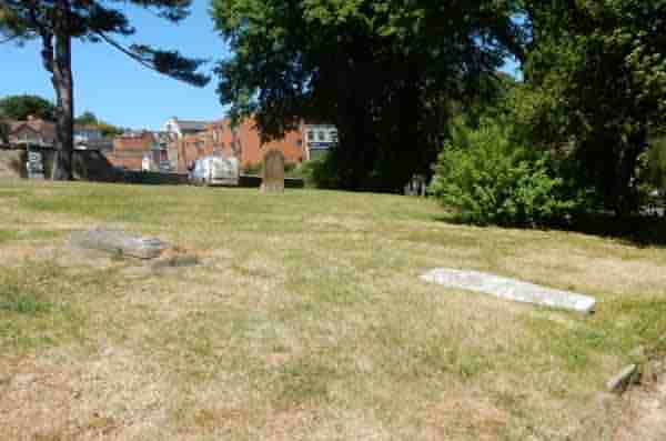
... and looking across the northern extension towards North Lane. Photographed in May 2020.
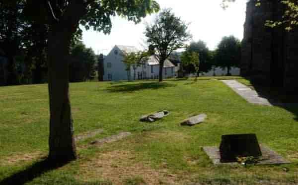
The remaining gravestones at the western end of the north side of the churchyard, adjacent to Church Walk and opposite the Chantry. Photographed in May 2020.