Fir Tree ground
Fir Tree ground
A former part of the great West Field of Kingston Manor
Originally part of the great medieval West Field of Kingston Manor, Fir Tree Ground (Parcel 1412) was a small field lying halfway between Larkhill Lane and Ilchester Road, to the south of today's Boundary Close.
In his will of 1761, linen draper of the Borough and Hendford Robert Glisson left all his lands, including Larkhill, French Grass Ground, Thorney Bush, Fir Tree Ground, New Close and Three Marle Grounds (Marle Close), to his four daughters - Betty the wife of Richard Manning, Mary the wife of John Wright, Sarah Glisson and Martha Glisson - although ensuring payments from the produce of the rents went to his widow Betty for her life. By 1777, the lands were held by Robert Glisson's daughter Mary, wife of John Wright. In a Lease for a Year of 1777, Mary leased the lands to her brothers-in-law Richard Manning of Culmstock, Devon, and Robert Winter of Sherborne, Dorset, who had married Sarah Glisson in 1767 (after her father's will). Although Martha had married Thomas Andrews in 1764, neither are mentioned in documentation referring to the lands, since Martha had died in 1767, aged 37.
The 1846 Tithe Apportionment note French Grass Ground as 3a 3r 7p and used as pasture for grazing livestock. The Apportionment noted that the owner was John Winter and the tenant was Joseph Brooks.
Fir Tree Ground was bounded to the north by the field access track that would later become today's Boundary Close, to the west by Higher Little Larkhill (Parcel 1413), to the south by Thorney Bush (Parcels 1419 and 1420) and to the east by Higher Larkhill Lane (Parcel 1411).
Today the site of the former Fir Tree Ground is occupied by the houses and gardens of the western end of Eliotts Drive and Boundary Close.
For details on historic land measurement (ie acres, roods and perches) click here.
maps

This map, based on the descriptions in the 1589 Terrier and the 1846 Tithe Map of Yeovil shows the approximate boundaries of the Manors of Kingston and Hendford as well as the manorial three-field system used in Kingston.
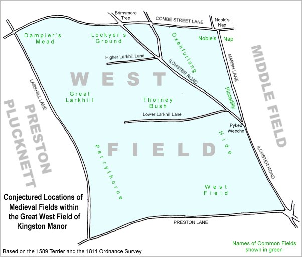
A conjectural map of the great West Field of Kingston Manor showing ancient sub-fields, most likely common fields, within the overall bounds of West Field.
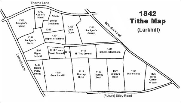
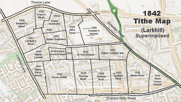
The Larkhill area reproduced from the 1842 Tithe Map. Fir Tree Ground is at centre.
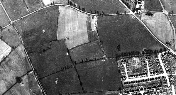
The 1946 aerial photograph showing Fir Tree Ground at centre bottom. By this time Fir Tree Ground had been combined with Thorney Bush and the eastern half of each had been built on with Elliott's Drive.
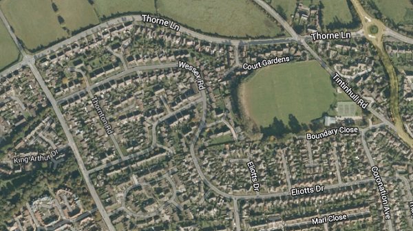
The same area today 'borrowed' from Google maps.
The 1842 Tithe Map superimposed (slightly out at the bottom) over a modern map.