Horsey Lane
Horsey Lane
Named after the Horsey family, Stewards of Yeovil
 The
name Horsey Lane
derives from the
Horsey family who were
Stewards of
Yeovil under the
Abbess of Syon,
Lord of Yeovil
from 1415 when
Henry V granted
Yeovil to the
Abbey after his
victory over the
French at
Agincourt, until
the Dissolution
of the
Monasteries by
Henry VIII in
1534.
In 1538
Sir John
Horsey
obtained the
lease of the
lordship and
parsonage of
Yeovil for an
annual fee of
£45. His
descendants kept
the Lordship of
the Manor of
Hendford in the
family until
1610.
The
name Horsey Lane
derives from the
Horsey family who were
Stewards of
Yeovil under the
Abbess of Syon,
Lord of Yeovil
from 1415 when
Henry V granted
Yeovil to the
Abbey after his
victory over the
French at
Agincourt, until
the Dissolution
of the
Monasteries by
Henry VIII in
1534.
In 1538
Sir John
Horsey
obtained the
lease of the
lordship and
parsonage of
Yeovil for an
annual fee of
£45. His
descendants kept
the Lordship of
the Manor of
Hendford in the
family until
1610.
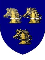
Their name is perpetuated in Horsey Lane, previously the whole of West Hendford. The arms were azure, three nags' heads couped or, bridled argent (on a blue field, three golden horses heads cut off in a straight line, with silver bridles).
Originally Horsey Lane, sometimes referred to as Horses Lane, ran from its entrance opposite the Three Choughs in Hendford to the catchpool (now the junction of West Hendford and Beer Street) before turning sharply left to Hendford Bridge by today's Railway Hotel.
Today's West Hendford appeared as Salthouse Lane on E Watts' map of 1806 and as Horsey's Lane on E Watts Jnr's map of 1831.
At the southern end of today's Salthouse Lane was a tan yard owned by John Perrott and facing today's West Hendford. Perrott was in dispute with the Town Commissioners and threatened to 'indict' the road unless they would put it into good repair. The authorities refused to be threatened but a compromise was reached in 1835 when it was agreed that Horsey's Lane, from the Three Choughs to today's Beer Street, was to be put into good repair at the expense of the private residents (of which there were very few), but after February 1836 the responsibility for maintenance of the road would be assumed by the Commissioners.
It was a rural lane bounded both sides by fields and in the 1841 Census it was listed as both Horsy’s Lane and Horsey’s Lane but only contained three households with a total of twelve people. In the mid-nineteenth century Horsey Lane was re-named West Hendford, apart from the final short stretch between the catchpool and Hendford which remains Horsey Lane to this day.
In a complete change, and for no currently-apparent reason, today's West Hendford was named Cricket Lane in the 1901 census. In fact Cricket Lane was a colloquial name used simply because a field used for cricket was situated off West Hendford, at the time a simple track beyond Beer Street, between the allotments and the Westland factory complex. This was later the Somerset County Cricket ground for five First-class matches between 1935 and 1939.
Although a few more houses had appeared by the time of the 1901 Ordnance Survey in the area of Manor Road, fields still bounded the north of West Hendford from Salthouse Lane to Beer Street.
map
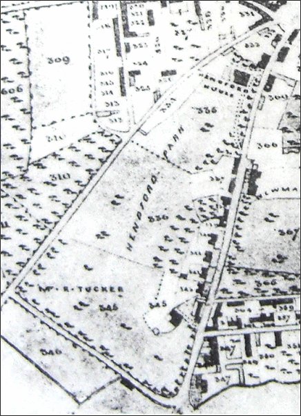
This section of Bidder's map of Yeovil of 1843 shows the extent of Hendford Park - the grounds of Hendford House (today's Manor Hotel) - all but filling the space between today's West Hendford, seen running from top right to lower left, and Hendford, running down the right hand side of the map. At the bottom, in the land marked as 'Mr R Tucker' was Hendford Lodge, the lodge to Hendford House.
The map also shows the length of the original Horsey Lane running from top right diagonally to lower left then running diagonally down to just right of centre at the bottom.
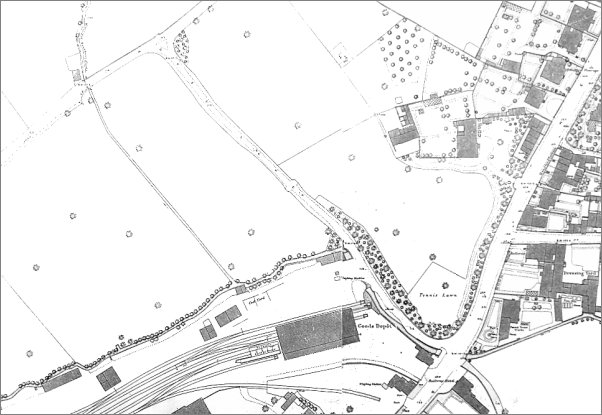
1886 Ordnance Survey showing today's Horsey Lane running diagonally across the centre, with West Hendford (formerly also Horsey Lane) at top left and Hendford at right. Originally the whole of today's West Hendford and Horsey Lane was called Horsey Lane.
gallery
The end of Horsey Lane at its junction with Hendford photographed from outside the Railway Inn in the late 1960s before the Police Station and Queensway were built.
.... and seen from a slightly different angle with Hendford running off to the distance at right.
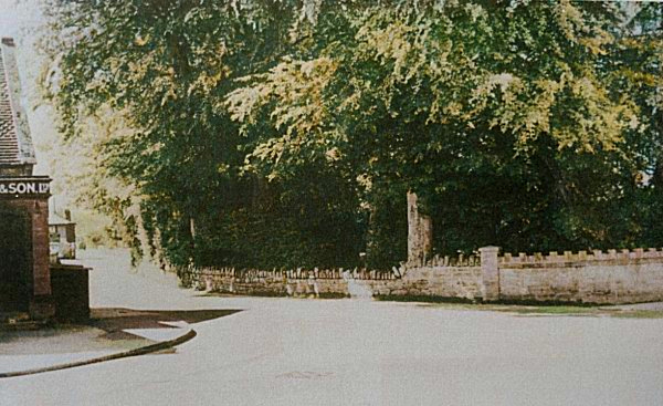
This is the junction of Horsey Lane (at left) and Hendford (at right) with the wall of Hendford Lodge being demolished.
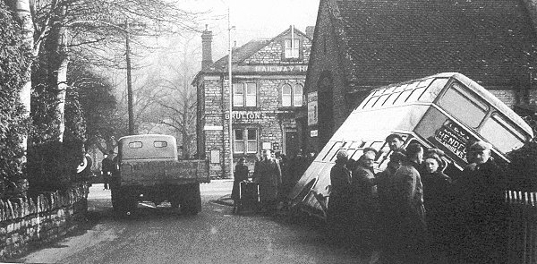
This photograph
features in my
book 'Secret
Yeovil'
The 1953 Bus Crash. Having crashed through railings, the Hendford bus lies at an angle of 45° in Dodham Brook which runs alongside Horsey Lane.
From my
collection
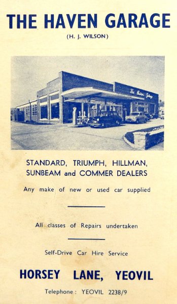
The Haven Garage's advertisement in the 1958 Yeovil Guide.
Courtesy of Jack
Sweet
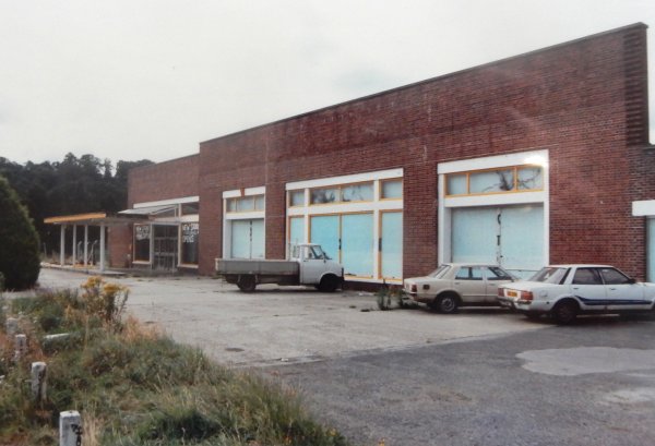
The former Haven Garage in Horsey Lane - later various DIY stores - photographed in 1993.
From the Cave
Collection
(colourised),
Courtesy of South Somerset Heritage Collection
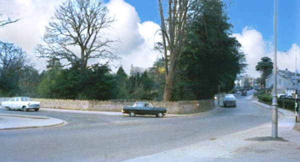
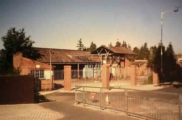
Looking along Horsey Lane in the mid-1960s.
From the Cave
Collection
(colourised),
Courtesy of South Somerset Heritage Collection
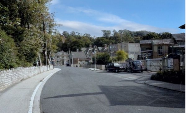
.... and seen from a little closer to West Hendford.
Courtesy of Jack
Sweet.
This
photograph
features in my
book "Lost Yeovil"
The Horsey Lane oil depot, probably photographed in the late 1970s.
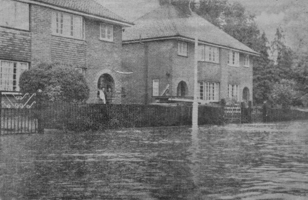
Dodham Brook broke its banks and flooded Horsey Lane on 6 August 1962 - reproduced from a newspaper clipping.
This
colourised photograph
features in my
book "Lost Yeovil"
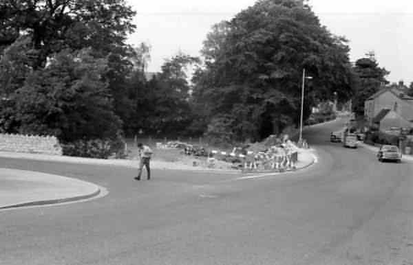
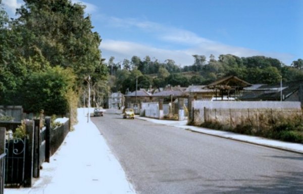
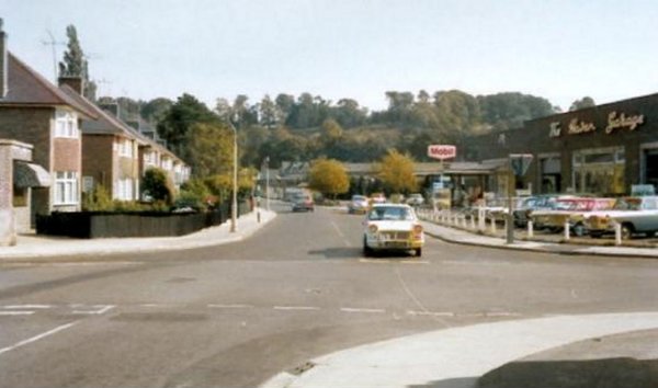
Horsey Lane seen from Beer Street, circa 1965.
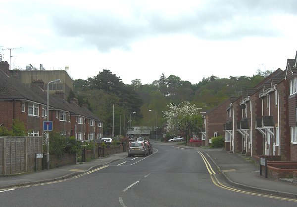
.... and the same scene photographed in 2013.
Courtesy of
James Caddy
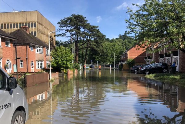
... and the flooding continues. This photograph was taken in 2020.