yeovil recreation centre
yeovil recreation centre
Former Mudford Road Playing Fields - 'Mudford Rec'
Originally part of the great medieval Middle Field of Kingston Manor, an ancient sub-field called Pikes, sometimes known as 'Coomb Street', covered a large area in the region between Marsh Lane in the west, Mudford Road to the east and Combe Street Lane to the north (see maps below). It was still called Pikes in the year 1800 and was noted as such on an indenture of that year.
At one time there was a continuous footpath from Yeovil to Yeovil Marsh and eventually to Ilchester by footpaths and lanes. It started at Kingston at Red Lion Lane, continued along Sparrow Lane to Mudford Road then crossed the road at a large sub-field called Green Cross then entered the large field called Pikes. From Mudford Road as far as Combe Street Lane the footpath was known as Hillon Path and was recorded in the 1589 Terrier ".... one acre and half, next Hillon path....".. Hillon Path became corrupted to Hellam Path and this, in turn, became corrupted to Elm Path.
By Victorian times the large ancient field called Pikes had taken the name of the footpath and became known as Elm Path. The marriage settlement of John Ryall Mayo and Penelope Worsfold Randall of 29 September 1824 refers to a "Close of Pasture Ground formerly called Pikes otherwise Coomb Street but then called Higher Elm Path otherwise Higher Hellam Path".
By the time of the 1846 Tithe Apportionment Elm Path (the field) had been subdivided into Higher Elm Path (Parcel 1094), Middle Elm Path (Parcel 1086) and Lower Elm Path (Parcel 1081). Today these three fields form the Yeovil Recreation Centre, affectionately known as 'Mudford Rec', and remain the only open green area in the Hollands section. The present Pitch & Putt course was built on two further fields; the western part of Combe Street (Parcel 1093) and Stoney Field (Parcel 1087).
|
Yeovilians
remember... |
The following is the history of the Mudford Road Playing Fields - known by generations of Yeovilians (and still known by most of us) as 'Mudford Rec' although now it is officially called the Yeovil Recreation Centre (who knew?).
I am very grateful to Vivien Cornelius, who researched the history of 'The Rec' for allowing me to include the history on this website below. In Vivien's own words "I was fascinated with the minutiae - a local Reverend outraged by the immoral conduct of young people by the play area, the vandalism of the trees by named children (fine upstanding members of communities now I'm sure!), the regrettably low yields of potatoes during and after the War, the constant concern of refreshment provision etc. etc. Words, from Civil Defence minutes in the early fifties, that made me gasp and sent an icy shiver down my spine were about the use of the changing rooms as an emergency mortuary......"
Yeovil Recreation Centre - a brief history of the land
In 1927 Yeovil
Borough Council
wanted to
provide
additional
recreation
ground in West
Ward. Councillor
William Earle
Tucker offered
two fields off
Mudford Road.
The purchase
price of £1,700
was raised by
private
donations and a
loan and the
sale completed
in March 1929.
£2,100 was
needed to turn
these two fields
into playing
fields and the
National Playing
Fields
Association
(NPFA) was
approached for a
grant. The
Carnegie UK
Trust offered a
grant, if the
Council would
abide by the
conditions
imposed by the
NPFA. The
Council agreed
and in June 1930
a Declaration of
Trust was signed
and sealed - the
land would be
used in
perpetuity as
public
recreation and
playing fields.
Carnegie UK
granted £300,
NPFA £100.
Mudford Road Playing Fields (MRPF) were opened with great ceremony by Mayor William Earle Tucker in June 1931.
In 1932 a cottage was built for the groundsman. A clock was erected over the front door in 1937.Over the years the cottage was improved and extended and eventually occupied by the park keeper. In 2003 it was sold, despite being on the land funded by the NPFA on the condition that no land would be sold.
In February 1946 William Rogers offered to sell to the Council the undeveloped portion of his land at Marsh Lane but they refused. Later that year he offered to give them the land at the fields’ entrance, then all the land he had wanted to sell. This gift, with two covenants, was accepted - the Council must erect and maintain a fence at the borders and the land must not be used for any purpose other than that of public open space or recreation. A mistake erecting the fence resulted in the purchase of a thin strip of land at the Marsh Lane entrance in 1947.
In 1951 the Corporation earmarked Larkhill Farm for use as an emergency mortuary in case of nuclear war, etc. However the farmhouse was demolished by 1953 and the changing rooms at Mudford Road Playing Fields were earmarked in its stead.
In 1954 a paddock behind houses in Mudford Road was bought. Potatoes were grown for a few years and hard tennis courts opened in 1963. Land to the other side of the Marsh Lane entrance was bought in 1959. Some of this land was sold for a Doctors’ Surgery, opened in 2003.
Early in 1963 Lower Stone Farm, the farm to the Combe Street Lane and Chilton Grove/Mudford Road sides of MRPF was bought. The Council had long wanted at least part of the land to extend MRPF, had refused planning permission for housing and were going to compulsory purchase. Eventually they paid the price of building land for the farm. The Chilton Grove car park was built on the farmhouse and farmyard land, soil excavated during the athletics arena construction was transferred to the field off Combe Street Lane, a pitch and putt course built on the land between Combe Street Lane and the farmhouse and a large pond on the triangle of land behind houses in Mudford Road filled in. In 1970 the pitch and putt opened and the following year Mudford Road Playing Fields were renamed Yeovil Recreation Centre.
To enable a long-requested athletics track to be built (on Declaration of Trust land) in 1970 Somerset County Council sold a small piece of their land at Little Hollands to the Borough Council. A small strip of land to the north of the current pedestrian entrance was bought in 1972.
In 2013 a large portion of the remaining Trust land was enclosed and an artificial grass pitch constructed. NPFA is now Fields In Trust. One of the Rights of Way traversing the site was diverted from the centre of the land to the edge of the Pitch and Putt in 2013, after the artificial grass pitch had been permitted and very shortly before its construction started. Evidence of ancient occupation of the site was unearthed during construction, not a total surprise given the ready availability of water across the land.
![]()
During 2013 salvage excavations at Yeovil Recreation Centre (specifically in the former field Lower Elm Path) recorded parts of a previously unknown late Iron Age and Roman settlement, discovered during earthmoving for sports pitches.
The site was reported following the discovery of a hoard of 3,339 coins by the digger driver. Experts established that the coins were from the 2nd-3rd centuries AD, with 164 being dinarii, four brass sestertii, and the rest radiates. Some coins had been stacked and carefully bound in textile, and string, some of which remained. Some of the coins carried the heads of empresses, and others emperors, including Philip I, born in Syria of a Syrian father, around 204AD.
To the east of the hoard, the settlement was represented by pits and ditches forming incomplete enclosures. There was also a four-post structure and evidence for some metalworking activity. It is possible that the coins, specimens of which are shown below, were intended as a source of metal for reworking although iron working is more likely. The presence of the coins and imported pottery suggests that the inhabitants had some degree of wealth and the site is likely to extend further.
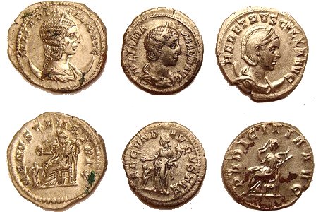
The coins, mainly of silver, include depictions of an elephant and a hippopotamus, animals which must have seemed exotic monsters to the Romano Britons through whose hands they passed. The hoard is thought to have been buried around 270AD.
Immediately prior to the Roman invasion of Britain, the area that would become Yeovil was inhabited by the British Celtic Durotriges, a loose tribal confederation occupying an area from east Devon to south Wiltshire that included south Somerset and most of Dorset.
MAPs / Aerial photographs

This map, based on the descriptions in the 1589 Terrier and the 1846 Tithe Map of Yeovil shows the approximate boundaries of the Manors of Kingston and Hendford as well as the manorial three-field system used in Kingston.
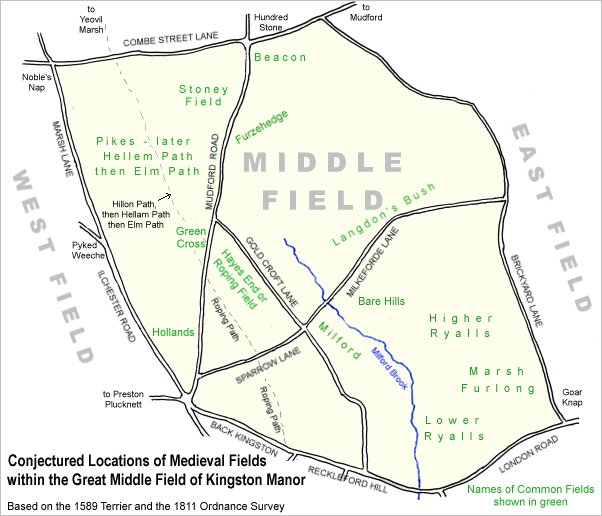
A conjectural map of the great Middle Field of Kingston Manor.
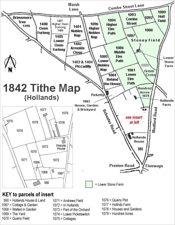
The Hollands area reproduced from the 1842 Tithe Map. Higher, Middle and Lower Elm Path are right of centre.
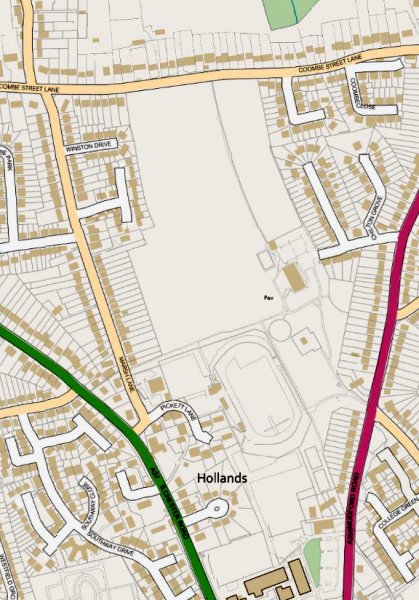
A modern Ordnance Survey map showing the location of Yeovil Recreation Centre between Coombe Street Lane at the top, Ilchester Road (in green) to the west and Mudford Road (in red) to the east.
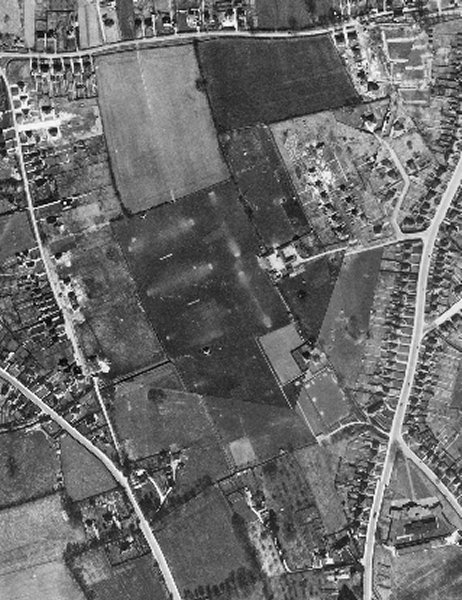
The 1946 aerial photograph shows the Mudford Road Playing Fields and Lower Stone Farm, just right of centre, which was replaced by the Chilton Grove car park in the 1960s.
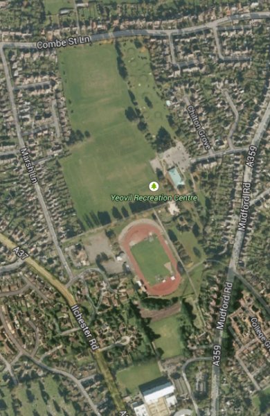
.... and seen in 2009 ('borrowed' from Google maps).
gallery
Courtesy of
Vivien and
John
Cornelius
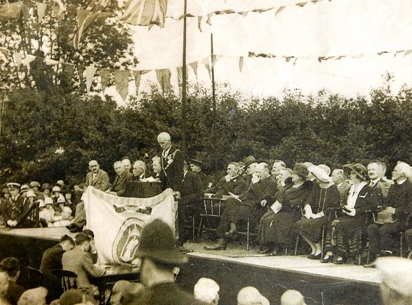
Mayor William Earle Tucker performs the official opening ceremony of the Mudford Road Playing Fields in June 1931.
Courtesy of Jack
Sweet
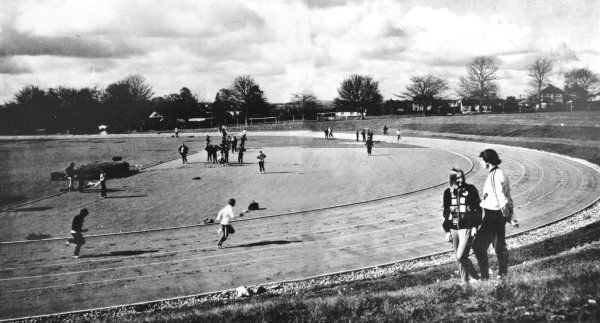
The athletics arena photographed in March 1972.
![]()
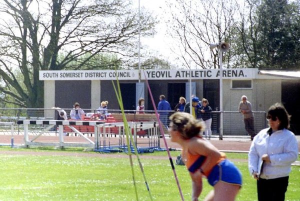
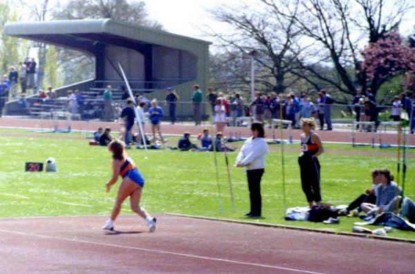
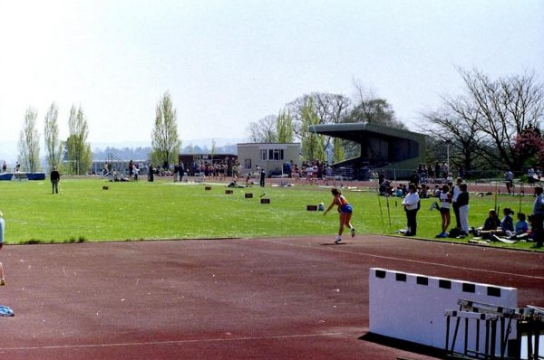
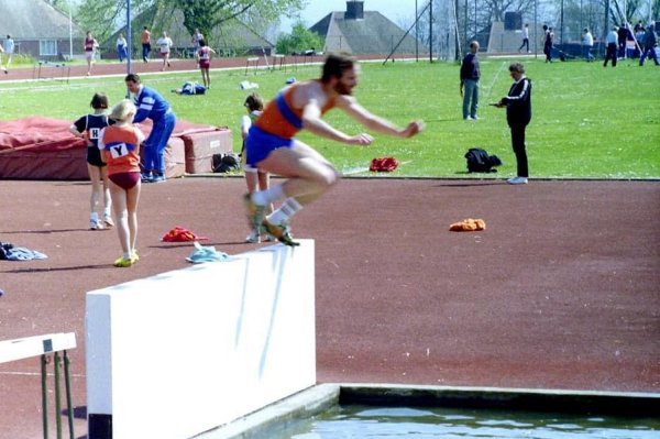
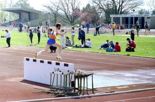
The following five photographs of a Track & Field Meeting in the 1980s were taken by Doug Keyse, a Yeovil Olympiads judge, and are courtesy of Andy Keyse.
![]()
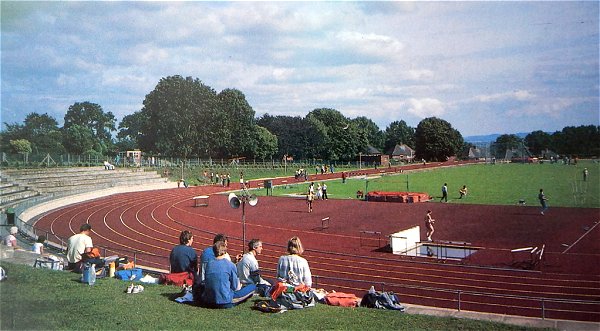
The all-weather athletics arena, photographed in the 1990s.
Courtesy of
Vivien and John
Cornelius
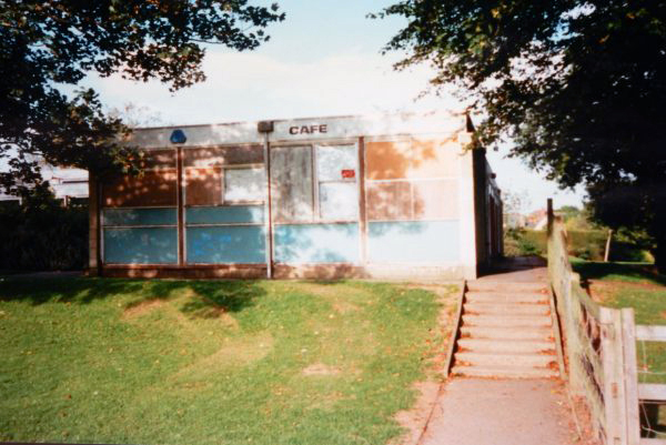
Mudford Rec Café. Photographed in 1997.
Courtesy of
Vivien and John
Cornelius
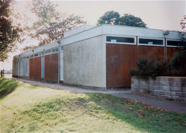
Mudford Rec changing rooms. Photographed in 1997.
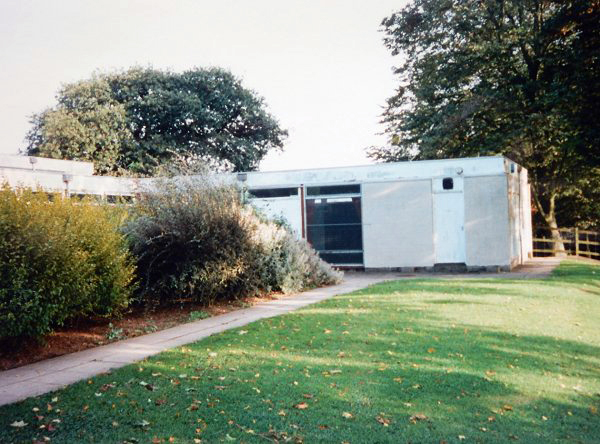
Courtesy of
Vivien and John
Cornelius
Mudford Rec changing rooms. Photographed in 1997.
Courtesy of
Vivien and John
Cornelius
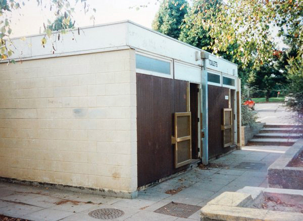
Mudford Rec toilets. Photographed in 1997.
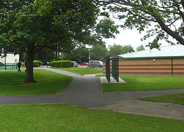
Higher Elm Path seen from the southeast corner, looking northwest. Photographed in 2014.
Higher Elm Path seen from the northeast corner, looking southwest. Photographed in 2014.
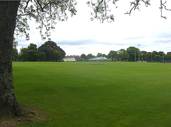
The changing room complex at right was built on what would have been the northern end of Green Cross. To the left, the car park and store at extreme left were built on the site of Lower Stone Farm.
Combe Street today, as the northern section of the Pitch & Putt course, seen from the northeast corner of Higher Elm Path. Photographed in 2014.
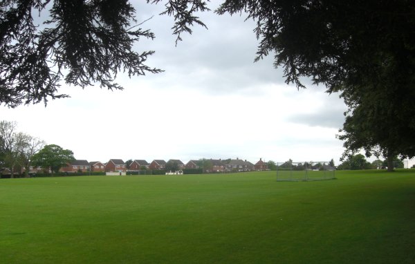
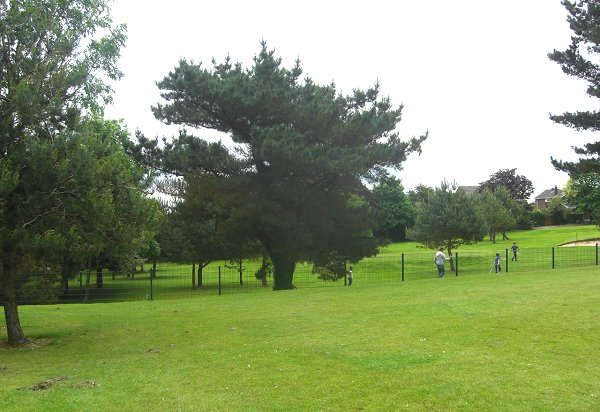
Middle Elm Path, seen from the northwest corner and looking south to the boundary with Lower Elm Path at the tree line. Photographed in 2014.
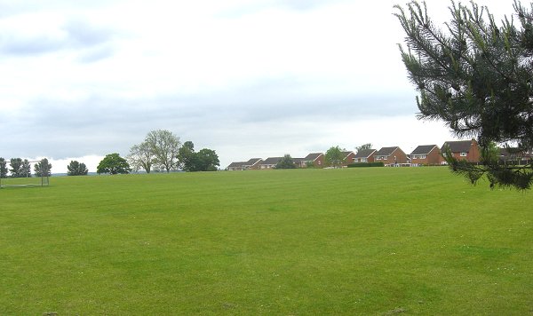
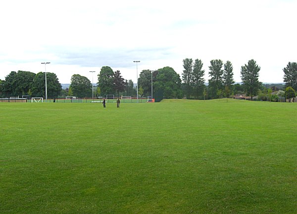
Middle Elm Path, seen from the northwest corner and looking east. The beige building at centre is the park store by the car park and is built on the site of Lower Stone Farm. Photographed in 2014.
Courtesy of
Chris White
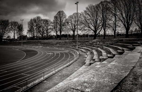
Yeovil Athletics Arena, photographed in 2016.