osborne house
osborne house
Originally known as Penfield House
 Originally
known as
Penfield House
or Penn Field,
since it was
built in the
corner of the
field called
Pen Field, Osborne
House was built
in the Regency
style but
slightly later,
around 1830 (it
is shown on
Watts' map of
1831).
Originally
known as
Penfield House
or Penn Field,
since it was
built in the
corner of the
field called
Pen Field, Osborne
House was built
in the Regency
style but
slightly later,
around 1830 (it
is shown on
Watts' map of
1831).
It is of two storeys and three bays with a roughcast render finish under a hipped Welsh slated roof with wide soffits. It has a fine central projecting porch, set on five steps, with fluted Ionic columns and attached columns supporting a full entablature.
There is a high
stone wall to
the front
boundary capped
by nineteenth
century
railings, with
two pairs of
simple gate
piers with
moulded caps,
although the
gates are
missing.
As seen from the
map below,
Osborne House
originally had
extensive
grounds but much
of these were
sold off in the
mid-1890's to
Aplin & Barrett
for the
construction of
their new cheese
and dairy
products
factory.
Of the owners of Osborne House it would appear that the first was glove manufacturer Charles Fone, as shown on Watts' map of 1831 when the house was newly-built. During Charles Fone's occupancy it was known as Penfield House and is listed as such in the 1841 census at which time Charles was living there with his wife Mary, six children and a female servant.
Charles Fone moved to Middle Street and in the 1851 census Osborne House was occupied by 51-year old Timothy Huffam of Peckham, Surrey who listed his occupation as brewer. Also living with him was his wife, Catherine, their four sons and a domestic servant.
By 1871 Osborne House was owned by Earle Vincent, owner of the Royal Osborne Brewery which was located alongside Osborne House. In the 1871 census he was listed as a brewer and a widower aged 33, living with his two young daughters Sophia aged 6 and Henrietta aged 4. Also living with him was his younger sister Augusta, who presumably looked after his daughters, a cook and a housemaid.
Earle Vincent died in the summer of 1893 aged 55 and on 23 November 1894 Emma Vincent, his second wife and widow and Sophia Fowle Vincent, his daughter by his first wife, conveyed to John Vincent of Yeovil, an outfitter, "a messuage known as Osborne House". On 8 April 1895 John Vincent conveyed to Jonathan Drew Knight of Yeovil, brewer, a piece of land on London Road, which adjoined The Royal Osborne Brewery and Osborne House and on 1 August 1895 John Vincent conveyed Osborne House to coachbuilder John Henry Boll of Yeovil, and on 3 August 1895 John Henry Boll mortgaged the property back to him.
On 20 February 1896 John Henry Boll conveyed to cheese factors James Shorland Aplin and William Henry Barrett (Aplin & Barrett), a piece of land, formerly part of the garden of Osborne House. On 31 December 1896 Emma and Sophia Vincent conveyed to Aplin and Barrett, a parcel of land in Newton Road, Yeovil as a right of way.
On 12 Nov 1897 draper Norman Buchanan of Yeovil, mortgaged Osborne House to spinster Mary Jane Hayward of Wollaston Terrace, Dorchester, Dorset. On 4 September 1905 Buchanan mortgaged Osborne House to ironmonger Thomas Cecil Laver of Yeovil and on 13 August 1912 Walter Herbert Baxter of Sherborne, Dorset, Esq. conveyed to Buchanan, a parcel of land fronting onto Sherborne Road, with its stables and coach houses. On 14 August 1912 Norman Buchanan mortgaged this land to Edmund Damon and William Willis Henley of Yeovil, gent.
In 1916 Buchanan, Yeovil's mayor at the time, died at home on New Year's Eve 1916 by falling down the stairs! On 7 July 1919 Buchanan's widow, Emily Rose, conveyed Osborne House to Aplin and Barrett and The West Counties Creameries Ltd.
Osborne House is now a dental surgery while the site of the brewery is now the adjacent car park.
MAP
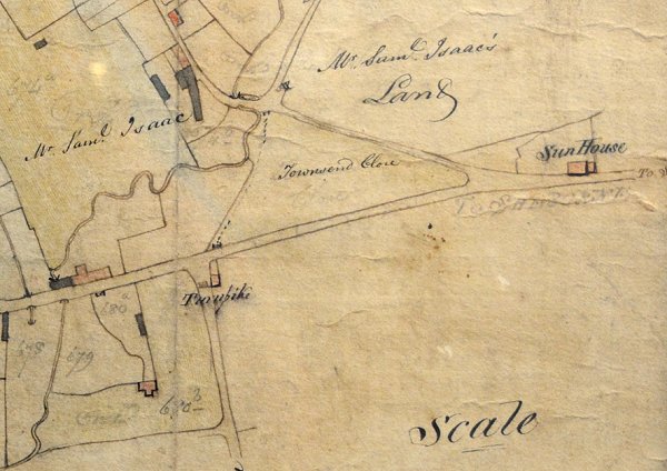
E Watts' map of Yeovil of 1806 shows Townsend Close at centre, completely devoid of buildings.
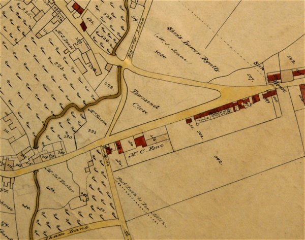
The same area on E Watts' map of 1831 showing the build-up of properties along the southern side of Townsend including Osborne House, albeit not named as such. At this time it was known as Penfield House and was the property of Charles Fone.
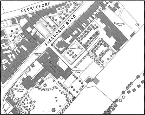
Map based on the 1886 Ordnance Survey. Osborne House and its extensive grounds take up the whole of the lover left of the map.
GALLERY
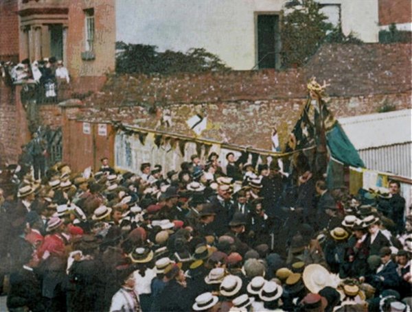
King Litunga Lewanika of Barotseland (in silk top hat, just below and slightly to the left of the flags) performs the foundation ceremony of the new Western Gazette building in June 1902. At the top of this colourised photograph is Osborne House, with a small crowd by the front door and the flank of the house running off to the right.
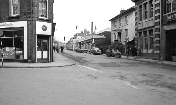
Osborne House, right of centre flanked by Sparrow's garage and the Western Gazette building, in its streetscape of the 1960s. At left is Wyndham Street.
Courtesy of
Colin Haine
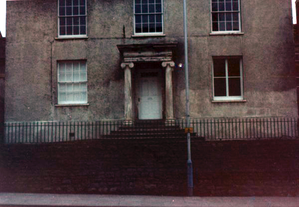
.... and photographed in the mid-1980s.
Courtesy of Bill and Audrey Robertson
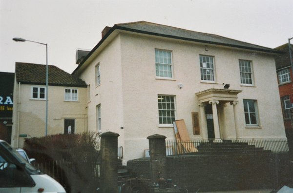
Osborne House photographed in the 1990s.
Courtesy of Bill and Audrey Robertson
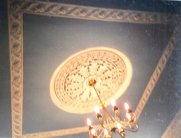
Ornate ceiling plasterwork, Osborne House, photographed in the 1990s.
Courtesy of Bill and Audrey Robertson
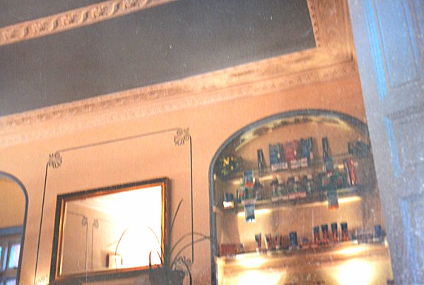
Decorative plasterwork and niches, Osborne House, photographed in the 1990s.

The front elevation displays the perfect Regency styling of Osborne House.

This photograph
features in my
book "A-Z
of Yeovil"
Osborne House, showing the nineteenth century railings with one of the pair of simple gate piers with moulded caps.