market street
market street
Formerly Ford Street, Rackleford and Rotten Row
The earliest mention of today's Market Street in the records occurs in a document of 1355 in which it was referred to as Ford Street, simply because it had a ford across a small stream. At one time a small brook called the Rackel or Rackle, little more than an open sewer, had crossed the road close to the Pall Tavern and was shallow enough to be forded, hence the early name of Market Street for hundreds of years was Rackleford, or Reckleford - right up until the 1840s - not to be confused with today's Reckleford which was originally called Reckleford Hill.
Alongside the Pall Tavern was a pond called the Horse Pool into which the Rackel ran, and then out the other side to continue eastwards.
In the early part of the nineteenth century Market Street was known as Rotten Row, so called because horses were paraded there especially at the time of fairs. Rotten Row was named after the famous broad track of the same name in Hyde Park, London, which is still reserved for the exercise of horses. Rotten Row appears in the Parish Registers in 1814 and there are mentions in Pigot’s Directory of 1830. In 1840 it appears in the Register of Electors and in the 1841 Census.
Although the market at the corner of Court Ash and today's Market Street, after which Market Street is now named, was started in the 1850's by William Palmer, even by the time of the 1871 census the enumerator still listed it as 'Reckleford formerly called Rotten Row' and it wasn't until the 1881 census and the 1886 Ordnance Survey that Market Street was finally established as the name.
map
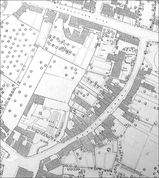
This map, based on the 1886 Ordnance Survey, shows Market Street named as such for the first time and running from its junction with Silver Street and Court Ash at bottom left to Reckleford Hill, today's Reckleford, at top right.
gallery

A colourised 1960's photograph, taken from the junction of Market Street, Silver Street and Court Ash, looking up Market Street. Where the woman is crossing the road is the approximate site of the ford of the Rackel Stream and to the side of the Pall Hotel, where the car is, was the site of the Horse Pool.

Seen at the centre of the previous photo, this is a colourised photograph of an early 18th century house in Market Street that didn't survive the 1960s.
.
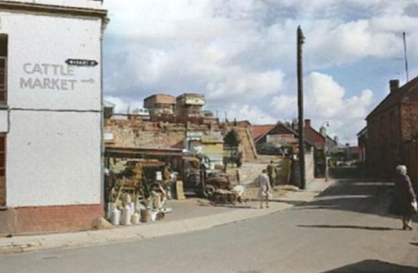
Just around the corner from the previous photograph, this colourised photograph of the 1950s moves into Market Street and at left is the market itself, established in the 1850's, which gave the street its modern name.
... and the same scene, in a colourised photograph of around the same time, but taken from the location of the two lorries seen in the previous photograph0

... and turning the corner, we can see the full range of market day wares for sale.
From the Cave
Collection
(colourised),
Courtesy of South Somerset Heritage Collection
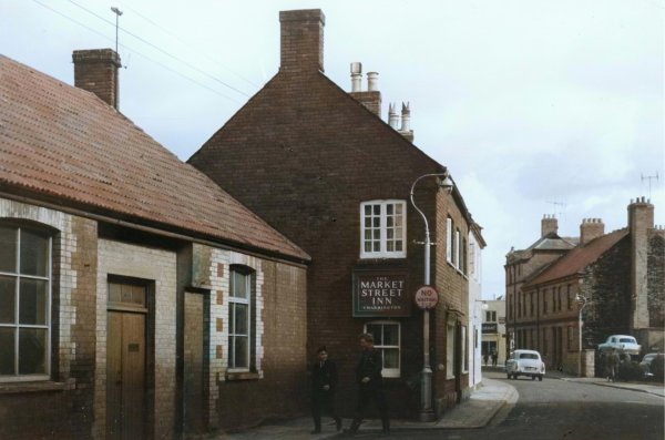
This photograph was taken halfway along Market Street, near the Market Street Inn which is just visible on the previous photograph between the telegraph pole and the lamp post. Just glimpsed at the end of the road in this photograph is today's Palmer's fish restaurant.
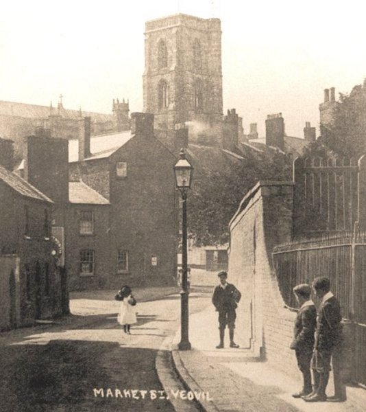
Market Street photographed in 1905.

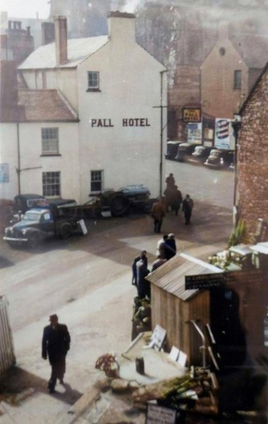
A colourised photograph of 1960 by Charrington & Co Ltd's surveyors as part of a 'stocktaking' exercise of photographing Brutton's pubs prior to the brewery takeover.
From the Cave
Collection
(colourised),
Courtesy of South Somerset Heritage Collection
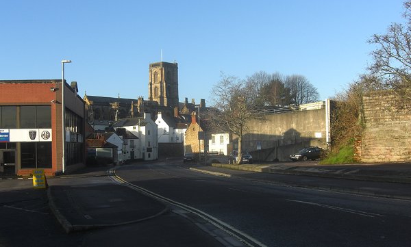
A photograph of 1965, showing Market Street looking back to the Pall Tavern and St John's church.

This colourised photograph, of 1956, shows Market Street houses on the western side of the road, roughly opposite Vincent Street.

This 17th century building, seen in the previous photograph at left, was known as Chantry House. A colourised photograph of 1942.
From the Cave
Collection
(colourised),
Courtesy of South Somerset Heritage Collection
This
colourised photograph
features in my
book "Lost Yeovil"
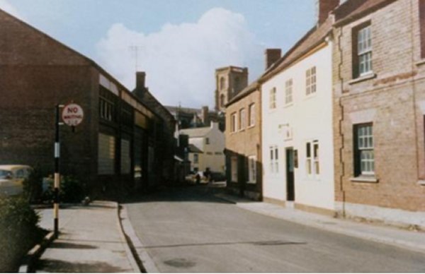
This photograph dates to the mid-1960s and was taken halfway along Market Street looking towards Palmers fish & chip shop on the corner of Vincent Street.
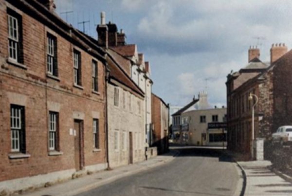
.... and pretty much the same view in 2014.

This colourised photograph looks back down Market Street and is taken from its junction with Vincent Street at left. With the building of the Quedam centre this part of Vincent Street became an extension of Central Road - in other words the photographer has got his back to Palmer's fish restaurant.
Courtesy of Olly
Ewens -
This colourised photograph
features in my
book 'Yeovil
From Old
Photographs'
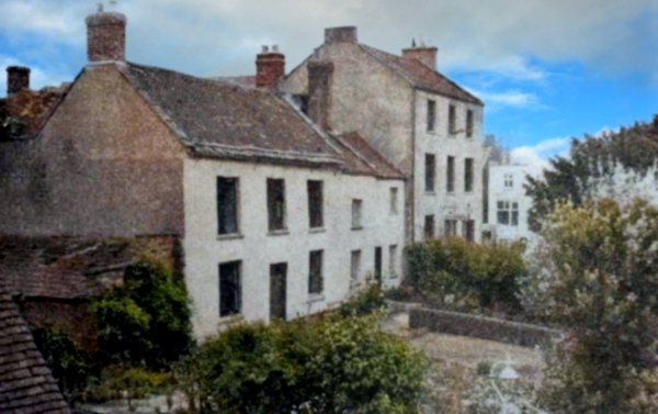
This photograph is dated 1960 and shows the three dwellings in Market Street about to be demolished. The two-storey, three-bay house at left is Ilex House and the three-storey, three-bay house at right is Reckleford Cross House. The small cottage between them was still occupied at the time by Mrs Mildred Bond who was waiting for new accommodation to be found for her.

A slightly earlier, colourised photograph of Ilex House, at left, seen from Vincent Street (now the site of today's Central Road).
.... almost the same view in 2014.
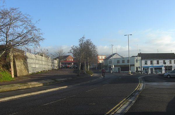
Market Street - Then and Now

Above, seen in the distance of this 1970s photograph, directly opposite Market Street, is Reckleford House. It was a Georgian house built between 1806 and 1831. It was a private residence for most of its existence, but by the time of its demolition in the mid-1970s for the widening of Reckleford, it was the offices of the Ministry of National Insurance. At left is untidy waste ground with cars parked on it with little change there in the last fifty years.
Today’s photograph, below, moves back a bit to include the roundabout created in 1983, when Central Road was extended beyond Vincent Street.