yeovil from above
yeovil from above
Get a fresh perspective on our town
Throughout this website are several aerial views, this page pulls them all together (in no particular order other than almost vaguely alphabetical) to give you a new perspective of Yeovil - from above!
gallery
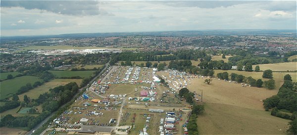
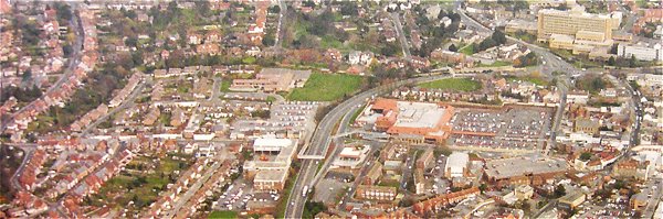
Yeovil seen from above the Yeovil Showground. The Westland complex shows as a long white splodge across top left with its green airfield beyond. Photographed in 2006, looking north.
Courtesy of Yeovil Library
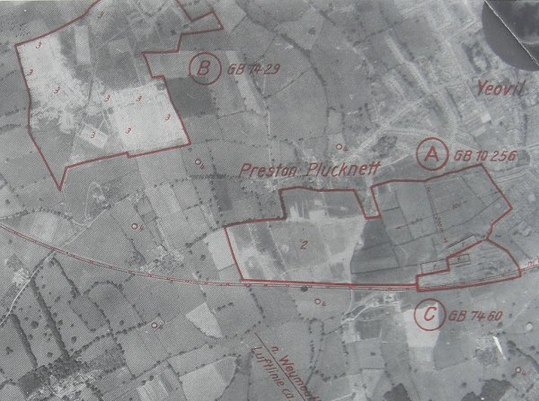
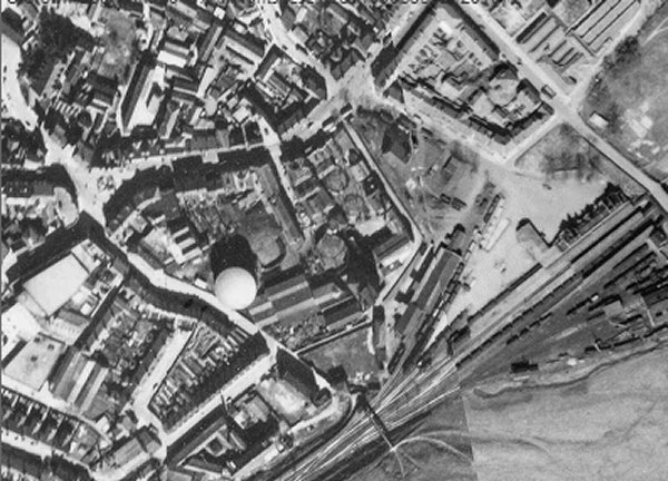
This is part of a German reconnaissance photograph of the Second World War highlighting the targets of Westland's Airfield (marked 'A'), a temporary army camp (marked 'B') and the Westland factory (marked 'C'). Within 'A' are three aircraft hangers marked '1' in the lower right corner and the airfield itself is marked '2' - note how the airfield has been camouflaged by pouring oil on the grass to create the appearance of hedges around small fields. Within 'B' are several barracks huts, each marked '3'. Dotted around the map and marked '4' are several sites of 'Fesselballons' or barrage balloon sites.
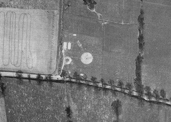
Yeovil Barrage Balloon Site No 22, "Preston Road, Yeovil", as seen in the aerial photograph of 1946. The site is now under the Houndstone Retail Park but Preston Road is seen running across the photograph and the hedgerow running from Preston Road to the top of the photo at right is the approximate line of today's Western Avenue.
A track leads from Preston Road to the circular loop road for the winching lorry, the track then continues towards two Nissen huts. The circular concrete base is seen to be surrounded by two rings of concrete blocks - these were mooring blocks used to tether the balloon.
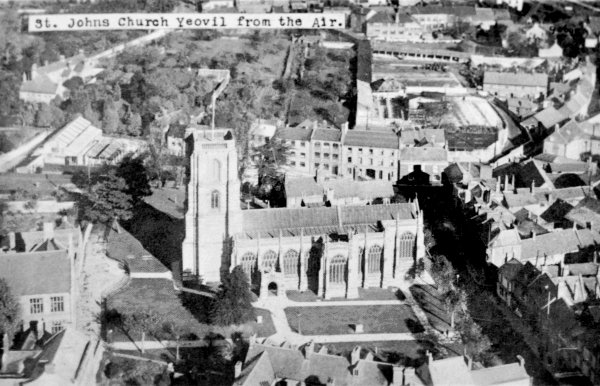
A postcard of the 1920s viewing St John's church from the air.
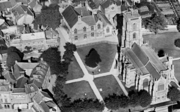
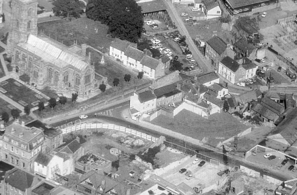
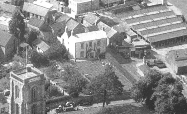
A 1928 aerial view of St John's church with Church House at left. Notice that this photograph shows the wing of the house, adjacent to Church Street, that was destroyed by a German bomb in October 1940.
A 1928 aerial view of the western end of South Street, running from centre bottom towards centre left with the Oxford Inn clearly visible towards the top left corner of the photograph at the junction of Hendford, West Hendford, Waterloo Lane and South Street. The large building taking up most of the centre of the photograph is, of course, the Three Coughs Hotel. Notice the old glove factory in Waterloo Lane at top centre - one of the few remaining glove factory buildings in Yeovil.
An aerial view of the Fair Ground between North Lane and Court Ash, taken in 1955 clearly showing the numerous buildings and sheep pens. St John's church is at bottom left and the Odeon cinema at top right. Note the cattle market at far right.
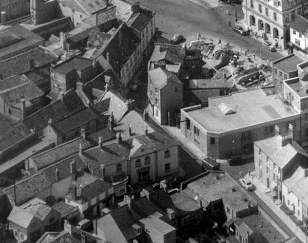
A 1928 aerial photograph of King George Street with South Street at left and High Street at right. Note that at this time only the municipal offices at centre, on the western side of the road, had been built. The post office building on the eastern side of the road would not open until 1932.
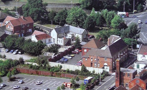
The Armoury is the white building at the centre of this 1994 aerial photograph. Behind the trees at the top of the photograph Queensway runs to join the Hospital Roundabout at top right. Clarence Street runs diagonally across the bottom right of the photograph and at bottom left is Tesco's car park when it was still one-storey. The large building in the right half of the photo is Telford House, built as a telephone exchange and later became Council Offices (where I worked in the early 1970's in the Architect's drawing office).
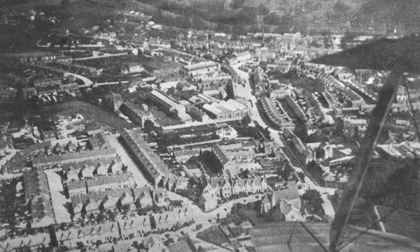
A 1919 aerial photograph taken from a biplane - its wing-tips and strut are seen at right. At the end of the lower wing-tip is the Church of the Holy Ghost and running across the bottom of the photograph is The Avenue. Running from the lower wing-tip towards the top of the photograph is Reckleford with the Nautilus Works at centre and Salisbury Terrace opposite.
An aerial photograph dating to 1975 shows the Black Horse at the centre with the three dormers. Reckleford, newly made into a dual carriageway, snakes across the lower half of the photograph while Higher Kingston comes down from the top left, past the Catholic Church of the Holy Ghost. The Avenue runs to top centre. At this point Higher Kingston ended and Reckleford Hill started, its original course marked by the line of remaining buildings starting with the Black Horse.
A 1928 aerial view of the junction of Vicarage Street (running across the centre of the photo) and Middle Street (running from bottom left towards centre top). At lower right is the Methodist church and above it, next to the spire, is the Britannia Inn.
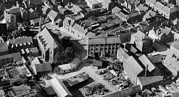
This aerial photograph of the 1920s shows the eastern end of Vicarage Street snaking across the photograph from its junction with Middle Street, seen at the very top left corner. At left the Methodist church dominates and just right of centre is the three-storey glove factory of William Raymond, later the factory of George Gould but it burnt down in 1908 and this photograph shows the rebuilt glove factory and dressing yard. The glove factory and the large yard at centre bottom was the Council's 'Town Yard' during the 1970s and 1980s - I spent many hours in that building during those years.
A 1946 aerial photograph with Hendford running along the left edge and Brunswick Street running across the centre of the photograph. Chant's Path is seen above the left half of Brunswick Street. Aldondale Gardens has yet to be laid out although there are a couple of houses. At top right is Penn Hill Park and Penn Hill. Penn Hill itself is covered with allotments.
A 1928 aerial view of Stars Lane with the Duke of Clarence (slightly masked, but seen as two separate buildings at centre).To the left of the Duke of Clarence and running to the top left of the photo are seen the houses in Duke of Clarence Yard. To the right the large building is the old Palace Theatre - Yeovil's first cinema - on the corner of Stars Lane and South Street. At extreme right is the Triangle. Note also the large gas holder at bottom left.
This aerial photograph of the Triangle dates to 1988. The Duke of Clarence is the white building at centre left. The left half of the large building at bottom left is now back to being Chicago Rock while the old Porter Black building, originally the Co-op offices, stands left of centre facing the Triangle with the start of South Street to its left and Middle Street, running from top centre to bottom centre, to its right. At top right is the recently-constructed Quedam shopping centre.
This 1946 aerial photograph shows the town gasworks, at centre, which had by this time extended as far as Stars Lane next to the new, large gas holder just left of centre. The right-hand side is occupied by Yeovil Town railway station.
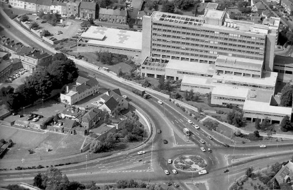
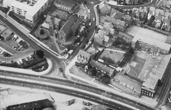
This aerial photograph of 1984 shows Kingston running down from the top left corner of the photo to join the hospital roundabout with Queensway running to the left and Reckleford to the right. The hospital dominates the photograph and the Duke of York, standing to the right of the clump of trees was one of the few survivors from the destruction of Kingston.
The entire length of Kingston photographed in 2005.
An aerial photograph of 1946 showing West Hendford running from lower left to upper right and The Crescent dominating top centre. Opposite the lower, western, junction of the Crescent and West Hendford is the eastern end of Everton Road. Opposite the upper, eastern, junction of the Crescent and West Hendford is Manor Road. The spur joining Manor Road and Everton Road is also Everton Road.
....and a modern aerial view of the same area (nicked from Google) showing the subtle effect the planners once again foisted on Yeovil.
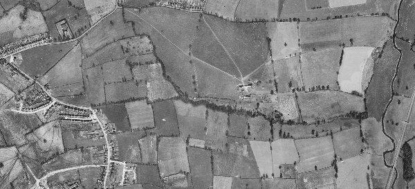
In this 1946 aerial photograph of Great Lyde Farm, at centre, shows Mudford Road at top left, St Michael's Avenue at lower left, the River Yeo and the railway at right. Note that the field boundaries remain unchanged after nearly three hundred years. However....
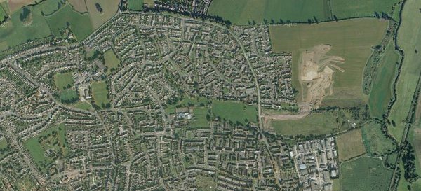
An aerial photograph (taken from Google) shows how Yeovil's suburbs have grown in the past sixty or so years. Nevertheless some former field boundaries are still discernible with close study - for example trees from former hedgerows have been retained around Bucklers Mead Road tracing former field boundaries. The markings in the fields to the right of the photograph were the preliminary groundworks of the new Great Mead / Collingwood Road estate in the former Middle North and Middle South fields.
The two green fields, formerly Hither Cowleaze and the Yonder Cowleaze, at centre right, were an open land-fill waste disposal site in the 1970's and consequently cannot be built on.
A 1928 aerial view of Westminster Street running from the bottom right corner towards the centre of the photograph with the Heart of Oak (now the Westminster) clearly visible at the junction with Clarence Street. The large building on the opposite corner was two houses, in the right hand one of which lived Mr Edgar of Petter & Edgar's Iron and Brass Foundry that lay behind it and pre-dated the Douglas Seaton building which, in turn, pre-dated Tesco's car park. Running from the centre of the photograph to the top left is Huish and the long terrace of small houses was Paradise Row where, it was reported in 1852, that there were only two privies for its eighteen houses.
This aerial photograph shows the complete length of the original Huish running across the centre of the picture. At extreme left Grove Avenue runs off in the top left corner while at centre is Queensway with its infamous 'quarter mile' Huish footbridge. Centre right is dominated by the Tesco store and its car park with the old line of Huish, now called Queensway Place running across in front of Tesco as far as Clarence Street at the eastern edge of Tesco's car park. At top right is the hospital and the Queensway / Kingston / Reckleford roundabout.
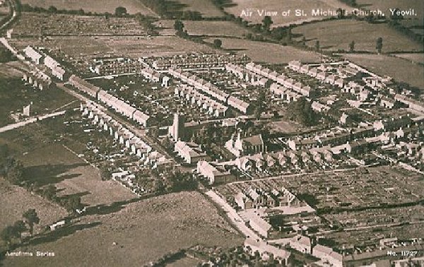
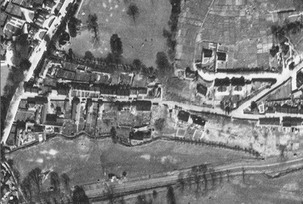
An aerial postcard of 1934 with St Michael's church at centre. This demonstrates remarkably well how isolated this part of Yeovil was at the time; St Michael's Avenue runs diagonally across the image from bottom right to top left, the first road off to its right is St Michael's Road, the last road off to the right towards the top of the photo is the partly-built Rosebery Avenue and the three roads between are, from left to right, Glenville Road, Percy Road and Alexandra Road.
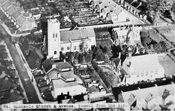
A postcard dating to 1927 and giving an aerial view of St Michael's church at upper left of centre, the vicarage at upper right, St Michael's Avenue at left and St Michael's Hall lower right - the only place big enough during the Second World War where barrage balloons could be repaired.
A 1946 aerial photograph showing Little Lyde Farm in the top left corner with the track running south to the Isolation Hospital at lower centre. Note that Lyde Road is not built beyond the farm at this time, and the track running across the top right of the photograph is Lyde Lane - which still partially remains as the only true country lane (it even has grass growing up the middle) surviving within the borough boundary of Yeovil. Note also the huge expanse of allotments at lower left and also the train at bottom.
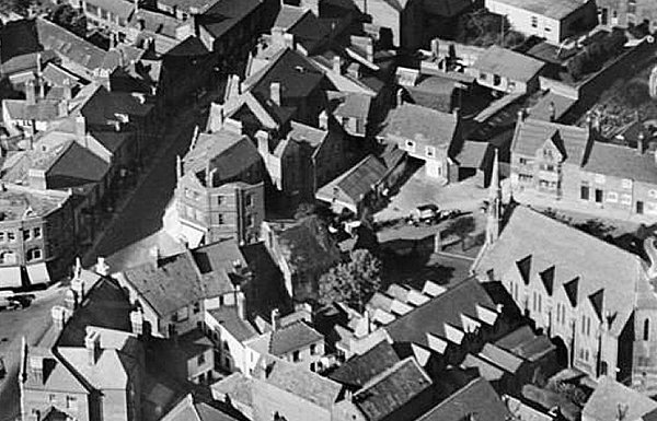
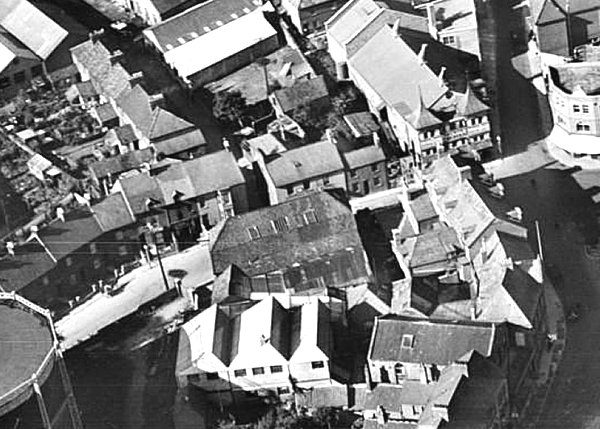
This aerial photograph dates to the 1970s and shows the Kings Arms at dead centre with St John's church at top left and the cattle market at top right. Notice that Vicarage Street, running from its junction with Silver Street at left of centre in the photograph to the lower right corner, has been all but flattened and fenced off in preparation for the construction of the Quedam Centre.
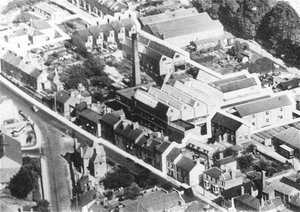
A 1946 aerial view of the Nautilus Works at centre, sandwiched between Goldcroft at left of centre, Dampier Street at right of centre and Reckleford running across the photograph (notice how narrow Reckleford is) while Eastland Road, known until the 1920s as Kiddles Lane, runs up the right hand side of the photograph.
An aerial view taken in 1928 of the Nag's Head (white building at centre) facing Reckleford with Court Ash Terrace just visible at the right hand edge of the photo. Note the two glove factories to the left of the Nag's Head - now all roughly where the Reckleford central reservation is, just in front of the large vacant plot that was the market.
This interesting aerial photograph, probably taken during the early 1960s, shows the junction of Reckleford and Sherborne Road at lower left, the house at the junction (now a pedestrian / flowerbed area), the Duke of Wellington at lower right and the industrial units between the Sherborne Road houses and Wyndham Hill at top right.
An aerial view of North Lane House at centre, taken in 1955. At this time there was clearly doubts about its structural stability as indicated by the two reinforcing struts on the front elevation, either side of the entrance porch. Note all the market animal sheds at top right between North Lane and Court Ash.
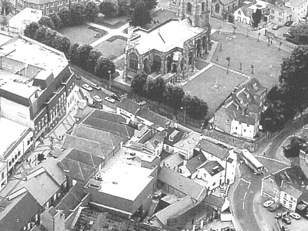
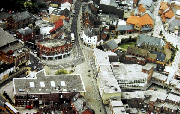
In an aerial photograph of 1988 dominated by St John's church at the top and new Quedam Centre shops at left, the Pall Inn is towards the lower right with the bus passing it.
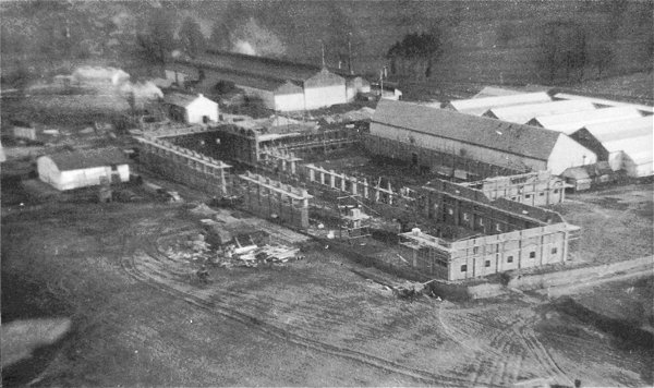
The Westland factory, with new buildings being erected in 1917.
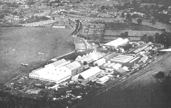
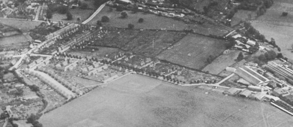
An early post-First World War aerial view of Westland Ltd with a biplane on the airfield. Note the proximity of the railway line running across the lower right of the photograph next to the works - this was one of the prime considerations in creating the works at this location. Note also the houses started to be built in Westland Road, at top centre, in what was originally intended to be a 'garden village'.
This aerial photograph dates to 1930 and shows the length of Westland Road, from its junction with Beer Street and West Street at extreme left, to the Westland complex at right and the airfield dominating the lower half of the photograph.
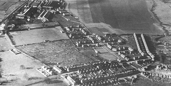
This is a an aerial photograph of Westland Road at centre right - note the absence of trees lining the road which were, apparently cut down during the late 1930s. This clearly shows how the houses were built around a series of culs-de-sac to produce an intimate 'garden village' feel that was later enhanced by extensive tree planting. At top left is the Westland complex with West Hendford - at this time only a stony track - running across the left corner. Seaton Road and Beer Street dominate the bottom centre with Orchard Street in the bottom right corner. On the very left edge of the photograph the white buildings were a stoneworks, just below that, what appears to be a rectangular enclosure was a greyhound kennels. On the opposite side of West Hendford, facing the back of Seaton Road are allotments and the field between the allotments and the Westland factory complex was the Somerset County Cricket Ground.
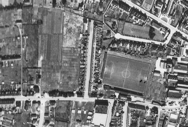
This 1946 aerial photograph shows Huish running across the bottom with the famous sloping pitch of Yeovil Town FC at right centre. Queen Street runs vertically at centre.
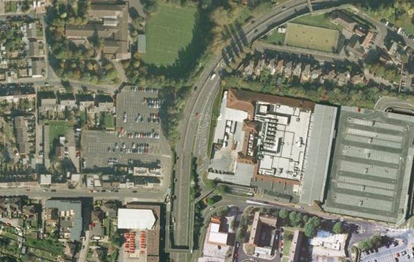
....and then came Queensway. The same view today (nicked from Google maps) with Queensway and the Tesco store and car park dominating the scene.
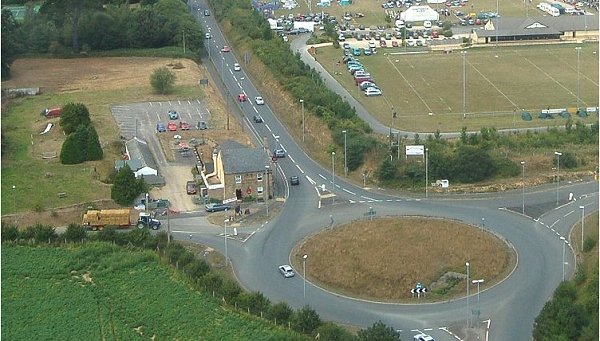
The Red House Inn next to Keyford roundabout. I took this photograph from a helicopter in 2006 when I was official photographer for the Yeovil Festival of Transport at the Yeovil Showground - just glimpsed at top right.
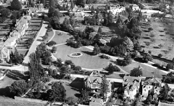
An aerial view of Sidney Gardens, taken in 1928. Preston Road runs along the top of the photograph while houses in L-shaped The Park are at left and bottom right.
This aerial photograph of 1946 shows Stiby Road only half built. At far left Larkhill Road runs diagonally with a track leading to a farm. At far right Ilchester Road runs diagonally across the top corner. Stiby Road, relatively newly constructed, ends at Marl Close.
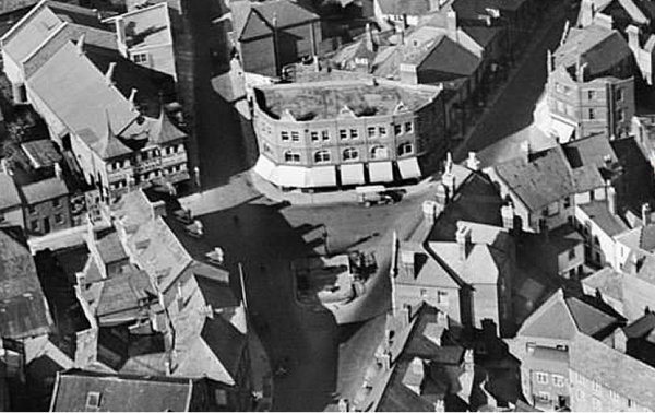
An aerial view of the Triangle dating to 1928 with the Co-operative Society's building and underground toilets in the centre - possibly under construction at this time? Note the old Palace Theatre at top left, on the corner of South Street and Stars Lane.
An aerial photograph taken in 1955 shows the Wine Vaults just below the centre of the picture. Wine Street runs to the Borough at the top of the photo. Note that the old Medical Hall, later Boots the Chemist's building that stood on the corner of the Borough and Middle Street, demolished by a German bomb on Good Friday, April 1941, is now a building site for the new Boots building. The new shop opened in 1956. In the time between being destroyed and rebuilt the site was turned into a garden and planted with tulips donated by Dutch children who had been evacuated to Yeovil during the war.
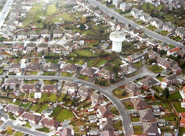
The Ashford Grove water tower seen in its wider setting in this aerial photograph of 1993. Mudford Road is at top right while High Lea curves around lower left. Ashford Grove runs towards the water tower at top left.
Courtesy of
Sarah Dennett
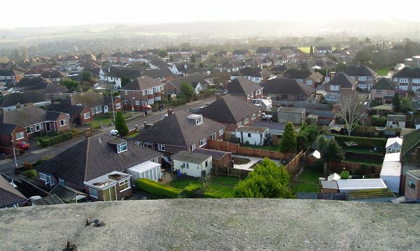
Not exactly an aerial photograph, but close. The view southeast, across High Lea, from the Ashford Grove water tower. Photographed in 2005.
Courtesy of
Sarah Dennett
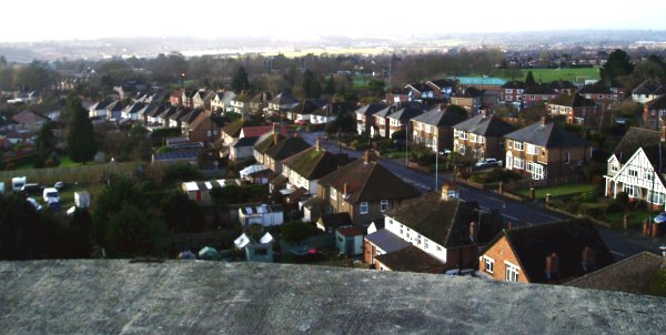
The view southwest, across Mudford Road and beyond to Westland, from the Ashford Grove water tower. Photographed in 2005.
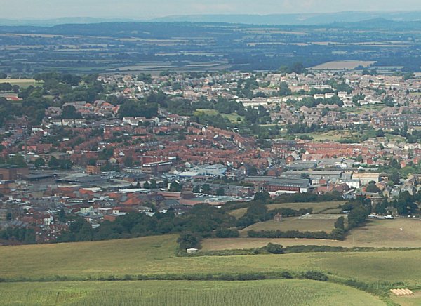
Yeovil seen from above Summerhouse Hill. Photographed in 2006.
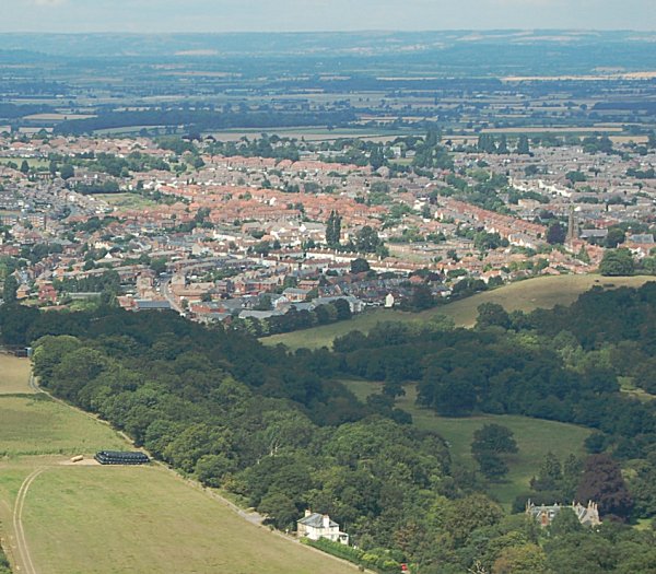
Eastern Yeovil seen from above Newton valley, with Newton Surmaville House at bottom right. Photographed in 2006.